
En la ciudad ecuatoriana de Durán, más del 70 por ciento de los 325.000 residentes estimados no tienen servicio de agua potable ni alcantarillado. Deben comprar agua transportada por camiones cisterna, una situación precaria y aparentemente insostenible que ha persistido durante casi 40 años. Cuando un equipo de periodistas se dispuso a investigar las razones de la inadecuada infraestructura de agua de Durán —y descubrió parte del encubrimiento del gobierno y la corrupción del sector privado detrás de esta—, comenzó a recibir amenazas de violencia.
Sin embargo, el equipo perseveró y publicó una serie de investigaciones multimedia, en la que se describe con gran detalle cómo la colusión entre los actores gubernamentales y el sector privado ha restringido el acceso al servicio básico de agua potable para la mayoría de la población de Durán. En octubre de este año, el Instituto Lincoln de Políticas de Suelo reconoció el trabajo de dos periodistas involucrados en el proyecto —Leonardo Gómez Ponce y otra persona cuyo nombre no se revela debido a amenazas continuas— con el Premio Lincoln 2024 (Premio Lincoln) al Periodismo sobre políticas urbanas, desarrollo sostenible y cambio climático. Ambos beneficiarios forman parte de la Unidad de Investigación Tierra de Nadie. El premio, ahora en su tercer año, se presentó como parte de la prestigiosa Conferencia Latinoamericana de Periodismo de Investigación 2024 (COLPIN) y reconoce al mejor periodismo de política de suelo en América Latina y el Caribe.
Ponce y otros ganadores del Premio Lincoln se unieron a una mesa redonda, moderada por Laura Mullahy, Senior Program Manager del Instituto Lincoln, el día 3 de la conferencia anual COLPIN, celebrada este año en Madrid. El organizador del evento de cuatro días fue el Instituto Prensa y Sociedad (IPYS), con sede en Lima, Perú.

Los periodistas enviaron 265 obras para el Premio Lincoln este año, dice Mullahy, más del doble del número recibido en cada uno de los primeros dos años. Dichas obras se extendían por todo el mapa, tanto literalmente (representando 63 ciudades en 22 países) como en relación con los temas tratados. La escasez de agua, el cambio climático y la vivienda fueron temas predominantes, al igual que las investigaciones sobre conflictos de suelo, migración climática, asentamientos informales y uso ilegal o injusto de la tierra.
Mullahy dice que la profundidad y la tenacidad de los informes fueron inspiradoras. Algunos de los periodistas ganadores dedicaron varios años a la investigación y escritura de sus reportajes. Dice: “Me emocionan un poco estos premios porque son personas tan dedicadas”. Mullahy también se enorgullece de que dos de los ganadores hayan participado en cursos del Instituto Lincoln para periodistas latinoamericanos en el pasado, que se diseñaron para presentarles los conceptos básicos de la política de suelo.
A continuación, encontrará los ganadores del Premio Lincoln 2024 al Periodismo sobre políticas urbanas, desarrollo sostenible y cambio climático, junto con enlaces a su trabajo (vea los ganadores de 2023 aquí).
Ganadores del Premio Lincoln 2024
Primer premio: Leonardo Gómez Ponce y colega por la serie Durán, los hijos del tren y las mafias del agua, una investigación de años publicada por la revista ecuatoriana Tierra de Nadie.
La plataforma en línea para esta serie de investigación de varias partes y muy informativa se abre con un conteo en tiempo real de los más de 38 años (cada mes, día, hora y segundo) que el 70 por ciento de los residentes de la ciudad de Durán, Ecuador, han pasado sin agua potable ni sistemas de alcantarillado en funcionamiento.
“Este es un ejemplo de cómo las empresas sin escrúpulos pueden limitar la planificación y el desarrollo de la infraestructura de una ciudad”, dice Mullahy. “El comité de selección valoró la calidad de la investigación, la contribución de datos y documentación de respaldo, y la clara demostración de que, sin infraestructura de servicios básicos, las poblaciones permanecen en la pobreza y no es posible progresar”.
Segundo premio: Alexánder Marín Correa, Juan Camilo Parra, Miguel Ángel Vivas, Camilo Tovar Puentes, María Angélica García Puerto y Juan Camilo Beltrán, por “Escasez de agua en Bogotá: ¿Cómo llegamos a este punto? ”, publicado por El Espectador en Colombia.
Producido por un grupo de periodistas del periódico colombiano El Espectador, en este artículo se narra cómo una combinación de factores históricos, ambientales y de gestión condujo a una catástrofe sanitaria en Bogotá.
En el artículo se relata cómo la capital de Colombia ha experimentado un rápido crecimiento y una mayor demanda de agua, mientras que la deforestación y el cambio climático han disminuido las fuentes de agua. La situación se ve agravada por la contaminación de los ríos y la falta de infraestructura adecuada. En el artículo se muestra claramente que la gestión del agua ha sido ineficiente, lo que ha provocado problemas de distribución y acceso inequitativo. Este contexto plantea un desafío urgente para garantizar el suministro sostenible de agua a la población de Bogotá.
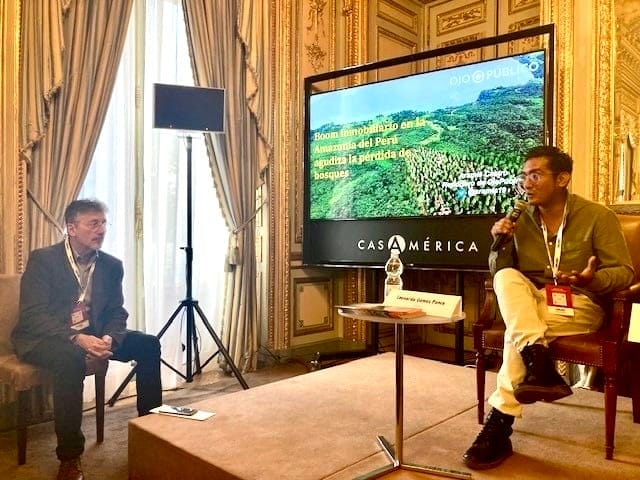
Tercer premio: Aramís Castro, por “Boom inmobiliario en la Amazonía del Perú agudiza la pérdida de bosques”, publicado por OjoPúblico en Perú.
En el artículo de Castro se analiza cómo la especulación inmobiliaria está contribuyendo a la deforestación en la Amazonía peruana, lo que demuestra cómo la venta de tierras rurales está transformando regiones como San Martín y Ucayali, donde ya se han perdido miles de hectáreas de bosques.
Castro analizó cientos de anuncios en las redes sociales y descubrió que las empresas inmobiliarias privadas estaban promoviendo representaciones de edificios modernos en entornos arbolados y naturales y atrayendo a los compradores con lemas como “El nuevo Miami en la selva peruana”. Sin embargo, muchos de los lotes rústicos carecen incluso de servicios básicos de agua o alcantarillado y, a menudo, contribuyen a la degradación del ecosistema. La investigación muestra cómo la falta de regulación y control en la venta de tierras agrava la deforestación, la pérdida de biodiversidad y otros problemas ambientales.
Mención de honor 1: Lucía Viridiana Vergara García, Darío Ramírez, Isabel Mateos, Rodrigo Flores Esquinca, Alonso Esquinca Díaz, Erick Retana, Eduardo Mota y Eduardo Buendía, por “Aquí no cabe un tren” y “La Sedena arrasó la selva para construir 6 hoteles del Tren Maya”, producido por Mexicanos contra la Corrupción y la Impunidad en México.
En este artículo y el pódcast que lo acompaña, se analiza cómo la construcción del Tren Maya en México y los nuevos hoteles vinculados a este megaproyecto podrían causar daños irreversibles al medio ambiente, lo que contradice los argumentos a favor del desarrollo de las regiones por las que pasará el tren. El trabajo explora de manera clara y creativa el tema con ricos testimonios y plantea una serie de problemas con el proyecto: desde la tala de árboles y la falta de estudios técnicos y científicos de sus impactos ambientales hasta los efectos de la construcción en áreas arqueológicas protegidas y una biosfera declarada Patrimonio de la Humanidad por la Unesco en 2002.
Mención de honor 2: Daniel Fonseca por “¿Dónde vamos a vivir? Datos, proyectos e intentos de solución al problema de vivienda en América Latina”, publicado por Distintas Latitudes, Honduras.
En esta investigación periodística, realizada para Distintas Latitudes por la séptima generación de la Red LATAM de Jóvenes Periodistas, se explora la crisis de la vivienda en América Latina desde diferentes ángulos. Se destacan problemas, como el acceso a la vivienda, el aumento de la desigualdad y la falta de políticas inclusivas para grupos vulnerables como los jóvenes, las mujeres y la comunidad LGBTI.
En la serie, se examinan la dinámica del crecimiento urbano no planificado y cómo los gobiernos no han abordado adecuadamente la demanda de vivienda digna, y se busca arrojar luz sobre las condiciones actuales y proponer soluciones para garantizar el derecho a una vivienda adecuada en la región.
Mención de honor 3: Aitor Sáez por “Aguas revueltas: sequía y saqueo en México”, publicado por Pie de Página, México.
En esta serie de investigación, se describe la crisis del agua en 12 regiones de México. En el informe, se reflejan los diferentes conflictos relacionados con la falta de agua, que resultan tanto de la crisis climática como de la intervención humana directa, especialmente a través de la coerción del crimen organizado.
Mención de honor 4: Miguel Ángel Dobrich y Gabriel Farías, por “De la sequía a la inundación: el impacto sobre el trabajo en la zona costera de Uruguay, de Este a Oeste”, publicado por Amenaza Roboto en Uruguay.
En este artículo, se explora el impacto del cambio climático en las condiciones de trabajo en diferentes áreas de Uruguay, desde Valizas hasta Ciudad del Plata, y se describe cómo el clima extremo afecta a los pescadores artesanales, los trabajadores domésticos y otras personas que dependen de ecosistemas vulnerables. También se aborda la desigualdad y el riesgo de inundaciones en las comunidades costeras. La investigación combina datos geoespaciales y visualización avanzada para mostrar el impacto de estos cambios.
Mención de honor 5: Vinicius Sassine y Lalo de Almeida por “Cerco às aldeias” (“Asedio de aldeas”), publicado por Folha de São Paulo en Brasil.
En esta obra, se describe cómo las empresas mineras, o garimpos, roban la tierra, el agua y la salud de los grupos indígenas mundurukú, kayapó, nambikwara y yanomami de la Amazonía brasileña. En las áreas donde operan estas empresas mineras, los habitantes sufren enfermedades debido al contacto con el mercurio, que es el metal pesado tóxico utilizado para separar el oro del suelo. Se diagnostica a los niños con retrasos cognitivos y a los adultos con enfermedades físicas. Sin embargo, el Gobierno brasileño no tiene planes de poner fin a la minería ilegal.
Imagen principal: Un camión lleva agua a Durán (Ecuador), donde casi el 70 % de los residentes ha vivido sin agua potable durante décadas. Hace poco, un proyecto plurianual que investiga esta crisis ganó un premio de periodismo del Instituto Lincoln. Crédito: Unidad de Investigación Tierra de Nadie.


