Place Database
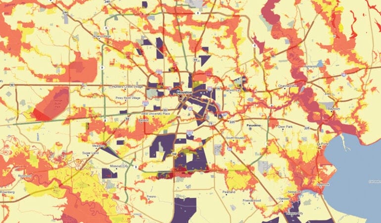
Houston-Area Brownfields Located in Flood Zones
By Jenna DeAngelo, April 10, 2018
 SHARE
SHARE
In the aftermath of Hurricane Harvey, the Environmental Protection Agency reported that 13 of the 41 federal Superfund sites in Texas had flooded. The Texas Commission on Environmental Quality lists 26 federal and state Superfund sites in Harris County. Houston is the county seat.
View the PDF version of this map for more detail and a key.
Source: The Place Database, www.lincolninst.edu/research-data/data/place-database