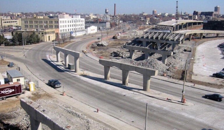
Deconstruction Ahead
With the interstate highway system in its seventh decade, the condition of many urban highways in the United States has deteriorated. Crumbling viaducts and other unsafe conditions call for an urgent fix. But rebuilding is complicated by rising construction costs, higher engineering and safety standards, scant funding, and other factors. While the federal government underwrote most of the cost of building the interstate system in the 1950s and 1960s, state and local governments now provide about 80 percent of public infrastructure funding. With perspectives on land use, transit, and equity also evolving, many cities are finding themselves at a crossroads when it comes to highways: remove or rebuild?
Some cities are opting for reconstruction. In Orlando, Florida, a 21-mile stretch of interstate jammed with 200,000 vehicles a day is being upgraded in the $2.3 billion “I-4 Ultimate” project, which includes building or rebuilding 140 bridges, redesigning 15 interchanges, moving exits, and adding toll lanes. But other cities have removed their highways entirely or relocated them underground, which repairs divided neighborhoods and opens new vistas. San Francisco’s Octavia Boulevard, completed in 2003, replaced the former Central Freeway, damaged in the 1989 Loma Prieta earthquake. Boston’s “Big Dig” moved an elevated section of the Central Artery underground, making way for the Rose Kennedy Greenway and reconnecting downtown districts to the harborfront.
Following these and other successful projects in places from Portland to Chattanooga, some of the biggest urban highway infrastructure efforts now involve deconstruction. Cities and states are trading highways for boulevards and connected streets that create space for public transit, walking, and cycling.
The Michigan Department of Transportation is planning to convert a one-mile stretch of I-375 in Detroit into a surface street; its construction in the 1960s paved over black neighborhoods in the city’s core. The Texas DOT is exploring ways to remove or reduce the footprint of the two major interstates that cut through Dallas, I-345 and I-30.
While government plays a key role, the highway removal movement often is built “from a grassroots base, by people in the neighborhood who have a vision for what it could be without the highway,” says Ben Crowther, manager of the Highways to Boulevards program of the Congress for the New Urbanism (CNU). The organization advocates for replacing freeways with streets networks that can contribute to urban vitality and livability. But this is no high-speed process, Crowther says. These efforts “don’t take years—they take decades.”
An Accelerating Trend
“Urban highway removal has been happening in the United States for the last 30 years,” says Ian Lockwood, a livable transportation engineer with Toole Design Group in Orlando. “During the past few years, interest has accelerated.”
Lockwood has served multiple times on the National Advisory Committee for CNU’s Freeways Without Futures report, which identifies and studies roadways that are ripe for removal (see sidebar). Since 1987, more than 20 highway segments have been removed from downtowns and urban neighborhoods and waterfronts, mostly in North America, says CNU. Lockwood says the movement has gained a national focus as more cities recognize “how costly and incompatible building highways was in cities.”
According to federal lore, President Eisenhower didn’t intend for interstates to blast through cities when he signed the Federal Aid Highway Act in 1956. But during previous congressional hearings, mayors and municipal associations had testified in favor of the interstate system because of the benefits cities expected to receive from urban highway segments, and the idea soon became unstoppable. The interstate system would eventually span 47,000 miles, many of them routed through cities experiencing what would turn out to be peak mid-century population growth.
Lockwood, who has worked on many highway removal projects, says bringing highways up to code can heavily impact neighborhoods, due to requirements such as adding lanes or bridges and realigning ramps. Removal, however, has positive impacts. “As we slow things down, value gets added” to cities through more mobility choices, better urban design, and greater investments, which draw new people and businesses, he says.
“This trend is part of an evolution in how we think about who cities are designed to serve,” says Lincoln Institute of Land Policy Associate Program Director Jessie Grogan, who leads the organization’s work in the area of reducing poverty and spatial inequality. “No longer are cities being planned for cars and commuters from the suburbs; instead, their multiple roles as commerce centers, homes, and places of recreation and tourism are being acknowledged and encouraged.”
This trend also has economic benefits. Milwaukee replaced the 0.8-mile elevated Park East Freeway spur with McKinley Boulevard and restored the street grid to enhance access to downtown, surrounding neighborhoods, and the Milwaukee Riverwalk. A master urban design plan and form-based code were prepared to shape pedestrian-scaled development and reinforce the area’s original form and character. Removing the spur cost $25 million in federal and state funds, as well as local tax increment financing (TIF) funds, says Peter Park, former Milwaukee planning director. The project transformed 24 underutilized acres into prime downtown real estate. Ongoing development in the area has helped generate more than $1 billion in new downtown investments, Park says. Between 2001 and 2006, the average assessed land values per acre in the freeway footprint grew by over 180 percent, and the average assessed land values in the TIF district grew by 45 percent, compared to a citywide increase of 25 percent.
Freeways Without Futures
For over a decade, the Congress for the New Urbanism (CNU) has campaigned for removing highways to improve cities. CNU published its first biannual Freeways Without Futures report in 2008, charting the benefits of highway removal, including knitting neighborhoods and communities together; revitalizing downtown cores; supporting active transportation; freeing up land for redevelopment for affordable housing, new businesses, and open space; and increasing tax revenues. The latest Freeways Without Futures report (CNU 2019) provides highway removal case studies for: I-10 (Claiborne Expressway, New Orleans, LA); I-275 (Tampa, FL); I-345 (Dallas, TX); I-35 (Austin, TX); I-5 (Portland, OR); I-64 (Louisville, KY); I-70 (Denver, CO); I-81 (Syracuse, NY); I-980 (Oakland, CA); and Kensington and Scajaquada Expressways (Buffalo, NY).
“We’ve shown that when you take the highway out of the city, it gets better,” says Park. “It’s that simple.” The most valuable real estate in any city is downtown, adds Park, who is a consultant to cities, a repeat member of CNU’s National Advisory Committee for the Freeways Without Futures report, and a former Lincoln/Loeb Fellow. By removing a highway, a city can develop more valuable assets, he says. An aging highway might attract matching dollars from the federal government for repairs, but if the city removes it and frees up land for redevelopment, that’s a much better long-term option for producing jobs, housing, tax revenues, and other benefits: “Building a city is the long play. There are no examples of a neighborhood that improved when a highway was cut through or over it. But every in-city highway removal has improved economic, environmental, and social opportunities for the local community.”
Overcoming a Dubious Legacy
While Eisenhower-era advocates promoted urban highways as expedient for shipping companies and suburban commuters, time has revealed a different story. Demographic and health data, photos, and maps confirm a fact known all too well by those living adjacent to highways: these roads cause serious health, economic, social, and environmental damage. Inserting highways often occurred in conjunction with “urban renewal” efforts, which targeted predominantly low-income and black communities with the least political purchase and least likelihood of resistance. Freeway construction in many U.S. cities caused homes and businesses to be demolished; limited access to housing, services, jobs, and open space; and polluted air, soil, and water.
Research on the short- and long-term impacts of living, working, and attending school near highways has documented many environmental and health risks, including elevated rates of asthma, cardiovascular disease, preterm birth, immune damage, and cancer. Tailpipe exhaust contains particulate matter, carbon monoxide, nitrogen oxides, and volatile organic compounds (VOCs) such as benzene. VOCs can react with nitrogen oxides to produce ozone, the most widespread outdoor air pollutant. Children, older adults, and people with preexisting conditions, especially in low-income urban areas, are at greater risk for air pollution-related health impacts, according to the Environmental Protection Agency (EPA). These environmental and health risks persist despite today’s more stringent emission and fuel standards, which have reduced harmful emissions by 90 percent compared to 30 years ago (EPA 2014).
“It’s important to understand the impact of the highway on the local community,” says Chris Schildt, senior associate at Oakland-based PolicyLink, a national research and action institute for advancing economic and social equity. Schildt managed the All-In Cities Anti-Displacement Policy Network in 2018 and 2019, which was composed of elected officials, senior staff, and representatives of local organizations in 11 cities impacted by displacement. The network focused on antidisplacement strategies cities can use when planning new public infrastructure investments.
“This is a chance for cities to start to repair the harm they created by bringing highways” through neighborhoods, Schildt says. One way to do that is for cities to secure land produced by highway removals for the community through land trusts or nonprofit organizations. If the city gains ownership of the land with the intent to redevelop, Schildt says, it should make sure that what gets built reflects actual needs expressed by the community.
In Minneapolis, the city’s newly adopted comprehensive plan includes a Freeway Remediation Recovery policy, which states the city will “repurpose space taken by construction of the interstate highway system and use it to reconnect neighborhoods and provide needed housing, employment, green space, clean energy, and other amenities consistent with city goals.” The city estimates the impacts on land value and tax revenue for property taken for freeway construction at $655 million.
Reclaiming a Roadway in Rochester
On a one-mile stretch of road in Rochester, New York, a neighborhood is growing, with new housing, restaurants, and retail. It’s the kind of development that might seem promising in any rebounding legacy city—but it’s especially remarkable for its location atop a former section of highway.
In the 1950s and early 1960s, a growing population of 332,000 and an increasingly traffic-clogged downtown led Rochester to construct the Inner Loop, a sunken beltway around the city core that spanned up to 12 lanes with travel lanes, ramps, and frontage roads. Officials demolished nearly 1,300 homes and businesses to make way for the 2.7-mile expressway, which connects to I-490. At least two similar projects didn’t get built because of local opposition. Before the loop’s eastern segment was built, the corridor was home to a working-class neighborhood with dense, tenement-style apartment buildings that was connected to more affluent East End neighborhoods. In the five decades that followed, as population declined by a third, many sites adjacent to the loop remained or became vacant.
The idea of eliminating the loop’s eastern segment and replacing it with a boulevard first appeared in 1990 in the city’s Vision 2000 plan, says Erik Frisch, a transportation planner and manager of special projects for the Rochester Department of Environmental Services: “From that point forward, every city plan created by or on behalf of the city contained the idea of removing this section, saying it had been overbuilt and created a moat-like barrier to downtown.” Traffic on this section of highway, which Frisch said never met its potential, had declined to only 7,000 vehicles per day, a volume that could be accommodated by a boulevard.
Federally funded planning and scoping began in 2008, says Frisch, but it wasn’t until 2013, when the city secured a TIGER (Transportation Investment Generating Economic Recovery) grant, that the project began to take shape. The city adjusted its plans, mobilized public engagement, and moved quickly to complete design and begin construction. The $22 million planning and construction costs were covered with $17.7 million in federal TIGER funds, $3.8 million in state matching funds, and $414,000 in city matching funds.
“It took so long to go from idea to reality that we had many planning layers,” notes Frisch. The city worked with small businesses, developers, and property owners in the corridor and on adjacent streets. “The goal of this effort was consistent: to serve transportation needs and encourage investment in a walkable and bikeable neighborhood.”
In 2014, the city began the work of burying the segment and building an at-grade, two-way street with cross-street connections to downtown. It demolished retaining walls and three bridges that had spanned the expressway and filled the roadbed with 120,000 cubic yards of earth. Stantec engineers and urban designers helped plan the streets, addressing challenges such as design for the north and south ends of the boulevard to ensure safe transitions from expressway to city streets. Getting land uses and character right was a big part of the redevelopment success, says Frisch. The city extended the existing center-city zoning, which is a form-based code, to these properties.
Completed in 2017, the new Union Street features two to four vehicle lanes, parking lanes, sidewalks, two-way protected bike lanes, signaled crosswalks, bike racks, benches, trees, and landscaping. The city maintains the new street infrastructure. Between 2014 and 2019, walking increased 50 percent and biking 60 percent in the project area, and the city anticipates more pedestrian and bike traffic as development around Union Street increases, says Frisch.
Charlotte Square on the Loop, with 50 affordable apartments, eight of which are reserved for ex-offenders reentering the workforce, was the first development in Rochester’s Inner Loop East Transformation Project. In the fast-growing area, Rochester-based Home Leasing also developed 10 market-rate townhomes and recently began construction on Union Square at the East End for Trillium Health, with 66 affordable apartments, including homes for people living with HIV and seniors requiring assistance. The project also will have a pharmacy, a service that downtown had lacked.
In all, the new neighborhood on and around the former expressway will include 534 housing units, more than half subsidized or below market rate, and 152,000 square feet of new commercial space, including services and amenities such as a day care center and restaurants, reflecting the city’s priority for an inclusive neighborhood with affordable homes and needed services. The largest project located on the new parcels will be the Neighborhood of Play, an expansion of the city’s popular Strong National Museum of Play that will include 236 apartments, a 120-suite hotel, retail, and a parking garage.
Seeing “$229 million in economic development from $22 million in public investment is a real coup,” said Anne DaSilva Tella, Rochester’s assistant commissioner of the Department of Neighborhood and Business Development, in a CNU webinar (CNU 2020). She noted that the project had also created 170 permanent jobs and over 2,000 construction jobs.
“The value created on the 6.5 acres is an incredible return on investment,” says Frisch. With only one project so far completed within the seven parcels created by burying the expressway, the city doesn’t have property tax revenues yet. But Frisch says private investment that otherwise would not have happened has extended beyond the site to increase property values and tax revenues and encourage new development, including residential and mixed-use structures on both sides of the boulevard, and redevelopment of nearby brownfield sites. Within blocks, a former hospital campus and an underused office building are being redeveloped, and a brewpub is expanding.
Removing the highway segment “has lifted the whole downtown area,” says Frisch. “We’ve seen it come back strong, because we’re making places of value where people want to invest.” The city also saved taxpayers $34 million by avoiding the future costs of federally required highway lifecycle repairs and maintenance. “That alone was greater than the project cost,” he says. The city recently began a Phase 2 planning study for the potential removal of the northern segment of the Inner Loop, which could help an area with more concentrated poverty connect to economic opportunities downtown.
“When federal or state funds are available for this kind of major investment in infrastructure, examples like Rochester show how these investments are repaid in multiples,” says Grogan of the Lincoln Institute. “Not only is this good for the short-term bottom line of cities, it can also increase access to opportunity for residents, which can lead to an improvement in their long-term financial and other life outcomes.”
I-10 in New Orleans
“My early memories of Claiborne Avenue were of being able to walk to the butcher, the grocery store, the dance supply shop,” says Amy Stelly, an urban planner and designer. “Those kinds of businesses don’t exist now. Some people lost land, some lost their businesses. We had a median with grass and trees and a grand traffic circle. Everyone misses that, because it made the area beautiful.”
Stelly is cofounder and creative director of the Claiborne Avenue Alliance, a coalition of local residents and property and business owners lobbying to “reclaim, restore, and rebuild” the Claiborne Corridor in New Orleans, which for over half a century has existed in the shadows of the elevated I-10 expressway. As a kid, she says, “I knew intuitively this was not right, and promised myself to work to change this situation.”
One of CNU’s Freeways Without Futures, the I-10 Claiborne Expressway slices through the neighborhood of Tremé (tre-MAY). Located next to the French Quarter, Tremé historically was the city’s main community of free people of color, and is renowned for its African-American and Creole-influenced food, music, and culture. Claiborne Avenue, which stretches for seven blocks through Tremé, was its main boulevard and commercial corridor, distinguished by a wide, tree-lined median park that served as the community’s main gathering place, including for Mardi Gras parades. Today, Mardi Gras revelers gather within sight of looming overpasses.
Construction on the Claiborne Expressway finished in 1968, around the time that a decades-long preservation battle resulted in the defeat of a proposed expressway along the Mississippi River in the French Quarter. The Claiborne Avenue community had little political clout. Hundreds of businesses, homes, and trees in the thriving corridor had been destroyed.
In 2012, Stelly returned to Tremé and her childhood home less than two blocks from the interstate after working for years in other cities, including with New Urbanist planners Andrés Duany and Elizabeth Plater-Zyberk. She began researching the history of the I-10 and became an advocate, like others before her, for taking down what many call “the monster.” Few thriving businesses line the corridor now, and the paving beneath the expressway is used as “a two-mile free parking lot,” Stelly says, with some areas occupied with drug sales, prostitution, and encampments for homeless people.
Demographic data point to impacts on the area’s population, racial composition, and economic level at least partially due to the arrival of the interstate. Over the past few decades, Tremé’s population has declined along with that of the city at large; the population of New Orleans shrank from 628,000 in 1960 to an estimated 391,000 by 2018. Between 2000 and 2017, the population of Tremé declined from 8,853 to 4,682, according to the Data Center, an independent nonprofit data analysis resource for Southeast Louisiana (The Data Center 2019). Both declines were partly the result of Hurricane Katrina, which caused significant flooding and damage in 2005. Tremé saw a post-Katrina influx of more affluent white residents, amplified by outside investors who renovated or built homes for short-term rentals, displacing long-term residents. In 2000, over 92 percent of households were black, and 57 percent lived below the poverty line; by 2017, 63 percent of households were black, 28 percent were white, and 39 percent of residents were living in poverty, compared to a citywide rate of 25 percent.
The notion of removing I-10 has been the subject of multiple studies, the first dating to the 1970s. In 2010, CNU’s Highways to Boulevards program brought planners to Tremé to create a vision for restoring the commercial corridor. A subsequent report and preliminary design advocated for the restoration of North Claiborne Avenue as a vibrant boulevard, with new street connections and multimodal infrastructure, a landscaped median park and grand traffic circle, and new homes and businesses (Smart Mobility and Waggonner & Ball 2010).
These planning efforts helped the city obtain a $2 million federal TIGER planning grant, which funded the Livable Claiborne Communities Study (Kittelson & Associates and Goody Clancy 2014). That study presented three options: maintain the expressway ($300 million for repair and maintenance over 20 years), remove ramps and develop street infrastructure in residential areas ($100 million to $452 million over the same time period), or remove the expressway entirely and develop a street-level urban boulevard, new street connections, and alternative transportation infrastructure ($1 billion to $4 billion). The third option would reclaim nearly 50 acres of land for open space and redevelopment.
While CNU’s vision of removing the highway and restoring the corridor “really resonates with people,” says Stelly, the city pursued another path. In 2017, city leaders partnered with the Foundation for Louisiana to launch an effort to develop the Claiborne Cultural Innovation District (CID) under I-10. With support from city, state, and regional agencies and the Greater New Orleans Funders Network, composed of 10 national and local foundations, a master plan for a 19-block innovation district was developed that would include micro-businesses, a marketplace, a youth activity area, performance space, and green infrastructure elements including bioswales, trees, and freeway drainage systems. The district would be phased in over 15 years, at a cost of $10 million to $45 million. Though some areas beneath the expressway have drawn artists, pop-up retail, and food vendors, revitalization has not been widespread or consistent, says Stelly, illustrating her point with a photo of an abandoned shipping-container kiosk that now provides a place for homeless people to gather.
The Alliance has objected to the plan and called for freeway removal, as well as for funds to improve the avenue’s existing building stock, for infill development on vacant land, and for restoration of the median as public open space. The group faces political opposition, however, from heavyhitters including the Port of New Orleans, which generates $100 million in revenue annually. In 2013, Port officials publicly supported the retention of I-10 as an important corridor between industrial real estate properties on the Inner Harbor and its riverfront facilities. The irony, says Stelly, is that “the avenue beneath the interstate is often empty while the interstate is backed up. People don’t think of other options.”
The Alliance has been gathering data to convince the community and city officials that the CNU vision will provide economic, social, and health benefits. The group commissioned a study by the Louisiana State University Health Sciences Center School of Public Health, located just south of Tremé, that analyzed decibel levels, air quality, and other indicators. The study found concerns including traffic-related air contaminants, lead in the soil, noise pollution, and fine-particulate emissions. It said vulnerable populations included children, seniors, pregnant women, those with compromised immune systems, and homeless populations living under I-10, and that policies encouraging use of the land beneath the interstate posed additional threats to health. The study also noted “the removal and paving over of historic green spaces along the corridor have exacerbated the impacts of local flooding, with consequences for water quality, ease of local transportation, [and] use of outdoor spaces.”
In summary, the LSU researchers noted that the interstate’s “physical division of previously connected neighborhoods and the removal of businesses along what used to be a commercial artery have fragmented the community socially, culturally, and economically. Today, poverty and crime are disproportionately experienced by residents of the Claiborne Corridor, and reliable access to jobs, housing, and transportation remains a challenge” (LSU 2019).
In January 2020, the Alliance launched a data-gathering “tactical urbanism” project on I-10 structural columns called “Paradise Lost, Paradise Found” to seek community responses to its vision for a restored Claiborne Avenue. It also presented its vision to the New Orleans City Council’s Transportation Committee.
“Very clear environmental racism led to the destruction of businesses and homes along that corridor,” notes Kristin Gisleson Palmer, the city council member who represents Tremé and chairs the Transportation Committee. As a city council member in 2010, Palmer advocated for taking down the expressway and wrote a grant that led to the Livable Claiborne Communities Study.
Given the increasing impacts of climate change, including storms that repeatedly flood Tremé and other parts of the city, she says, the city council has priorities other than removing the viaduct. Short-term, the city’s focus in the Claiborne Corridor should be on an incremental plan for new green infrastructure and housing, Palmer suggests. Bike and walking paths, alternative transportation, and flexible open space with trees and other stormwater management elements under and adjacent to the expressway would mitigate flood risks, enhance the corridor’s business environment, and still be useful if the expressway eventually were taken down.
Palmer still advocates for removal, as do most people in the community, she says, though some fear that taking it down will lead to further gentrification and displacement.
The Way Forward
In July 2019, the U.S. Senate’s Environment and Public Works Committee advanced the America’s Transportation Infrastructure Act of 2019, which includes funding for the study and removal of highways in cities. The five-year program would allocate grants of up to $2 million for planning, $15 million for technical assistance, and $5 million up to half the total cost of capital construction, with total federal assistance capped at 80 percent. Priority would be given to disadvantaged communities whose highway removal projects could be covered completely. Unlike past federal block grants, this funding is targeted specifically for removing highways, and focuses on economic development. Grants would be available to cities, states, metropolitan planning organizations, and, for the first time, community and nonprofit organizations.
To prepare for a potential infusion of federal highway removal funds, CNU is assembling a best practices manual and tool kit that could be adopted by municipalities. “Cities have been working from scratch,” says Larry Gould, a principal and transit planner with NelsonNygaard in New York City and a CNU board member. Decisions about highway removals are “context-sensitive,” he says, and determining factors include physical and policy contexts, as well as funding and community vision. The manual will likely include design standards, transportation network concepts, engineering specifications, and metrics to measure success.
Some planners have already been sharing lessons learned. In a webinar for the global Institute for Transportation and Development Policy on the unintended consequences and solutions for urban highways, Peter Park outlined several requirements for successful highway removal and redevelopment (ITDP 2019):
- strong community support, leadership, and political will;
- an urban vision for the city that is not dominated by automobiles and favors short trips by different modes, such as walking and biking, along routes that are part of the city fabric, like well-connected streets and multiuse path networks;
- decisions driven by a long-term community investment strategy rather than by the short-term pressure of spending federal allocations;
- control of land by local government and clear regulations, such as form-based codes that create walkable urban places and shape new development that supports priorities like affordable housing and job creation.
PolicyLink’s Schildt says public officials and staff should consider key questions: Has the city discussed highway removal with the neighborhoods affected before seeking funding or beginning planning? How will the city reduce the impacts of deconstruction? How will the city ensure that investments don’t signal to the private market that this is an up-and-coming neighborhood, which could catalyze higher land costs, rent increases, and destabilization? What kinds of affordable housing, tenant protections, and job-generation policies and programs are in place? Be transparent about the realities on the ground and present them to the community early in the planning process, says Schildt. “If you receive a $2 million grant for planning a highway teardown that took 10 years to get, but the community doesn’t want to remove the highway, are you willing to reject it and start over with a planning process that identifies and responds to what the community wants?”
As urban highway removal becomes a viable option, the costs and benefits are increasingly clear. New Orleans City Council member Palmer notes the city now has “concrete examples of other cities that have taken down expressways” resulting in success and economic development. “The reality is that something has to be done with the expressway, and at some point the feds are going to have to reconstruct it or take it down,” she says. “Taking it down is expensive, but reconstructing it could cost even more.”
Kathleen McCormick, principal of Fountainhead Communications in Boulder, Colorado, writes frequently about healthy, sustainable, and resilient communities. As a board member for CNU Colorado in 2012–2014, she advocated for removing I-70 through Denver.
Photograph: Milwaukee tore down the 0.8-mile Park East Freeway spur, replacing it with McKinley Boulevard and freeing up 24 acres of land for redevelopment. Credit: Courtesy of Congress for the New Urbanism.
References
City of Minneapolis. 2019. “Freeway Remediation Policy.” Minneapolis 2040 (website). https://minneapolis2040.com/policies/freeway-remediation.
CNU (Congress for the New Urbanism). 2019. Freeways Without Futures. Washington, DC: CNU. https://www.cnu.org/highways-boulevards/freeways-without-futures/2019.
CNU (Congress for the New Urbanism), Maryland Department of Planning, and Smart Growth Network. 2020. “American Highways Are Being Removed. What’s Next?” Webinar. February 4. https://smartgrowth.org/american-highways-are-being-removed-whats-next.
ITDP (Institute for Transportation and Development Policy). 2019. “Urban Highways: Unintended Consequences and Possible Solutions.” Webinar. December 16. https://www.itdp.org/event/urban-highways/.
ITDP (Institute of Transportation and Development Policy) and EMBARQ. 2012. The Life and Death of Urban Highways. New York, NY: ITDP (March). https://www.itdp.org/2012/03/13/the-life-and-death-of-urban-highways/.
Kittelson & Associates and Goody Clancy. 2014. “Livable Claiborne Communities Final Report.” https://s3.amazonaws.com/networkneworleans/9-LCC-Study-Final-Report-web.pdf.
LSU (Louisiana State University Health-New Orleans School of Public Health). 2019. “Traffic-Related Pollutants and Human Health Within the I-10 Claiborne Corridor, New Orleans, LA: Land Use Implications.” April 4. https://www.cnu.org/sites/default/files/Claiborne%20Corridor%20Report_KATNER_05042019.pdf.
Plyer, Allison, and Lamar Gardere. 2018. “The New Orleans Prosperity Index: Tricentennial Edition: Measuring New Orleans’ Progress toward Prosperity.” New Orleans, LA: The Data Center (April). https://s3.amazonaws.com/gnocdc/reports/ProsperityIndex.pdf.
Smart Mobility and Waggonner & Ball. 2010. “Restoring Claiborne Avenue: Alternatives for the Future of Claiborne Avenue.” July. https://www.cnu.org/sites/default/files/Claiborne_Alternatives_071510.pdf.
The Data Center. 2019. “Tremé/Lafitte Statistical Area.” Data Resources (website). Last updated April 19, 2019. https://www.datacenterresearch.org/data-resources/neighborhood-data/district-4/treme-lafitte/.
EPA (U.S. Environmental Protection Agency). 2014. “Near Roadway Air Pollution and Health: Frequently Asked Questions.” Washington, DC: U.S. Environmental Protection Agency, Office of Transportation and Air Quality (August). https://www.epa.gov/sites/production/files/2015-11/documents/420f14044_0.pdf.