Topic: Água

Partners

Anne Castle, senior fellow at the Getches-Wilkinson Center for Natural Resources, Energy, and the Environment at the University of Colorado Law School is a co-author.
Erin Rugland, former Program Manager at the Babbitt Center for Land and Water Policy is a co-author.
The Babbitt Center for Land and Water Policy is a project funder.
The Colorado Water Conservation Board is a project funder.

The Problem

The State of Colorado has required retail water providers serving 2,000 acre-feet or more to submit Water Efficiency Plans (WEPs) since 1991. In 2015, Colorado Senate Bill 8 stipulated that WEPs must evaluate “best management practices for water demand management, water efficiency, and water conservation that may be implemented through land use planning efforts.” Colorado has provided extensive guidance on the preparation of these plans; however, new requirements for incorporating land use practices into WEPs were not covered in the previous guidance. The Addendum bridges this gap.

The Addendum, adopted by the CWCB in January 2019, includes land use best practices that can be implemented by water providers, either independently, or through collaboration with a land use authority. It is tailored to Colorado communities, uses numerous examples and additional resources, and is designed to be adapted as applicable to varying local circumstances.

Methods

The Addendum was developed through an extensive review of literature on integrating land use and water planning; interviews with ten Colorado water providers; valuable input from regional experts; and a workshop focused on the use and readability of the guidance.

Taking the Addendum into Action

The Babbitt Center and Water Education Colorado worked to educate practitioners, consultants, engineers, and other stakeholders about the Addendum during the fall of 2019. This education and outreach included two webinars hosted in collaboration with Colorado’s Special District Association and Colorado Municipal League, and four workshops around Colorado. Watch the webinars below.

October 25, 2019 Webinar

August 12, 2019 Webinar


For more information, please contact the Babbitt Center at babbittcenter@lincolninst.edu or 602-393-4309.

Growing Water Smart

Growing Water Smart is a joint program between the Lincoln Institute and the Sonoran Institute, and the partnership has expanded to include numerous other contributors like Utah State University’s Center for Water Efficient Landscaping (CWELL) delivering workshops that introduce communities to the full range of collaboration, communication, public engagement, planning, and policy implementation tools to realize their watershed health and community resiliency goals. Through Growing Water Smart, communities learn to better integrate land use and water planning.

Watch the Growing Water Smart video to learn more about the program and participant experiences.

Workshop Format

The workshop brings key community staff and decision-makers on water and land use planning together and takes teams through facilitated discussions that set common goals around land use and water. The community teams ultimately develop collaborative action plans tailored toward local needs. Growing Water Smart workshops provide the time and space for focused team discussions and offer an opportunity to learn from peers and experts about the challenges and opportunities of achieving a secure water future. Participating teams spend much of their time defining their water resilience goals and a path to attain them. Teams develop action plans on behalf of their communities and commit to post-workshop implementation activities to advance those action plans.

State-Specific Resources

A unique curriculum is designed for each state that hosts Growing Water Smart. This includes a Community Self-Assessment and Guidebook that are tailored to the legislative requirements of that state and features local examples of land and water integration. We currently have these resources for Arizona, California, Colorado, and Utah.
A unique curriculum is designed for each state that hosts Growing Water Smart. This includes a Community Self-Assessment and Guidebook that are tailored to the legislative requirements of that state and features local examples of land and water integration. We currently have these resources for ArizonaCaliforniaColorado, and Utah.  

Recognition

At the 2019 American Planning Association (APA) Colorado Chapter Conference held in Snowmass Village, Colorado, the Growing Water Smart program was awarded the 2019 APA Colorado Honor Award in the category of Sustainability and Environmental Planning.


Join Us

Participants in the February 2020 Arizona Growing Water Smart Workshop


Participation in Growing Water Smart is by application on a biannual basis. Selection criteria is based upon:

  • Diverse team composition including board members and senior staff from the town and/or county, such as:
    • Elected officials and planning commissioners;
    • City/town/county managers;
    • Water utility and water resource managers;
    • Land use planners;
    • Regional planning organizations;
    • Economic development staff;
    • Public health planners;
    • Consultants employed by the town or county; and
    • Developers.
  • Whether the desired outcomes demonstrate readiness to focus on thoughtful land use and water planning integration and if they are cohesive with the stated goals.
  • Firm commitment to participate and leadership to coordinate team activities, such as completing a community self-assessment and taking part in orientation activities. The workshop is offered at no cost for community teams selected and teams can apply for further technical assistance after the workshop’s conclusion. Overnight accommodations and most meals are provided, however travel to and from the workshop is not covered for in-person workshops, which are typically held retreat style.

For more information about upcoming workshops and the application process please contact Kristen Keener Busby at kbusby@lincolninst.edu or 602-566-7570 or visit growingwatersmart.org.

The Babbitt Center is committed to assisting communities in the Colorado River Basin secure their water future. Are you? If you are a funder, working to ensure your community’s health, vibrancy, and resiliency, we’d love to work directly with you. Please contact Paula Randolph at prandolph@lincolninst.edu or 602-393-4313.

Babbitt Center for Land and Water Policy

    Past Projects

    High-Resolution Mapping

    We collaborated with the Conservation Innovation Center of Maryland’s Chesapeake Conservancy on precise high-resolution mapping, down to one square meter, to model how water moves across the landscape and impacts local and regional land use. This collaboration resulted in floodplain mapping for green infrastructure for the Pima County Flood Control District in Arizona; regional land use land cover mapping for the Denver Regional Council of Governments in Colorado; an ArcGIS StoryMap, Swimming Upstream,  of the Endangered Fish Recovery Program for the Colorado Water Conservation Board; and ecosystem service opportunities near Bears Ears National Monument, Utah, in collaboration with the Grand Canyon Trust. These high-resolution mapping products provide organizations with information critical to identifying priorities at the parcel scale, such as green infrastructure placement. This work is invaluable to land and water managers, local planners, and policymakers whose decisions impact the economy and quality of life in their communities.

    Colorado Water and Land Use Planning Alliance

    The Babbitt Center provided seed funding for a position within the Colorado Department of Local Affairs to spearhead this group and still collaborates with various alliance members. The alliance is a grassroots group of multidisciplinary partners comprising state agencies, local governments, NGOs, and researchers that help local communities effectively incorporate water into comprehensive planning. The alliance’s work supports priorities in the Colorado Water Plan, one of which is to help achieve a Colorado Water Plan goal: by 2025, 75 percent of Coloradans will live in communities that have incorporated water-saving actions into land use planning.

    Water, Land, and Growth in Central California

    The San Joaquin Valley is one of the fastest growing regions of California, and the state’s Sustainable Groundwater Management Act (SGMA) is likely to have far-reaching implications on communities’ future growth there. The valley’s urban, suburban, and rural communities bear the brunt of new growth in the region yet may not have renewable water supplies to meet future demands. The Babbitt Center worked with the Public Policy Institute of California’s Water Policy Center to understand the implications of California’s SGMA on urban, suburban, and rural communities in the San Joaquin Valley.

    2019 Journalists Forum

    In partnership with the Walton Family Foundation, the Gates Family Foundation, and the Arizona State University Cronkite School of Journalism, we hosted a Journalists Forum that explored the history, science, and politics of water management, and delved into innovative policies and practices that help forge a sustainable water future.

    Presentations, session video clips, and the agenda from the forum are hosted online.

    View Forum Materials

    Enhance Colorado’s Water Efficiency Plans

    We worked with the Getches-Wilkinson Center for Natural Resources, Energy, and the Environment at the University of Colorado Law School to write Best Practices for Implementing Water Conservation and Demand Management Through Land Use Planning Efforts. This document, adopted by the Colorado Water Conservation Board in January 2019, updated the State of Colorado’s water efficiency plan guidance to include land use practices that foster water savings.

    Lessons from the Colorado River: Climate, Land, and Drought

    Previous US Interior Secretary and Arizona Governor Bruce Babbitt and former US Bureau of Reclamation Commissioner Brenda Burman discussed the future of the Colorado River. Moderated by Babbitt Center for Land and Water Policy Director Jim Holway, this 75th Anniversary Lincoln Institute Dialogue covered Colorado River conditions; current and emerging policy challenges; lessons on international and interstate river management; and how local governments, water utilities, land managers, and Native American nations can promote water sustainability.

    View the Recording of the Dialogue and Related Resources

    Trouble in Paradise: Arizona’s Distressed Golf Courses

    The Babbitt Center catalogued Arizona’s golf courses, detailing information on location, state of operations, relation to nearby homes, and water use to pinpoint courses that are either already distressed or could become distressed. If a golf course is identified as distressed, the Babbitt Center and the impacted community can study best-case scenarios to revitalize or adapt it to enhance financial stability, optimize livability, and promote more sustainable use of valuable land.

    Babbitt Center for Land and Water Policy

      Our Mission

      The Babbitt Center for Land and Water Policy, a center of the Lincoln Institute of Land Policy, seeks to advance the integration of land and water management to meet the current and future water needs of Colorado River Basin communities, economies, and the environment. We help communities to effectively manage their land and water resources.

      Spheres of Focus

      Our current work spans three spheres of focus, with another planned for the future.

      Growing Communities

      Growing cities, suburbs, and edge and rural communities alike are confronting unpredictable climate conditions and water availability and seeking ways to address an uncertain future. We work with communities to address these complex challenges of population and economic growth by helping boost local capacity, reach consensus, and implement meaningful policies and practical solutions.

      Irrigated Agriculture

      In an era of uncertain water availability, innovative and collaborative solutions are essential to optimize adaptive irrigated agriculture in the Colorado River Basin. Local cultures and economies and the national food supply depend on it. How those solutions take shape impact not just the West, but the entire United States.

      Tribal Communities

      The 30 Native American tribes in the Colorado River Basin hold 15 percent of the land and more than 25 percent of the Colorado River water allocation. However, tribal communities have historically been excluded from state and basinwide water management decisions. The Babbitt Center supports tribal nations’ efforts to engage in basinwide policy decisions to strengthen their capacity to manage their water resources.

      Future Focus: Public Lands Management

      Fifty-eight percent of the land in the Colorado River Basin is publicly owned, mostly by the federal government, and its management is critical to water quality and water supply. Looking ahead, the Babbitt Center will begin to integrate this land use into our work and concentrate on the connections between public land management and water.

      How We Work

      To build capacity in the communities and regions that will shape the future of the Colorado River Basin, we take a four-pronged approach.

      1. Research

      Communities need timely and accurate information and data to address the unique challenges they face in harnessing opportunities to prepare for an uncertain future. We work with leading researchers across multiple disciplines to generate new insights into major policy and management challenges at the nexus of land and water. We make new knowledge accessible and relevant to decision-makers and practitioners through myriad publications and courses.

      Examples

      Basin Story Maps: Overviews of Conditions and Issues

      We dig deep into the details of water in the West to provide visually stunning and succinct information on the issues facing the basin. With more than 250,000 views, our flagship storymap, The Hardest-Working River in the West, and data portal make the science and policy of the Colorado River Basin accessible to a broad audience.

      Policy Focus Report: Integrating Land Use and Water Management, Planning, and Practice

      Land without water cannot support communities of any scale, yet many land use decisions are made without regard to water, and vice versa. This report introduces readers to best management practices that enable local governments and water providers to integrate the two systems. Supported by case studies from several US communities, the report demonstrates that planning is a crucial step for land and water integration.

      Arizona State University: Ongoing Research

      We have worked with the Decision Center for a Desert City at Arizona State University on a variety of land use and water management integration projects, which include research on the connection between plans for land use and those for water supply; evaluation of water sustainability indicators; joint execution of the 2019 Urban Water Demand Roundtable and Report, cofunded by the Water Research Foundation; and a systematic survey of planners and water managers from cities and towns across the Colorado Basin states about their views on how integrated water and land use practices relate to water sustainability challenges.

      2. Resources

      Creating resilience depends on a community’s access to appropriate resources—tools, funding, and applicable processes—to implement next steps and transform conditions and achieve desired outcomes. We provide an array of resources that help communities make effective decisions, galvanize broad-based engagement, employ long-term and comprehensive visioning, and offer access to innovative planning tools.

      3. Partnerships

      Partnerships link organizations with shared goals and can leverage and contribute new resources. The Babbitt Center invests in innovators and collaborates with vested partners from state, local, and tribal governments, nonprofits, private businesses, academia, and other private foundations. Together, we amplify our collective influence and impact across the Colorado River Basin to connect communities to best practices and valuable resources to advance their work.

      Example

      Water & Tribes Initiative

      Thirty Native American Indian tribes have inhabited the Colorado River Basin region for millennia. They depend on the waters of the Colorado River and its tributaries and are major water rights holders. However, many tribes are unable to access their water rights and have traditionally been excluded from the development of Colorado River policy. The Water & Tribes Initiative (WTI) was founded in 2017 to address these issues. The goals: facilitate connections among tribes and other leaders, build trust and understanding, and create opportunities to explore shared interests and take collaborative action. The Babbitt Center is proud to serve as the founding and managing funder and fiscal agent for the Water & Tribes Initiative (WTI).

      4. Education and Dissemination

      Outreach, education, and training are essential for communities to understand the nuances of the land-water connection and to make and implement decisions that best secure their water future. We conduct training, develop and publish guidance, and transfer knowledge to research networks and practitioners. We support the next generation of scholars and practitioners through fellowships, internships, and mentoring opportunities. And we disseminate our work in a variety of media.

      Example

      Indicators

      We will soon work with partners to develop a curated suite of indicators and metrics to benchmark and track both social and physical dimensions of water and land resources across the Colorado River Basin. The forthcoming Indicators for Land and Water Sustainability in the Colorado Basin will comprise an interactive web report unpacking our findings and a companion dashboard website with web maps and other explorations of data and trends. These resources will allow practitioners and general audiences alike to diagnose hot spots, raise productive questions, and draw connections across time and geography.

      Center for Geospatial Solutions

      Established in 2020, the Center for Geospatial Solutions (CGS) works to ensure that organizations of all sizes have access to data and advanced technologies to improve decision-making for land and water conservation, climate action, and other efforts to promote social equity. We extract better insights from data through a combination of geographic information systems (GIS), earth observations, artificial intelligence, machine learning, and advanced analytics. We deliver products and services that support decision-making, track impacts, and tell powerful stories.


      “The Center for Geospatial Solutions is moving the global environmental field forward to meet ambitious goals set forth by scientists to save and restore our planet.”

      —Jack Dangermond, President and CEO of Environmental Systems Research Institute (Esri)

      Our Work

      Geospatial technology enables users to combine and analyze datasets to understand complex interactions and decide where and how to act. Adjacent to the core technologies of GIS and Remote Sensing are a variety of other technologies, such as artificial intelligence, field data collection tools, and advanced analytics, that can help people extract more and better insights from data.

      We discovered that many people and organizations still cannot access complete or consistent data or use advanced datasets and analytic capabilities when necessary. The Center for Geospatial Solutions was founded to overcome this barrier.

      Our team will support your organization to frame the relevant questions, gain a more holistic understanding of the issues you face, and make an action plan. We will ensure you have ready access to the highest-quality data and tools you need.

      Case Study: Nature Conservancy of Canada

      The Nature Conservancy of Canada (NCC) is the leading land conservation organization in Canada. Since 1962, the nonprofit and its partners have helped protect more than 35 million acres (14 million hectares) across Canada. NCC is working with us to develop a long-term technology strategy that streamlines data collection and management across the organization and allows all of its programs to leverage the latest technology to improve conservation prioritization, securement, and management. This strategy is helping reduce the time it takes staff to effectively manage properties and communicate key metrics to outside partners and funders. Access to better technology is also making it easier for NCC to effectively leverage new revenue sources, such as carbon offsets, by quantifying and capitalizing on the ecological benefits of land conservation.

      Learn About the Nature Conservancy of Canada

      Internet of Water Initiative

      In March 2022, the Lincoln Institute launched the Internet of Water Initiative at CGS to help modernize and connect water-related data in the United States from thousands of different sources to enable better decisions, ultimately making communities more sustainable and resilient. The Internet of Water Initiative will significantly expand the suite of tools CGS is developing.

      Learn More About the Internet of Water

      Featured Resources

      Work With Us

      Everything we do seeks to advance social and climate justice. With a mindset open to learning, we want to fully realize equity and inclusion through our partnerships, our work, and our organization. We believe that when these values are applied, data, science, and technology are powerful tools, enabling everyone to act effectively and with equal responsibility to all stakeholders.

      Learn More About Working With Us

      Our Experts

      Anne Scott

      Executive Director, Center for Geospatial Solutions

      Lincoln Institute of Land Policy

      Faith Sternlieb

      Associate Director of Engagement, Internet of Water

      Lincoln Institute of Land Policy

      Phoenix, Arizona

      Jeff Allenby

      Director of Geospatial Innovation, Center for Geospatial Solutions

      Lincoln Institute of Land Policy

      John Paul “JP” Miller

      Director of Environmental Strategies, Center for Geospatial Solutions

      Kyle Onda

      Director, Internet of Water, Center for Geospatial Solutions

      Reina Chano Murray

      Associate Director, Center for Geospatial Solutions

      Lincoln Institute of Land Policy, Center for Geospatial Solutions

      Advisory Council

      Nick Dilks, Mei-Po Kwan, Bonnie Lei, Kathryn Lincoln, Peter Stein, Holt Thrasher, Dawn Wright

      Water in the West: Jim Holway Reflects on Decades of Problem-Solving

      October 31, 2023

      By Anthony Flint, October 31, 2023


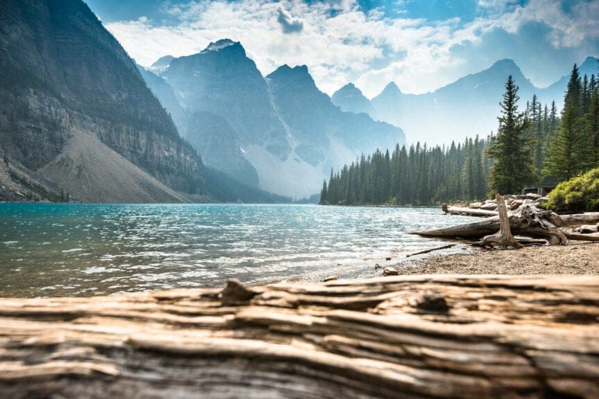
      Water in the West—one of the most enduring and confounding stories of human settlement anywhere around the world.

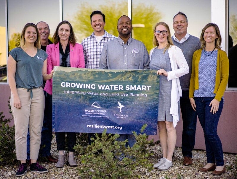
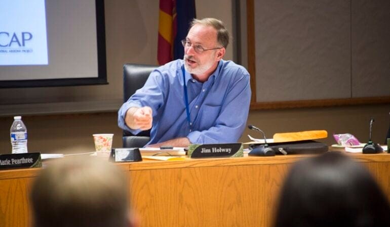
      Jim Holway, who retired as director of the Babbitt Center for Land and Water Policy this summer, has spent more than 40 years helping to solve the puzzle of ensuring sustainable water resources in this increasingly arid region. In the latest Land Matters podcast, he describes the challenges ahead, and the kind of leadership—and serious, good-faith negotiation—it will take to establish a more secure water future.

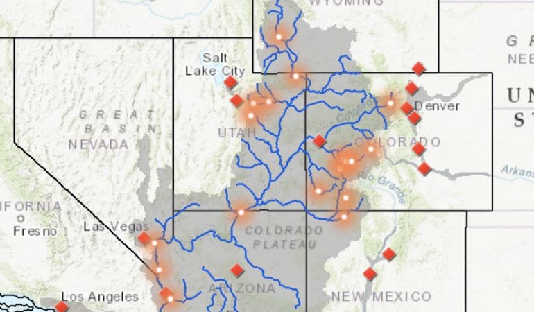
      With some places having their water restricted, and big reservoirs like Lake Mead drawing down to historically low levels, it has become increasingly clear that water from the Colorado River—distributed to nine states in the US and Mexico through a series of agreements and amendments hammered out since the 1920s—is no longer enough to meet the demands of a fast-growing population.

      How did the region get to this point? “I’d say it was a combination of optimism, beginning with allocating more water [than would be available], and then it was just ignoring science for political reasons,” said Holway. “If I want to get my water project approved, it’s going to be a lot easier if I can convince people there’s enough water left for their project too. Even once we should have known better, we acted like we didn’t know better.”

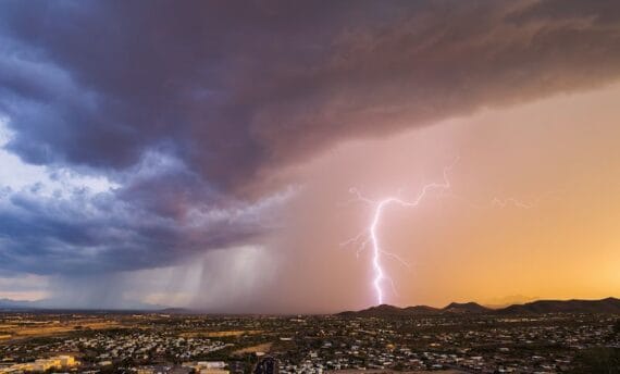
      The water allocations now have a structural deficit, Holway said, that is clear throughout the year-to-year ups and downs of drought and sufficient snowpack. Climate change is intensifying everything.

      “We designed a hydrologic system for a physical reality that is changing on us, and the change in the level of heat is driving the system. More evaporation and more demand for agriculture, more demand in urban use—that heat is actually a more significant factor than precipitation. Whereas there is a lot of uncertainty about what the future precipitation changes will be in the Southwest, it’s very clear that it’s going to be hotter.”

      While politicians debate climate science, Holway says, water and land managers know they have no choice but to prepare for the uncertain future that climate change will bring: “Droughts that cause inadequate supplies for historic uses, floods that exceed the infrastructure we’ve built to handle flooding, wildfires of much greater intensity and size, urban areas that are getting increasingly hot and leading to crisis situations in the middle of the summer—this is the reality of our future, and we need to adapt to deal with it.”

      Building the capacity of local communities to integrate land use planning and the management of water resources has been the calling card of the Babbitt Center under Holway’s tenure, including using scenario planning techniques to map out future supply and demand conditions. Importantly, agriculture—which uses approximately three-quarters of Colorado River water—has increasingly been at the table, Holway said.

      When asked to look to the future, Holway said, “It’s important for anyone doing this kind of work to find some way to sustain themselves. I suspect the thing that makes me most optimistic is when I look at the 20- and 30-year-olds getting involved . . . it seems that they really have an understanding of the challenges they’re inheriting.”

      One of those challenges is developing the capacity to work together as a civilization to address water shortages in a more serious and straightforward manner, he said.

      “When societies fail, it may look like it’s because of a flood, a drought, disease, or warfare. However, societies have survived those challenges before. Why do they not survive the next one? Typically, what we find is they have lost the ability to govern themselves.

      “To me, that is where my main pessimism comes from. It isn’t our water challenge. It’s, will we come together? Will we make the necessary decisions we need to govern ourselves? That is our biggest challenge, and it’s what we’re doing particularly badly at the moment.”

      Water, Holway said, “perhaps will help us rediscover our ability to come together and make collaborative decisions. There are very few things that humans see as critical to their survival [more than] a good water supply. That’s pretty clear and pretty compelling. Let’s hope it’s part of our path forward.”

      Jim Holway served as director of the Babbitt Center for Land and Water Policy from its founding in 2017 until late 2023. He was elected to the board of the Central Arizona Water Conservation District, directed the Western Lands and Communities program with the Sonoran Institute, and served as a professor of practice in sustainability at Arizona State University and assistant director at the Arizona Department of Water Resources. He has degrees from Cornell University and the University of North Carolina, and was inducted into the College of Fellows of the American Institute of Certified Planners.

      You can listen to the show and subscribe to Land Matters on Apple PodcastsGoogle PodcastsSpotifyStitcher, or wherever you listen to podcasts.


      Anthony Flint is a senior fellow at the Lincoln Institute of Land Policy, host of the Land Matters podcast, and a contributing editor of Land Lines.

      Lead image: Jim Holway, founding director of the Babbitt Center for Land and Water Policy. Credit: Courtesy image.


      Further Reading

      Colorado River growers say they’re ready to save water, but need to build trust with states and feds (NPR)

      John Farner Named Executive Director of the Babbitt Center for Land and Water Policy (Land Lines magazine)

      Fellows in Focus: Neha Gupta (Land Lines magazine)

      The Babbitt Center: Who We Are (Lincoln Institute of Land Policy)

      The Hardest-working River in the West (Lincoln Institute of Land Policy)

      Sowing Seeds (Lincoln Institute of Land Policy)

      Babbitt Center for Land and Water Policy

      Image Credit
        Contact

        Phoenix, Arizona

        Paula Randolph
        Associate Director
        prandolph@lincolninst.edu
        602-393-4313

        Who We Are
        The Babbitt Center is building capacity to secure our water future. Learn More

        The sustainability of water and land resources is one of the greatest challenges facing the Colorado River Basin. Since most land use requires an adequate water supply, meaningfully addressing this challenge requires recognizing how land use decisions shape water demand. This link is the cornerstone of the Babbitt Center for Land and Water Policy, a center at the Lincoln Institute of Land Policy.

        Building Capacity to Secure Our Water Future

        Land use decisions that shape our water future are made every day. And a thriving, sustainable future in the West requires that communities integrate land and water policy decisions. The Babbitt Center seeks to advance the integration of land and water management to meet the current and future water needs in the Colorado River Basin. Our efforts will advance water sustainability and resilience in the Colorado River Basin, throughout the West, and ultimately throughout the world.

        Watch the Babbitt Center signature video to learn more about our approach to solving water management and land use integration challenges.

        Our Work

        Real-world understanding, research and training, and collaborative partners who share resources are valuable catalysts that strengthen a community’s ability to secure its water future. Our work is focused throughout the seven Colorado River Basin states, binationally across the basin into Mexico, and with 30 Native American tribes, boosting communities’ resilience and building a global exchange of transformative ideas with other arid and semiarid regions.

        Learn More About Our Work

        Featured Programs and Projects

        Integrating land use and water management requires innovative approaches and partnerships. The Babbitt Center works closely with governmental organizations, nongovernmental organizations (NGOs), academic institutions, and business leaders to address challenges and harness opportunities. We conduct research and develop tools, promote best practices, provide training, and facilitate partnerships to guide decision-making for sustainable management of land and water resources.

        Map of Colorado River Basin

        Colorado River Basin Map

        The Babbitt Center for Land and Water Policy produced an updated Colorado River Basin Map in partnership with the Center for Geospatial Solutions. This map showcases the geography and hydrography of the Colorado River Basin, corrects inconsistencies in contemporary maps of the region, and provides water managers, tribal leaders, educators, and other stakeholders with an updated resource as they confront critical issues related to growth, resource management, and sustainability.

        See the Map

        Growing Water Smart

        Historically, planning for water resources and land use have been conducted separately. Yet, where and how we build greatly impacts water supply and demand and the quality of water that supports our ecosystems. The Growing Water Smart program helps community leaders integrate water and land use planning to further the sustainability and resilience of their community. Multidisciplinary community teams of key decision-makers and personnel, such as elected officials, planning commissioners, water resource managers, land use planners, and economic and community developers, come together in facilitated work sessions to: 1) set a workshop intention, 2) evaluate current water smart policies and practices, 3) develop community water efficiency goals, 4) make the case for water smart change in their communities, and 5) create a team action plan that identifies tasks and timelines for meeting the community’s water efficiency goals.

        Learn More About Growing Water Smart

        The Hardest-Working River in the West: A StoryMap of the Colorado

        Explore the key water sustainability issues in the Colorado River Basin through data and stories updated regularly. Although not the largest or longest river in the world, the Colorado River connects a rich array of social and ecological communities along its 1,450-mile journey from its headwaters in the Rocky Mountains of Colorado to its mouth in the Gulf of California, Mexico.

        See the StoryMap

        Sowing Seeds: How Scenario Planning Can Help Agricultural Communities Build a Resilient Future

        In March 2023, a consortium of Mesa County, Colorado, residents gathered to use a process called exploratory scenario planning, or XSP, to envision a more resilient future for their community and agricultural economy. The Mesa Conservation District hosted the workshop, developed by the Babbitt Center in partnership with Lincoln Institute’s Scenario Planning team and Arizona State University’s Arizona Water Innovation Initiative. XSP helps communities plan for an uncertain future by exploring multiple possibilities of what might happen. The practice helps planners, community members, and other stakeholders consider various futures and how to effectively plan with various driving forces at play. XSP encourages a wide range of perspectives and brings diverse voices into the discussion to help create plans that community leaders and stakeholders can implement.

        Watch the Documentary

        Cover of Perspectives from the Field

        Perspectives from the Field: The Future of Agriculture

        The Colorado River is pivotal in supporting agricultural production throughout the basin, not only contributing significantly to the economies and livelihoods of rural communities but also supporting our national food supply and global food security.

        The Babbitt Center engaged in a yearlong study to understand the perspectives of agricultural producers in the region. The team personally interviewed 74 farmers and ranchers to understand the difficulties they are facing as well as their immediate concerns regarding the need for collaboration to secure the future of agriculture in the Colorado River Basin. Our goal was to learn about their reality and elevate their voices as crucial stakeholders in any water discussions.

        Read the Executive Summary

        OUR EXPERTS

        John Farner

        Executive Director, Babbitt Center for Land and Water Policy

        Lincoln Institute of Land Policy

        Phoenix, Arizona

        Paula Randolph

        Associate Director, Babbitt Center for Land and Water Policy

        Lincoln Institute of Land Policy

        Phoenix, Arizona

        Kristen Keener Busby

        Associate Director for Practice and Partnerships, Babbitt Center for Land and Water Policy

        Lincoln Institute of Land Policy

        Phoenix, Arizona

        Nike Opejin

        Program Manager, Babbitt Center for Land and Water Policy

        Lincoln Institute of Land Policy

        Phoenix, Arizona

        Nina Gruber

        Administrative Manager, Babbitt Center for Land and Water Policy

        Lincoln Institute of Land Policy

        Phoenix, Arizona

        Zach Sugg

        Associate Director for Research, Babbitt Center for Land and Water Policy

        Lincoln Institute of Land Policy

        Phoenix, Arizona

        The Hardest Working River in the West

        A StoryMap Exploring the Colorado River Through Data

        Although not the largest or longest river in the World, the Colorado River is known for its many legacies. The Babbitt Center for Land and Water Policy developed a StoryMap about the Colorado River, its tributaries, and the lands upon which communities, economies, and the environment depend. It is also about the places, people, and policies that have shaped water and land management and planning in the past and will continue to shape decisions about how we use, share, and conserve these finite resources today and in the future. With a widening gap between supply and demand, the water resources upon which land use, planning, and development depend are more vulnerable than ever.

        This story is told across five sections:

        • A Balancing Act
        • Of Storage and Shortages
        • Who’s Using Water and Where?
        • Water Management Hurdles
        • Tools for a Resilient Future
        data

        The Babbitt Center has created an Esri ArcHub open data portal that contains the data, maps, and related reports seen or mentioned in The Hardest Working River in the West StoryMap. This allows individuals to download and explore the data for themselves.

        Explore the Portal