Think of digital signage in an urban streetscape, and you probably picture something like Times Square or Las Vegas. The unique attractions of those places notwithstanding, few municipalities are looking to replicate that aesthetic. In most urban downtowns, big, bright signs with moving images have faced very tight restrictions, if not outright banishment.
But a different response has started to emerge over the years, and especially recently, in cities from Denver to Atlanta, San Antonio to San Jose. The evolution of digital signage technology, combined with some adventurous thinking and experimentation, has led to the development of “media districts” designed to breathe life into existing neighborhoods in urban downtowns and beyond.
Denver has been a notable pioneer. Two decades ago there was, by legislative design, no digital signage downtown. As an advertising medium, such signs were seen as little more than extra-garish billboards, benefitting only their outdoor-media company owners and private landlords. But at the same time, the city was trying to figure out how to bring more activity—and actual light—to downtown streets around its performing arts complex and convention center, an area that tended toward unwelcoming darkness after nightfall. It was tough for restaurants and other businesses to draw customers, and the area lacked “a sense of place,” says David Ehrlich, who is now the executive director of the Denver Theatre District, and back then was a consultant with sports and entertainment businesses on venue projects.
Asked to work with the city on ideas for enlivening the district, Ehrlich was inspired by an old photograph of the same area in the late 19th century, lit up by then-newfangled light bulbs and dubbed “the brightest street in America” by Thomas Edison. “Literally in the picture you could see a bunch of people on the street,” Ehrlich says. “I thought, you know, let’s do a back-to-the-future thing. Let’s take modern media to serve that purpose of creating a sense of place, a sense of safety.”
Today there are 17 digital signs of varying size installed in a 16-square-block area (along with 29 static, non-digital billboard-style signs that have gone up since the city implemented new regulations). Participating media companies that own the signs distribute 15 percent of their revenue — which generally works out to more than $1 million a year — to the nonprofit, nongovernmental Denver Theatre District, which funds various events and arts projects in the area. Some of these projects take place on the signs themselves: the companies are also required to turn over 20 percent of the screens’ time to the DTD for arts and cultural organizations, which can either promote their events or present their own programming. DTD also produces events and attractions like Night Lights Denver, an ongoing outdoor art installation involving light projection on certain buildings in the district; a “15-second video festival,” presenting short films made by artists on downtown LED screens; and other digital work by local, national, and international artists.
A glimpse of Denver’s brightly lit Curtis Street, once known as “theater row,” in the early 1900s. Credit: Denver Public Library via Denver Community Planning and Development.
Officials in Denver created a DTD sign plan as a supplementary document to the city code, originally involving a potential for 10 signs that were strictly banned elsewhere downtown. The plan put in place some general design parameters, explains Matthew Bossler, a senior city planner for Denver. These include, for example, a limitation on the luminosity of 25 lumens, and a specification that signs be located above the ground floor]. “There’s a kind of flexibility granted in exchange for higher design standards,” Bossler adds. “It also describes where on each building facade different types of signs can occur and some additional requirements such as how to avoid residential impacts.”
Given the initial permit application process (and the aftermath of the financial crisis), the first few signs went up gradually, over a period of four or five years. The technology underpinning digital signage, which had already evolved toward LED lighting, continues to improve. “You’re looking at a technology that has changed substantially in the last 15 years,” says James Carpentier, director of state and local government affairs for the International Sign Association (ISA), a trade organization. In addition to allowing for adjustable brightness and automatic dimming, it’s now much easier to configure “hold time,” to address concerns about quickly rotating ad messages potentially distracting drivers. (A typical digital sign, or “electronic message center” in most cities is 100 square feet, compared to an average of 7,000 square feet in Las Vegas, according to the ISA.)
On a more aesthetic level, modern LED signs offer much higher resolution and better color, can automatically adjust to changing light conditions, and consume less power than earlier technologies. Modular LED panels allow for varied design options, including curved screens – like the 25-by-60-foot sign-and-screen cluster at the intersection of 14th and Champa streets on the parking garage of the Colorado Convention Center. And they’re easier to coordinate, so that programming can run in sync on multiple screens.
Ehrlich now works with other cities, including Atlanta and San Antonio, through the Urban Activation Institute. While specific implementations vary, the basic blueprint is similar: Media companies get leeway to deploy signs under certain conditions, providing a steady revenue stream for local arts or other initiatives. Previously undervalued areas get a boost, ideally helping restaurants and other businesses. Proponents also say the additional light can help promote public safety. And local government spends nothing.
Opponents counter that the signs are too bright, potentially unsafe, or compromise the authenticity and character of cityscapes. “Imagine a digital advertising dystopia,” wrote one electronic signage foe in response to San Jose’s consideration of trying its own version of Denver’s experiment. Others contend that the tie-in to arts funding is a slick trick by advertisers to gain the support of resource-strapped policy makers. Planners, meanwhile, have had to consider how to regulate the technology, developing guidelines based on size, location, and other factors.
Even in Denver, the district is a work in progress, but one that seems to have at least some fans. Bossler, the planner, is currently managing two rezoning cases involving properties that are immediately adjacent to the DTD, whose owners are seeking to be rezoned in order to get into the district, specifically aiming for approval for large-format sign installations.
“The theater district is one that we can generally describe as being a unique sub area within downtown that draws many visitors,” Bossler says. “And the special allowances for signs can contribute to that. The electronic billboards that are allowed in the district bring light, color, and dynamism to some of the most frequented areas of downtown, particularly those that are connected to our major theaters. This creates kind of a special ambiance and liveliness in the streets and public places within the district.” It encourages walking and presents a vibrant image, he adds, drawing more people to the district’s businesses—and that kind of economic impact is a positive sign.
Lead image: A moment from the Supernova digital animation festival organized by Denver Digerati, visible on a digital billboard at 14th and Champa streets in downtown Denver. Credit: Denver Digerati.
This article is reprinted with permission from Bloomberg CityLab, where it originally appeared.
At the American Institute of Architects conference this year in Boston, those dressed in black—long the unofficial uniform of uber-creative design professionals—seemed to be outnumbered. The architects prowling the convention center were more likely to be sporting button-down Oxfords or Patagonia, on their way to such sessions as “Next-Level Roofs: Energy Efficiency, Embodied Carbon, and Code Compliance.”
An architectural trend can’t be based on a wardrobe census, of course, but a shift toward more practical, sustainability-oriented work was palpable. And increasingly, that means working on retrofits, rather than creating snazzy new structures. AIA billings survey data in 2022 revealed that architects for the first time were earning more revenue for commissions on existing buildings than new construction. Recent Pritzker Prize wins by Lacaton & Vassal and David Chipperfield represent high-profile recognition of advances in restoration and renovation. Rules are being put in place to encourage adaptive reuse, as in Los Angeles, or to promote a circular economy and limit demolition, as in San Antonio. Those ordinances are alongside financial incentives offered by several local governments for converting office buildings to residential use.
So while some may still dream of becoming the next Frank Gehry or Zaha Hadid, many design professionals these days seem to be singularly—almost soberly—occupied with reworking blueprints, as part of the quest to make the built environment as green and socially responsible as possible.
“The most urgent thing that’s on our plate right now is climate action, and that we have to decarbonize very rapidly,” said Carl Elefante, author of the recently published Going for Zero: Decarbonizing the Built Environment on the Path to Our Urban Future and the architect credited with coining the phrase that the greenest building is the one that is already built.
It might be called the Retrofit Revolution. Or, more dramatically: the End of Architecture. At least as we knew it.
“Architecture’s long capital-P Project of exploring ever-more-complicated forms has finally come to an end. The heroic pursuit of formal complexity for its own sake feels like a bygone thing,” writes editor Jack Murphy in the May issue of The Architect’s Newspaper. “Architects should still make things, but perhaps they should be making maintenance plans or organization charts or business plans or adaptive reuse scenarios or affordable housing. Making form is necessary but easy; it’s the rest of the stuff that is hard.”
Does this mean nobody can build anything new, much less have any fun anymore? Not necessarily. It’s a safe bet there will always be a place for contemporary design—just as long as it’s green.
“There is only one crucial divide in architecture: architecture that is dependent on heavy fossil fuel inputs, and architecture that isn’t,” writes Barnabas Calder, historian of architecture at the University of Liverpool. In this context, style is beside the point.
The more critical distinction with this baseline specification of sustainability is that existing buildings, and all their embodied carbon, generally have an edge over new construction. So not only architecture but related fields like urban design, landscape architecture, planning, engineering, and mechanical, electrical, and plumbing work “are all duking it out, so to speak, to get a share of this emerging market sector,” said Lori Ferriss, executive director of the Built Buildings Lab.
Increasingly, advances in technology in the field are geared toward retrofits, including determining the all-important issue of cost (it can often be cheaper to renovate versus demolish and build anew, though that’s not always the case). The CARE Tool (Carbon Avoided: Retrofit Estimator) is used by builders to help measure the environmental benefits of renovations. The global design firm Gensler has developed software called Conversions+ that can help determine the viability of converting office buildings to residential use, through a cost-conscious algorithmic analysis of elements such as floor plates, window and elevator locations. A company called Existing Conditions, exhibiting at the AIA convention, offers laser scanning and radar sensors so renovators can know the location and condition of the guts of any building, from pipes to rebar.
And accordingly, much of the brain power in architecture is being devoted to things other than creating sculptural elements that are interesting to look at. The work is almost by definition not showy, in the sense that it’s more likely to be rethinking the arrangement and quality of spaces on the inside of existing buildings, rather than the appearance of facades and exteriors. Some of the best energy and innovation in the field is likely to be found not in starchitect-led firms but ones like Gensler, a roll-up-the-sleeves operation that just won theNational Building Museum’s 2025 Honor Award. The company, spurred on by the need for reinvented workplace interiors post-pandemic, has excelled in what This Old House viewers might recognize as the gut rehab. Similarly, a rising star is Annabelle Selldorf, is best known for projects like her expansion of New York City’s Gilded Age Frick Collection.
“Architecture is becoming less about individual expression and more about collective responsibility,” said Harry Cliffe-Roberts, Gensler’s building transformation and adaptive reuse leader.
All kinds of design innovations, whether in new construction or retrofits, are being celebrated more for broader societal goals, like affordable housing. The winner of the Single-Stair Design Competition, for example, was recently honored at the Congress for the New Urbanism in Providence, Rhode Island. Outdated codes requiring multiple egress in multifamily projects four stories and higher have been identified as a major contributor to higher housing costs; the problematique is how to configure stairways to maintain access and safety.
A little bit nerdy, to be sure, but part and parcel of the new ethos.
As to the next logical question: Have US architecture schools kept up? A handful of institutions have prided themselves on weaving practical elements into the curriculum, from zoning to finance. It’s a bit of a subjective assessment, but those that worship a little bit less at the altar of form include Northeastern, Carnegie Mellon, the University of Notre Dame, and the University of Miami.
At the Rhode Island School of Design, Liliane Wong, author of Adaptive Reuse in Architecture: A Typological Index, has catalogued 50 conversion and reuse projects worldwide, including buildings such as the TWA Hotel at New York’s John F. Kennedy Airport, the Caixa Forum in Madrid, and the New Museum in Berlin.
“Let’s say I’m a design professor at a top university—I’m so erudite, you can hardly understand a single word I say. Is there a pedagogy of building reuse that would interest that guy?” said Elefante. In creating that pedagogy, he said, retrofit-minded professors ask, “What are the different ways that you can intervene with an existing building? Wouldn’t this be a cool design? It’s sort of the fox guarding the henhouse on getting the designers who scorn existing buildings for their architectural character, to actually understand retrofit as something that could be an interesting design challenge.”
Those who emphasize reuse are up against a stubborn tradition, in both firm culture and design education. “There’s always been a professional bias toward building new,” said Hillary Brown, author of Revitalize | Resettle: How Main Street USA Can Provide New Beginnings for America’s Climate Displaced. “It starts in architecture school where the studios mostly emphasize new form making. The journals seem to prefer new construction … that needs to change.”
Altogether, the prospects don’t look good for architect as artist. It’s not just the technological advances of artificial intelligence, which is poised to do the work of humans just as in the fields of medicine, journalism, and law. Pattern language playbooks provide step-by-step instructions for traditional ways of building. At Northeastern, an initiative called Equitable Zoning by Design offers visualizations of residential buildouts in areas being considered for rezoning. The idea is to conjure an easily repeatable urban design that will make dense multifamily development more acceptable to wary neighbors.
All sensible, though it does raise an uncomfortable question. With all the new software and off-the-shelf guides, who needs creative types to make aesthetic judgements?
Shaking up established frameworks is never easy, as George Clooney, playing the journalist Edward R. Murrow, recognizes in the opening monologue of Good Night, and Good Luck: “This just might do nobody any good.”
What seems likely is that the top architecture schools may have students learn about Le Corbusier as historical artifact—but disabuse their graduates of any notion of operating like him. With an eye toward being that much more employable, the next generation of architects may well demand it.
Lead image: In Boston, this former office building at 31 Milk Street is slated for conversion to 110 residential units. Credit: Jimmy Emerson via Flickr.
City Tech
Augmented Reality Offers a New Perspective on Urban Planning
Public land use projects and digital gaming don’t seem to have much in common. But the next wave of innovation to shape cities may come from a technology that’s blurring those lines. Last year, for instance, the Central Ohio Transit Authority (COTA) set out to win voter approval for a tax to fund a new transit plan in Columbus, called LinkUs, that included a new bus rapid transit corridor. To make its case, the agency needed to help officials, and ultimately the public, visualize the positive changes this could bring to the corridor, adjacent neighborhoods, and the commuting experience. That’s a familiar challenge, but COTA’s strategy included an unusual component: augmented reality (AR) technology.
Artists and game designers have made creative use of AR—which layers digital images on top of real-world views seen through phones, headsets, and other devices—for years. In popular games like Pokémon Go, you peer at the world through your device’s screen, and the physical environment is suddenly inhabited by animated creatures and other digital objects relevant to game play. But AR can also be used to layer visualizations of more civic-minded elements onto city spaces: public art, monuments, and even transportation infrastructure.
“A lot of presentations were being done in the community via PowerPoint or a pitch deck,” recalls Aslyne Rodriguez, COTA’s senior director of regional strategic partnerships. “However, there was this need for and want to have something that was a more tangible experience.” The planned corridor was simply a highway. How to engage citizens with what its future could be? “It was important for people to know what bus rapid transit looks like, but we also wanted to show them what happens when you bring bus rapid transit,” Rodriguez continues. “New development pops up, new business, new grocery stores. And [the project included] protected bike lanes and connections to trails. So it was a very big message.”
Learning about AR led them to inCitu, a technology firm based in New York that has produced a range of AR experiences, from walking tours to visualizations of municipal projects. With additional partners including the strategic engagement firm MurphyEpson, they identified key sites along the current, regular bus route and devised an immersive tour: Participants would use their phone to scan a QR code, activating AR-enhanced depictions of what was planned. Guided, immersive bus tours ran twice a week for six months, attended by hundreds of community stakeholders. In addition, the partners placed QR codes on existing bus shelters and other points along the route to make the AR pitch even more accessible for those unable to take the guided tour. Voters approved the plan’s funding.
Of course, COTA also used traditional outreach methods, including community meetings and presentations, and a social media push (the mayor even posted a selfie in the AR version of a new transit station). But this form of digital immersion offers a distinct engagement experience. “There is something magical about scanning a QR code, raising your phone, and seeing the future,” says inCitu founder and CEO Dana Chermesh-Reshef.
Participants in a walking tour of permitted developments in Brooklyn, New York, scope out the future with their phones. Credit: inCitu.
COTA’s successful experience was cited in a December 2024 report from Urban Tech Hub at Cornell Tech’s Jacobs Institute that explored the possibilities of augmented reality for cities and municipalities. But those possibilities may also introduce challenges; consider, after all, the disruptions caused by the emergence of ride-sharing, short-term rentals, and smart-city technologies, says Greg Lindsay, the report’s author and a former urban tech fellow at the Urban Tech Hub. Lindsay wrote the afterword for the Lincoln Institute’s City Tech book and delivered remarks on cities and technology at a recent Lincoln Institute convening on land policy and digitalization.
A taller building is visible on screen in this augmented reality prototype created for a Manhattan development. The prototype earned more than 100,000 views. Credit: inCitu.
AR, Lindsay argues, is at heart a new way of using public spaces by adding digital layers to them, potentially raising questions about how such content (commercial and otherwise) should be overseen or regulated, and who will end up setting those terms: tech platforms, cities, or some other entity. The challenge for cities, Lindsay says, is: “Can you get better at anticipating disruptors and heading them off at the pass?”
This is why one of the recommendations in Lindsay’s report is that cities should be open to experimenting with AR sooner rather than later, to develop a comfort level with the technology, even if potential use cases aren’t fully determined. While COTA provides a striking example of using AR in a way that directly impacted land use decisions, Lindsay points out that collaborations with artists, educators, and civic groups can also play a role. This year, Bloomberg Philanthropies, the New York Parks Department, and the Christo and Jeanne-Claude Foundation presented an AR restaging of the artists’ famous 2005 installation, The Gates, creating a digital version of the piece’s 7,500 saffron-colored panels, visible through a smartphone. And artist Marcus Brown used AR to create what amounted to a digital installation around New Orleans, mapping and illustrating the history of the slave trade in that city. The possibilities, say AR proponents, are nearly endless.
These nascent technologies have considerable potential to improve cities, argues Chip Giller, cofounder and executive director of Agog: The Immersive Media Institute. “Storytelling can become three-dimensional, and planning tools can become three-dimensional,” he says. “So rather than just having a charette or having a computer model, you’ll be able to actually step into what the future could be.” Agog works with creators and nonprofit leaders to “harness the power of extended reality,” or XR, a term that encompasses augmented reality, virtual reality, and adjacent technologies.
One of Agog’s partners, Arizona State University, is in the third year of an ambitious project to reimagine and redevelop 14 vacant parcels in Los Angeles owned by Caltrans, the California transit agency. ASU is adopting the parcels, which Caltrans owns but had no plans for, under the agency’s Adopt-A-Highway program. With the help of other partners including Los Angeles Trade Tech Professor Marcela Oliva and the Collaboratorium, ASU’s Narrative and Emerging Media program is using technology to help engage community members in plans to develop the sites, says Nonny de la Peña, director of the ASU program and a pioneer in immersive digital storytelling.
Many of the lots are highway adjacent and awkwardly sized and located, and some have become targets for dumping and graffiti. The goal is not only to use AR and other immersive tech to plan new uses, but to help bring community members into the process, says de la Peña, “to regreen [the spaces], turn them into parks.” One space along the 110 freeway through downtown, not far from ASU’s satellite campus, has been turned into a community garden and park, and the partnership has broken ground on a second space and was choosing a third this spring.
As de la Peña explains, the project involves creating a three-dimensional digital twin of each site that students, residents, and stakeholders can experiment with, shaping what the space might become. “Before we even update the physical side of the site, we’re working with the community by teaching them some basic skills of creating 3D models,” says Sultan Sharrief, an ASU researcher and self-described “media scientist” in de la Peña’s program. “We’re providing the tools and the kind of structure—for example, how do we create the digital library of plants that will succeed in these spaces so they can then design with those in mind?” They’re now equipping the first site with sensors to keep its digital twin updated, so community members can keep tweaking the space. “We’re just getting started,” de la Peña says.
InCitu, the firm that helped bring AR into the Columbus transportation effort, is now involved in projects in Phoenix, New York, and other cities. In Washington, DC, the company is working with both the planning office and the office of technology, and it’s starting work with a downtown revitalization effort in Myrtle Beach, SC. It also now provides a web-based AR platform called inCituAR, designed to let planners and architects share their ideas and proposals, to experiment directly with the technology and its capabilities. In other words, plenty of municipal entities seem to be taking Lindsay’s advice to get familiar with AR and other immersive tools while they are still in relatively early stages.
“It’s not about the cool technology,” says inCitu’s Chermesh-Reshef, “it’s about the fact that this technology actually enables easy engagement and effective engagement.” The most promising projects, she says, are attempting to address one of the most familiar and longstanding challenges, and aspirations, of planning: “Our goal is to foster better conversations.”
Rob Walker is the author of City Tech: 20 Apps, Ideas, and Innovators Changing the Urban Landscape and The Art of Noticing. More of his writing can be found at robwalker.substack.com.
Lead image:Augmented reality allows this tablet owner to visualize a proposed affordable housing development in the Bronx, New York. The building visible behind the people on the screen replaces the parked cars in the actual background. Credit: inCitu.
At the Center for Geospatial Solutions (CGS), we partner with mission-driven organizations to build the data and technology infrastructure necessary for more informed and faster decision-making. We do more than deliver tools. We collaborate to create lasting solutions that reflect the complexity of today’s challenges.
Our work focuses on areas where interdisciplinary expertise and spatial data and systems design are essential to impact:
Ecosystem conservation and restoration
Water quality and scarcity
Affordable housing and equitable land use
Climate adaptation and sustainable development
We serve nonprofits, foundations, governments, coalitions, and businesses through fee-for-service contracts, cooperative agreements, and grant-supported partnerships. With every engagement, our goal is the same: to help clients use geospatial intelligence to drive better outcomes for people and the planet.
Core Expertise
Many mission-driven organizations still lack access to the modern data infrastructure and tools they need. CGS helps fill that gap by delivering practical, scalable solutions across three key areas:
Data Modernization
We help partners upgrade and connect fragmented systems, developing scalable, interoperable data infrastructure that supports long-term use and collaboration.
Data Fusion
We integrate diverse datasets, like parcel ownership, demographics, infrastructure, and environmental indicators, to create a clearer, more complete picture of complex issues.
Data Visualization
We build intuitive tools including dashboards, maps, and planning interfaces that turn data into actionable insights for decision-makers and communities alike.
Director, Internet of Water, Data Science and Engineering
Center for Geospatial Solutions, Lincoln Institute of Land Policy
Events
Consortium for Scenario Planning 2026 Conference
February 4, 2026 - February 6, 2026
Salt Lake City, Utah
Offered in English
SHARE
The Lincoln Institute of Land Policy’s Consortium for Scenario Planning is hosting its ninth annual conference February 4–6, 2026, at the University of Utah in Salt Lake City, Utah. Cohosted by the Lincoln Institute, the University of Utah, Wasatch Front Regional Council, and Envision Utah, the Consortium for Scenario Planning Conference brings together practitioners, academics, planners, students, and policymakers to share scenario planning cases, discuss new tools and methods they are using, and network with peers.
En el barrio de Carondelet en St. Louis, donde los astilleros que alguna vez estuvieron ocupados dieron paso a espacios vacíos y abandonados durante las últimas décadas del siglo XX, una compañía global de minerales especializados está construyendo una fábrica de US$ 400 millones para producir baterías de alta eficiencia para el almacenamiento de energía.
Recientemente, se levantó una nueva fábrica en medio de las acerías y las minas de carbón cerradas de Weirton, Virginia Occidental, construida por un fabricante diferente cuya tecnología de baterías consiste en mezclar partículas de hierro y aire.
Y en Schenectady, Nueva York, donde la producción de luces, electrodomésticos y motores eléctricos por parte de la compañía General Electric (GE) de Thomas Edison estimuló un auge económico que comenzó a fines del siglo XIX y se había desvanecido a mediados del siglo XX, la primera de una clase de turbinas eólicas terrestres súper altas y de alta eficiencia recientemente salió de una línea de ensamblaje prístina en una nueva planta de GE.
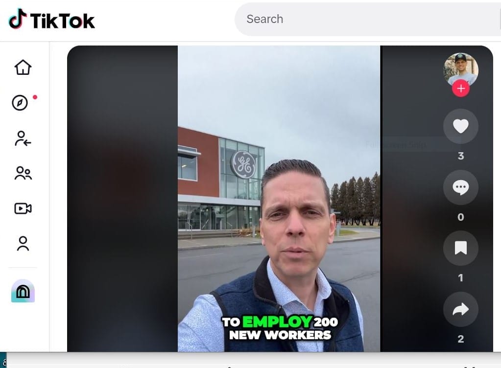
“Es un beneficio mutuo para el medio ambiente y la fuerza de trabajo local”, dijo el asambleísta del estado de Nueva York, Angelo Santabarbara, en un video de TikTok grabado fuera de la planta, que llegará a emplear a 200 personas, incluida la mano de obra calificada del sindicato. El resultado final, dijo, será “un futuro energético más asequible, confiable, sostenible y seguro”.
El legislador neoyorquino, Angelo Santabarbara, elogia el auge de la energía limpia en TikTok. Crédito: Oficina del legislador Santabarbara.
Todos estos proyectos y docenas más en todo el país son manifestaciones de una nueva política industrial federal basada en el lugar, impulsada por más de US$1 billón en créditos fiscales y subvenciones en virtud de la Ley de Empleo e Inversión en Infraestructura, el Plan de Rescate Estadounidense, la Ley de CHIPS y Ciencia, y sobre todo, lo que en esencia es una legislación de acción climática radical, la Ley de Reducción de la Inflación.
Ante la necesidad urgente de fabricar los componentes de la transición a energía limpia (vehículos eléctricos, baterías y almacenamiento de energía, equipos para estaciones de carga, turbinas eólicas, paneles solares y muchas otras piezas de la transición sin combustibles fósiles, como líneas eléctricas de fibra de carbono de alta capacidad para reforzar la red eléctrica sobrecargada del país), la administración de Biden ha tomado varias decisiones estratégicas.
En primer lugar, la Casa Blanca declaró que los Estados Unidos no debería ceder toda esta industria avanzada a China, que es el actual líder mundial en la producción de equipos eólicos y solares y vehículos eléctricos baratos. Y si estos artículos se van a fabricar en los Estados Unidos, según dicen los funcionarios de la administración, debería suceder en antiguas ciudades industriales y condados empobrecidos: los “lugares donde la oportunidad se ha ido”, como dijo el asesor climático de la Casa Blanca, Ali Zaidi, en una conferencia de la Universidad de Columbia el otoño pasado.
Desde que el presidente Biden asumió el cargo, las empresas han anunciado más de US$250.000 millones en inversiones privadas, una cantidad sin precedentes, para fabricar “las tuercas y los tornillos de la energía limpia”, dijo Ben Beachy, asistente especial del presidente para Política Climática, Sector Industrial e Inversión Comunitaria. “La administración se compromete a garantizar que las comunidades y los trabajadores más afectados cosechen las recompensas de este auge, incluidas las comunidades desindustrializadas”, dijo Beachy.
Los dirigentes de las antiguas ciudades industriales, que han estado luchando con la pérdida de producción y población durante décadas, dicen que reciben el impulso con gratitud. Muchos perciben algo poético sobre el reemplazo de procesos de fabricación altamente contaminantes de hace un siglo por una industria que funciona de manera sostenible y que produce equipos que ayudarán a reducir las emisiones de combustibles fósiles. El pivote, tanto cultural como en relación con el desarrollo económico, ya está llevando a algunos a llamar el Medio Oeste y el Sureste el “cinturón de baterías”.
“Ciudades como la nuestra han crecido en base a la innovación energética, pero eso tuvo un precio”, dijo Paige Cognetti, alcaldesa de Scranton, Pensilvania, una ciudad conocida desde principios del siglo XX por sus industrias de carbón y electricidad que generaban hollín. Cognetti cita las raíces de Biden en la ciudad de clase obrera como factor en la iniciativa para ayudar a las antiguas ciudades industriales a participar en la transición a la energía limpia: “Creo que entiende que son necesarias grandes inversiones para preparar regiones para el éxito económico y la resiliencia ante el cambio climático”.
Sin embargo, quedan muchas preguntas sobre la implementación, entre ellas, si las regiones económicamente empobrecidas pueden hacer aparecer, por arte de magia, el ecosistema necesario para apoyar a la nueva industria: primero que todo, una fuerza laboral capacitada, pero también otros elementos como infraestructura, viviendas e instituciones cívicas y de educación superior activas para proporcionar no solo capacitación sino también investigación y desarrollo.
Además, la enorme cantidad de inversión federal que fluye de Washington requerirá una gran capacidad administrativa a nivel estatal y local para descubrir las oportunidades, gestionar las transacciones, y cumplir con las normas y regulaciones.
Por último, se espera que los problemas de uso del suelo compliquen el esfuerzo. La cantidad de espacio que necesitan muchas de las empresas privadas, en particular, para construir vehículos eléctricos, es tal que los mejores sitios se encuentran en la periferia de las ciudades que requiere un desarrollo totalmente nuevo, en lugar de en el núcleo urbano. El redesarrollo en terrenos urbanos vacíos es posible, pero la reutilización adaptativa y la regeneración de terrenos abandonados implica un importante aumento de los costos.
Los desafíos son muy reales, pero también lo es la oportunidad. Si bien el gasto federal de la IRA podría verse interrumpido con un cambio en las administraciones, la derogación requeriría una acción del Congreso. Mientras tanto, miles de millones de dólares en fondos federales han comenzado a fluir de las primeras inversiones de esa ley. Los gobiernos locales, regionales y estatales y sus socios deben estar listos con planes reflexivos y viables para su implementación, dijo Peter Colohan, director de Estrategias Federales del Instituto Lincoln de Políticas de Suelo.
“El dinero y los incentivos que salen del gobierno a un ritmo acelerado están haciendo que la inversión privada sea irresistible: en energía limpia, soluciones climáticas basadas en la naturaleza y fabricación avanzada”, dijo. Añadió que los problemas del uso del suelo y la equidad surgirán con regularidad, lo que demandará que los gobiernos estatales y locales, las organizaciones filantrópicas y las organizaciones sin fines de lucro ayuden a “crear círculos virtuosos de inversión comunitaria y evitar daños no deseados”.
* * *
La historia de los subsidios en la manufactura estadounidense tiene algunas complicaciones, pero en última instancia, el gobierno ha apoyado a la industria de una forma u otra durante más de dos siglos. Desde los primeros molinos de harina a fines del siglo XVIII hasta el advenimiento de la línea de ensamblaje automotriz, la fabricación en los Estados Unidos satisfizo una necesidad del mercado de bienes y suministros que fue impulsada en gran medida por el espíritu empresarial individual, aunque en general fue recibida con los brazos abiertos por funcionarios locales felices de asegurarse de que las transacciones de tierras, por ejemplo, se realizarán sin problemas para establecer fábricas y viviendas de trabajadores cercanas.
Durante esa primera era de crecimiento industrial, el gobierno también intervino para proporcionar la infraestructura necesaria para apoyar el comercio, desde una red ferroviaria nacional hasta puertos y canales. Las fábricas solían ubicarse bien cerca de los límites de la ciudad, ya que su acceso a las vías fluviales y las líneas ferroviarias hacía que fuera bastante fácil llevar los productos al mercado, tanto el nacional como el extranjero. La huella física de este crecimiento en las ciudades de los Estados Unidos fue transformadora, con estructuras de muchos pisos que se extendían por varias cuadras construidas para emplear a 10.000 trabajadores o más, y una densidad adyacente de viviendas y servicios.
Las principales fábricas y sucursales de Westinghouse Electric & Manufacturing Company en Pittsburgh, alrededor de 1905. Crédito: Biblioteca del Congreso.
La Segunda Guerra Mundial orientó el poderío industrial de la nación hacia la construcción de tanques y aviones para los militares, y comenzó una tradición de gastos en defensa descentralizados, con contratistas que se establecieron en los distritos del Congreso que se aseguraron de que los fondos del Pentágono siguieran fluyendo. La Ley de Carreteras Interestatales de 1959 fue otra importante fuente de inversión federal para las ciudades, impulsada por el argumento de que se necesitaba una infraestructura de autopistas nueva para el rápido movimiento de mercancías.
Cuando las economías de Japón y Europa se reactivaron en las décadas posteriores a la guerra, la fabricación en las ciudades del Cinturón del Óxido fue disminuyendo de forma gradual. Desde la década de 1950 hasta la década de 1970, las empresas privadas fueron aprovechando cada vez más la mano de obra más barata del extranjero, y la automatización tecnológica en la producción y la distribución redujo aún más la nómina. Así comenzó el declive de las ciudades que supieron ser prósperas en una franja que abarcaba desde el río Mississippi hasta el noreste, desde St. Louis hasta Cleveland, Allentown hasta Hartford.
La avalancha de cierres de fábricas durante la década de 1970 fue devastadora, dijo Alan Mallach, coautor de Regenerating America’s Legacy Cities (La regeneración de las antiguas ciudades industriales de los Estados Unidos), un informe de enfoque político publicado por el Instituto Lincoln. “Comience con la propuesta de que, en la década de 1950 y principios de la década de 1960, la mitad de todos los empleos en ciudades como Cleveland o Youngstown se concentraban en la manufactura, y luego tenga en cuenta que la mayoría de los empleos minoristas y de servicios tenían el soporte de salarios que ganaban los trabajadores de las fábricas, hay que calcular que del 70 al 80 por ciento de las economías locales en estas ciudades se basaban en su sector de manufactura. Así que ‘condenado’ puede ser un poco fuerte, pero se acerca”.
Agregue el fenómeno de la fuga blanca en el que los residentes blancos se movían en masa desde las áreas urbanas del centro hasta los suburbios, y lo que es notable es que las antiguas ciudades industriales sobrevivieron de cualquier modo, dijo Mallach. Dice que, con un entorno urbano físico y un tejido social y económico que atravesaba un cambio drástico, “gran parte del crédito se atribuye a las miles de familias negras de clase obrera y clase media que se mudaron a los barrios desocupados por familias blancas y los estabilizaron durante las próximas décadas”.
Durante el último medio siglo, ciertos tipos de manufactura continuaron siendo apoyados ad hoc por el gobierno de los Estados Unidos, en forma de aranceles selectivos, impuestos a competidores extranjeros para beneficiar al acero fabricado en los Estados Unidos, por ejemplo, o rescates directos, como los que gozó la industria automotriz después de la Gran Recesión. Mientras tanto, las empresas de tecnología, incluida Amazon, han recibido con frecuencia un tratamiento de alfombra roja que implica importantes exenciones fiscales y otros incentivos, dado que los dirigentes locales compiten para que las empresas se establezcan en su ciudad o pueblo.
En particular, es el sector energético el que se ha beneficiado de la historia de subsidios más larga y sólida, desde los incentivos federales por el agotamiento de los pozos de petróleo en la década de 1920 hasta las exenciones fiscales y los subsidios hasta el día de hoy, que se estiman, en base a un cálculo prudente, en US$20.000 millones al año para productores de carbón, gas natural y petróleo crudo.
Ahora que los combustibles fósiles están listos para el reemplazo por energías renovables, incluidas la eólica, la solar y la hidroeléctrica, la Casa Blanca está tratando de ejecutar el equivalente a una jugada de billar a tres bandas: combatir el cambio climático impulsando una transición sin combustibles fósiles, fabricar componentes y sistemas de energía limpia en los Estados Unidos y restaurar empleos en lugares con dificultades.
“No lograremos nuestros objetivos climáticos sin movilizar billones de dólares en apoyo de la acción climática. Con una guía adecuada, esa ola de inversiones puede fluir hacia buenos empleos sindicalizados”, dijo Beachy, de la oficina federal de Política Climática. “Con una guía adecuada, puede fluir hacia las comunidades que han soportado décadas de desinversión. Nuestra estrategia climática es una estrategia de trabajo, es una estrategia de equidad. Esa es la lógica básica”.
Para una iniciativa que ha estado operando relativamente bajo el radar, el enfoque basado en el lugar parece haber tenido un buen comienzo. Según dos bases de datos del gobierno federal, en el Departamento de Energía y el inventario Invirtiendo en Estados Unidos de la Casa Blanca, se estima que 700 proyectos de energía limpia ya están en curso o en proceso, en sectores que incluyen los siguientes:
Baterías y materiales: las baterías de alto rendimiento son muy demandadas por los vehículos eléctricos cada vez más populares, incluido el Ford F150. El almacenamiento de energía es una gran necesidad en la red de energía limpia para extender y preservar la energía proporcionada por las energías renovables. Impulsadas por la innovación, las fábricas de baterías y las instalaciones de minerales críticos están surgiendo en Michigan (Our Next Energy), Georgia (Anovion Tech, SK Battery), Carolina del Norte (Albemarle Corp.) y Mississippi, donde una nueva iniciativa conjunta de baterías de camiones creará más de 2.000 empleos, más que cualquier inversión individual que se haya realizado en el estado.
Vehículos eléctricos: dada la ventaja de los fabricantes de vehículos eléctricos con sólidos subsidios en China, así como la posición competitiva de la empresa pionera Tesla, la expansión de la producción en los Estados Unidos se ha detenido. Los funcionarios de la administración dicen que hay una creciente demanda, ayudados por el crédito fiscal de US$7.500 que las personas pueden reclamar al momento de la compra; desde la aprobación de la IRA en 2022, hubo un récord de 1,46 millones de ventas de vehículos limpios para pasajeros, según el Departamento del Tesoro. Además de las nuevas plantas de vehículos eléctricos, como la de Rivian en Illinois, hay miles de millones disponibles para remodelar las instalaciones de fabricación de automóviles existentes y fomentar la fabricación y el despliegue de la importante red de estaciones de carga, cuya presencia está a punto de ser tan generalizada como la de las estaciones de servicio.
Viento: una vez más, China es el principal productor de turbinas eólicas, con el 60 por ciento de la capacidad de producción mundial. Pero las empresas estadounidenses, como GE Vernova en Schenectady, están avanzando en el desarrollo de torres, aspas e infraestructura asociada más eficaces y eficientes para mejorar la conectividad a la red. Las innovaciones tecnológicas también están abriendo nuevas posibilidades, como turbinas sin aspas menos costosas que capturan los vientos dominantes o giran para capturar el viento desde diferentes direcciones.
Solar: la fuente de energía de más rápido crecimiento del mundo es otro desafío complejo, ya que los paneles solares más baratos continúan fabricándose en China y, de hecho, las siete principales compañías solares chinas proporcionaron recientemente más energía al mundo que las compañías petroleras, según Bloomberg. Pero algunos destacados han tenido éxito, en particular, es poético en lugares que solían producir carbón o manufacturas pesadas. En Farmington, Nuevo México, se está construyendo una granja solar cerca de una planta de energía a carbón y una mina desmanteladas. Al igual que con la tecnología eólica, la energía solar está evolucionando con rapidez; una empresa ha desarrollado esferas de cristal que captan el sol y que ocuparían una fracción del espacio que ahora se requiere para los paneles.
Otros apoyos auxiliares: varios programas bajo la IRA están brindando apoyo general a la nueva industria mediante la mejora de carreteras, puentes, aeropuertos y sistemas de agua potable, con mejoras notables en las obras en Milwaukee, Buffalo y Allentown. La Casa Blanca también tiene la intención de reforzar la cadena de suministro de materiales como el aluminio, que es fundamental en los paneles solares, los vehículos eléctricos y las líneas eléctricas, y asegurarse de que la producción de esos materiales sea menos contaminante. Por ejemplo, Century Aluminum está recibiendo fondos del Departamento de Energía para un proyecto de US$3.900 millones para construir una nueva planta de fundición de aluminio primario limpia en la cuenca del río Mississippi.
Este generador aerodinámico sin aspas, desarrollado por Aeromine, está diseñado para su uso en tejados grandes y planos. Crédito: Aeromine.
Es difícil exagerar el volumen sin precedentes de apoyo federal para estos esfuerzos. Hacer un seguimiento de los fondos disponibles y hacia dónde se dirigen se ha convertido en una industria artesanal. En parte porque el principal instrumento es el crédito fiscal, el costo final para el presupuesto federal depende de la cantidad de empresas privadas que colaboran con las regiones locales en los proyectos (así como de los hogares individuales que aprovechan los descuentos para los vehículos eléctricos, la eficiencia energética y los sistemas respetuosos con el clima, como las bombas de calor para climas cálidos y fríos).
La cifra de referencia compartida por la administración Biden fue que la IRA, un programa plurianual, proporcionaría al menos US$370.000 millones para la transición hacia la energía limpia, en gastos y créditos fiscales. La Brookings Institution estima que US$780.000 millones podrían estar circulando por la economía estadounidense para 2031, mientras que Goldman Sachs calcula el monto potencial total en US$1,2 billones.
“Es un momento político extraordinario”, dijo Mark Muro, miembro sénior de Brookings, quien fue coautor de un informe que enumera unos 70 condados en dificultades que ya han recibido algún tipo de inversión. “Esta es una estrategia industrial nueva, moderna y claramente estadounidense, que reequilibra la economía. Esto traerá esperanza y actividad económica genuina a lugares que no han tenido eso durante años”.
Los partidarios señalan docenas de inauguraciones de plantas que ya han ocurrido, parte de lo que comparan con los fabricantes que se presentaron para el esfuerzo de guerra hace más de 80 años, como una especie de movilización nacional patriótica simbolizada por Rosie, la remachadora, que flexiona el bíceps y proclama: “Podemos hacerlo”.
De dónde proviene el financiamiento
En teoría, la administración de Biden ha puesto a disposición más de US$3,6 billones en fondos federales para infraestructura, fabricación y resiliencia comunitaria desde 2021, incluidos cientos de miles de millones para apoyar la transición sin combustibles fósiles (Carey y Shepard 2022). En la actualidad, solo se ha distribuido una fracción del compromiso de gasto plurianual.
Ley de Reducción de la Inflación (IRA, por su sigla en inglés): La característica principal de esta ley de casi US$500.000 millones firmada por el presidente Biden en 2022, además de las medidas para frenar la inflación, como la reducción del déficit presupuestario federal y la reducción de los precios de los medicamentos recetados, es una inversión sin precedentes en energía limpia para combatir el cambio climático. La IRA, un plan de gastos plurianual basado en gran medida en créditos fiscales, podría tener un costo total de US$1 billón, según algunas estimaciones.
Ley de CHIPS y Ciencia (CHIPS): También promulgada en 2022, la Ley de Creación de Incentivos Útiles para Producir Semiconductores (CHIPS, por su sigla en inglés) y Ciencia tiene la intención de volver a fabricar microchips en los Estados Unidos después de décadas de fabricación de semiconductores en el extranjero, en su mayoría, en China. Se están destinando alrededor de US$60.000 millones para fortalecer la fabricación estadounidense, las cadenas de suministro y la seguridad nacional, e invertir en investigación y desarrollo para la industria de alta tecnología, incluida la nanotecnología, la energía limpia, la computación cuántica y la inteligencia artificial.
Ley de Empleo e Inversión en Infraestructura (IIJA, por su sigla en inglés, también conocida como la Ley de Infraestructura Bipartidista): Esta ley autoriza US$1,2 billones en gastos que incluyen alrededor de US$550.000 millones en fondos para carreteras y puentes de los Estados Unidos, infraestructura de agua, Internet y más. La Casa Blanca describe la legislación, promulgada en 2021, como un impulso a la competitividad de los Estados Unidos que creará empleos y “hará que nuestra economía sea más sostenible, resiliente y justa”.
Ley del Plan de Rescate Estadounidense (ARPA, por su sigla en inglés): Este paquete de estímulo nacional de US$1,9 billones, aprobado por el Congreso y firmado por el presidente Biden, incluyó US$30.500 millones en fondos federales para apoyar los sistemas de transporte público de la nación y otras inversiones de capital. La legislación, promulgada en 2021, fue en gran medida una respuesta a la perturbación económica causada por la pandemia de la COVID.
* * *
Aunque la generosidad federal es bienvenida, algunos se preguntan si una sola fábrica en verdad puede lograr reducir los problemas de la pobreza profundamente arraigada, las escuelas de bajo rendimiento, las propiedades vacantes y el crimen persistente que han hecho metástasis durante décadas en las antiguas ciudades industriales.
“La reindustrialización en torno a la energía limpia y la tecnología es algo bueno hasta donde llega, pero no creo que vaya tan lejos como sus impulsores parecen creer”, dijo Mallach. Hay una gran carga que superar. El renacimiento en lugares como Cleveland o St. Louis ha sido desigual. Algunas antiguas ciudades industriales más pequeñas han tenido problemas en parte debido a la falta de instituciones cívicas sólidas e instituciones de educación y salud, las instituciones ancla sin fines de lucro que brindan empleo e innovación.
La ciudad industrial tradicional se sustentaba en una especie de fábrica que ya casi no existe: instalaciones con grandes huellas y que emplean a 10.000 personas o más. Esa configuración no se reemplaza con facilidad, dijo Mallach. La nueva fabricación requiere mucha menos mano de obra.
Como ejemplo, citó una nueva fábrica de acero en Youngstown, Vallourec Star, que reemplazó una instalación anterior. “Puede que produzca más que el antiguo molino, pero lo hace con 700 a 800 trabajadores, no con 10.000 a 15.000. Y la mayoría de esos trabajadores se sientan frente a consolas y operan maquinaria y robots, lo que, por supuesto, significa que necesitan un nivel significativo de conocimiento informático. Ahora, 700 puestos de trabajo son importantes, pero es una gota en el mar en comparación con lo que se ha perdido”, dijo Mallach.
Otros tienen preocupaciones a un nivel político más alto, ya que expresan dudas sobre la capacidad del gobierno para elegir ganadores y perdedores en los mercados privados, y recuerdan el fracaso de la empresa de energía solar Solyndra durante la administración de Obama. Algunas empresas emergentes no funcionan. Es posible que los mineros del carbón no puedan pasar a ser electricistas en una fábrica de turbinas eólicas. El fabricante de vehículos eléctricos, Rivian, ya tuvo que detener la construcción de una planta de 1 millón de metros cuadrados en Georgia debido a pérdidas financieras a la vez que la compañía intenta aumentar la producción.
“Creo que debería haber un criterio bastante exigente para justificar” el apoyo del gobierno a la industria privada, dijo Colin Grabow, director asociado del Cato Institute. “Si hay alguna necesidad que el mercado no está satisfaciendo, el gobierno podría intervenir”, dijo, o si hay problemas de seguridad nacional en juego, como es el caso de los microprocesadores.
Pero Grabow también cuestiona la política industrial emergente en términos prácticos, y plantea que el mundo debería tener acceso a la energía limpia más barata posible, ya sea hecha en los Estados Unidos o no.
“Si el objetivo primordial dice: ‘oye, nos enfrentamos a una emergencia planetaria y tenemos que hacer esta transición’, . . . si los chinos quieren darnos vehículos eléctricos y celdas solares baratos y todo lo demás, entonces eso debería ser bienvenido. La economía y el empleo deberían pasar a un segundo plano”, dijo. Aun así, los partidarios argumentan que, si alguna vez hubo un momento para impulsar la transición hacia la energía limpia, es ahora, ya que básicamente el futuro del planeta está en juego. Muchos lamentan un patrón que se percibe en el que el sector de la energía limpia se está examinando y cuestionando sin razón, a la luz de la historia del gobierno de apoyar con tanto empeño a otras industrias.
Dirigir las fábricas hacia regiones postindustriales se considera una medida apropiada para abordar las desigualdades económicas, en especial en aquellos lugares que, a fin de cuentas, se vieron perjudicados por los impactos medioambientales y de salud de la minería del carbón u otras industrias altamente contaminantes.
“Lidiar con el cambio climático también ofrece una oportunidad real de enfrentar la desigualdad que afecta a nuestro país”, dijo Bill McKibben, profesor de Middlebury College y fundador de las organizaciones de acción climática 350.org y Third Act. La administración Biden “ha estado colocando fábricas en lugares en base a necesidades reales”.
Hasta ahora, los fondos federales para apoyar la fabricación de energía limpia hecha en los Estados Unidos se destinan a los estados azules y rojos por igual y, de hecho, un análisis de Politico mostró que la mayoría de los proyectos se encuentran en estados rojos.
“Queremos ser capaces de producir energía limpia en todos los rincones del país. Estados azules, estados rojos, en realidad ayuda a ahorrar dinero a la gente, así que todo se trata de lo verde”, dijo la secretaria de Energía de los Estados Unidos, Jennifer Granholm, a los periodistas en una sesión informativa de la Casa Blanca el año pasado cuando explicó cómo los distritos republicanos estaban utilizando las inversiones en energía limpia.
La secretaria de Energía, Jennifer Granholm, en el centro, con el gobernador de Misuri, Mike Parson, y otros funcionarios en la inauguración de 2023 de la planta de fabricación de materiales de baterías de ICL en San Luis. Crédito: ICL.
Sin embargo, quedan al menos tres desafíos principales para que la implementación de la política industrial basada en el lugar tenga éxito. El primero es la capacidad de los gobiernos estatales y locales para aprovechar todos los fondos y programas que se han puesto a disposición con mucha rapidez.
Los estados y municipios están luchando para postularse para docenas de nuevos programas a fin de aprovechar los créditos y reembolsos fiscales, lo que requiere un amplio conocimiento de las reglas de otorgamiento de subvenciones y cumplimiento. La administración ha tratado de hacer que el proceso sea lo más fácil posible para el usuario y ha establecido el “pago directo”, que extiende la elegibilidad para recibir fondos a organizaciones sin fines de lucro y municipios, por primera vez. “Si calificas, obtienes un cheque”, dijo el asesor sénior de la Casa Blanca, John Podesta, a los funcionarios estatales y locales en la reunión de invierno de la Conferencia de Alcaldes de los EE. UU. en enero en Washington D. C. “Esperamos que sean evangelistas” en la difusión de la palabra, agregó.
A pesar del esfuerzo, seis de cada diez alcaldes dijeron en una encuesta realizada por la Initiative on Cities (Iniciativa de Ciudades) de la Universidad de Boston que las complejidades burocráticas estaban entorpeciendo el proceso, e hicieron referencia a un “desafiante proceso de solicitud de subvenciones y la falta de familiaridad del público con sus detalles”.
Algunos estados como Illinois y Nevada han establecido oficinas para asegurarse de que los fondos federales se utilicen de manera eficiente y efectiva. Recientemente, Massachusetts también hizo algo similar, para ayudar a informar a las comunidades en dificultades sobre las oportunidades de financiamiento federal que pueden ayudar a fomentar el interés de la inversión privada. Randall Woodfin, el alcalde de Birmingham, Alabama, estableció un “centro de mando” para realizar un seguimiento de las solicitudes y los plazos.
Otro obstáculo más complicado es la necesidad de apoyar las fábricas nuevas con un ecosistema que incluya la capacitación de la fuerza laboral, el cuidado de niños y el importante compromiso de las instituciones sin fines de lucro, cívicas y de educación superior. Y eso, a su vez, guiará las decisiones de uso del suelo que desbloquearán la actividad económica de manera equitativa, dijo Bruce J. Katz, director del Nowak Metro Finance Lab (Laboratorio de Finanzas Metropolitanas de Nowak) en la Universidad Drexel.
“Es una transición notable. Es extraordinaria. Pero la ubicación es importante”, dijo Katz, quien también es cofundador de New Localism Advisors, que busca ayudar a las ciudades a diseñar, financiar y ofrecer iniciativas transformadoras que promuevan el crecimiento inclusivo y sostenible. “El diablo está en los detalles cuando se trata del lugar donde se encuentran las grandes plantas, y todas estas piezas del rompecabezas deben unirse, ya sea la cadena de suministro, los efectos secundarios, o la preparación de la fuerza de trabajo”.
El país “tiende a tener una perspectiva del mundo en la que se invierte primero y se planifica después”, dijo, lo que lleva a un sistema con un alto nivel de descentralización. “Abrimos el grifo y la inversión corporativa está allí lista. Bueno, las ciudades deben tener los sitios listos”.
Además de determinar las ubicaciones adecuadas, agrega Amy Cotter, directora de Sostenibilidad Urbana en el Instituto Lincoln, “las ciudades van a necesitar tener una intención concreta sobre la planificación de una industria nueva en coordinación con la resiliencia y la inclusión”. El planeamiento urbano reflexivo, señala, “puede dar lugar a una industria limpia en un ecosistema de apoyo que mejore la prosperidad equitativa tanto para los residentes antiguos como para los nuevos”.
Varios gobiernos estatales y locales están sentando las bases para este auge. En Pensilvania, el gobernador Josh Shapiro estableció una iniciativa de US$500 millones para garantizar que los sitios comerciales e industriales estén listos para el desarrollo. West Virginia Northern Community College prometió establecer cursos y pasantías para preparar a los estudiantes para trabajos en Boston Metal, un fabricante de aleaciones de energía limpia.
Los avances tecnológicos ayudarán. La inteligencia artificial puede impulsar una variedad de instituciones de educación superior, grandes o pequeñas, para brindar apoyo a la investigación y el desarrollo a las incipientes industrias de energía limpia. “No hay duda de que las universidades y los ecosistemas de investigación pueden apoyar e informar la fabricación de energía limpia, y la IA puede ser un gran factor en el descubrimiento, la innovación y la ampliación”, dijo John Werner, director de innovación de MIT Connection Science, un programa interdisciplinario que facilita las redes de emprendedores.
Muro, de Brookings, dijo que el desarrollo y la capacitación de la fuerza de trabajo es clave para conseguir empleados que quizás no tienen un título universitario, que buscan medios de vida satisfactorios y gratificantes que son una mejora frente a la pesada rutina de la era de los combustibles fósiles. “No es el trabajo de fábrica de tu abuelo”, dice.
Nada al respecto será particularmente fácil. Tratar de cultivar un ecosistema de apoyo “no es apto para cardíacos”, dijo Muro. “Recursos, transporte, servicios integrales, apoyo para turnos de medianoche, cuidado de niños. . . . Hay mucho con lo que luchar en esta transición ”. Aun así, dice, el momento no tiene precedentes y es realmente prometedor: “Algunas antiguas ciudades industriales harán un gran trabajo y algunas tendrán dificultades, pero al menos serán parte y tendrán esta oportunidad”.
Anthony Flint es miembro sénior del Instituto Lincoln de Políticas de Suelo, conduce el ciclo de pódcasts Land Matters y es editor colaborador de Land Lines.
El Instituto Lincoln ofrece una variedad deoportunidades de carrera temprana y media para los investigadores. En esta serie, hacemos un seguimiento con antiguos académicos y becarios del Instituto Lincoln para obtener más información sobre su trabajo.
Como director del Centro de Ciencias de la Conservación Resiliente de The Nature Conservancy, el ecologista Mark Anderson dirigió un equipo de científicos en el desarrollo y mapeo de lared nacional resiliente y conectada de TNC: paisajes vinculados especialmente adaptados para preservar la biodiversidad y resistir los impactos del cambio climático. En 2021, Anderson recibió elpremio y la beca Kingsbury Browne, que lleva el nombre del abogado de Boston y exmiembro del Instituto Lincoln cuyo trabajo condujo a la creación deLand Trust Alliance. En esta entrevista, que ha sido editada con motivos de longitud y claridad, Anderson explica por qué las fortalezas naturales conectadas son vitales para combatir nuestra crisis de biodiversidad.
JON GOREY: ¿Cuál es el enfoque de su investigación?
MARK ANDERSON:La conservación de la tierra y el agua es extremadamente costosa y tiene un objetivo a largo plazo. En lo que nos hemos centrado en realidad es en asegurarnos de que estamos conservando lugares que son resistentes al cambio climático, pensando en la pérdida de biodiversidad, y dónde están los lugares en el suelo o en el agua que creemos que continuarán sosteniendo la naturaleza, incluso cuando el clima cambia de maneras que no podemos predecir por completo.A medida que profundizamos cada vez más en la ciencia, la belleza de esto es que las propiedades del suelo y el agua, la topografía, los tipos de suelo, la forma en que el agua se mueve y se acumula, en realidad crean resiliencia en el sistema. Cuando escuchas sobre un desastre climático, por ejemplo, una sequía o una inundación, te lo imaginas como un gran revuelo en todas partes. Pero de hecho, hay todo tipo de detalles sobre cómo se desarrolla eso en el suelo, y, en realidad, podemos usar una comprensión de eso para encontrar lugares que son mucho más resistentes y lugares que son mucho más vulnerables. Entonces, los efectos de eso se propagan de manera comprensible y predecible, y eso es en lo que nos enfocamos: encontrar esos lugares donde creemos que la naturaleza retendrá la resiliencia.
El cambio climático es muy diferente a cualquier otra amenaza que hayamos enfrentado porque es un cambio en las condiciones ambientales del planeta. Es un cambio en los regímenes de temperatura y humedad. Y, en respuesta a ese cambio, la naturaleza literalmente tiene que reorganizarse. Entonces, una gran pregunta es, ¿cómo ayudamos a la naturaleza a prosperar y conservamos la capacidad de la naturaleza para reorganizarse? La conectividad entre lugares donde las especies pueden prosperar y moverse es clave para eso.
Dividimos los EE. UU. en alrededor de 10 regiones y, en cada una de esas regiones, teníamos un gran comité directivo de científicos de todos los estados. Lo revisaron, discutieron sobre los conceptos, probamos cosas, lo probaron en el suelo, y eso es lo que mejoró la calidad del trabajo, todo gracias a ellos. Para cuando terminamos, se necesitaron 287 científicos y 12 años, así que fue mucho trabajo. Involucramos a muchas personas en el trabajo, por lo que ahora hay mucha confianza en el conjunto de datos.
The Nature Conservancy (TNC) pasó más de una década construyendo su Resilient Land Mapping Tool, basándose en los aportes de 287 científicos de los Estados Unidos. Crédito: TheNatureConservancy.
JG: ¿En qué está trabajando ahora y en qué le interesaría trabajar luego?
MA: Estados Unidos no ha firmadoel acuerdo global 30×30 [para proteger el 30 por ciento del suelo y los océanos del mundo para 2030], pero tenemos a America the Beautiful, que el gobierno de Biden lanzó como un plan 30×30. La gente se obsesiona con ese 30 por ciento, lo cual es importante, pero si queremos mantener la biodiversidad, lo que en realidad importa es, ¿cuál es el 30 por ciento? ¿Estamos representando a todos los ecosistemas, estamos abarcando a todas las especies? ¿Estamos encontrando lugares que sean resilientes y los estamos conectando de manera que la naturaleza pueda moverse y sostenerse?
Nuestro trabajo tiene que ver con la resiliencia, la conectividad y la biodiversidad, y resulta que la red que se nos ocurrió, que tiene una representación completa de todos los hábitats, ecorregiones y conectividad, resultó ser el 34 por ciento [de los EE. UU.]. Así que lo hemos adoptado internamente en TNC como nuestro marco: Estamos tratando de conservar esa red, y ha sido muy emocionante. Porque en los últimos cinco años, conservamos 445 mil hectáreas, de las cuales unas tres cuartas partes estaban directamente en la red.
En 2023, The Nature Conservancy protegió paisajes de alta prioridad, como el lago Fern, que se extiende por la frontera entre Kentucky y Tennessee en Cumberland Gap. Crédito: PapaBear a través de iStock/Getty Images Plus.
Es muy poco probable que el gobierno federal vaya a hacer la conservación; en realidad la van a hacer las ONG privadas, las agencias estatales y losfideicomisos de suelo. De hecho, en el noreste, la conservación de tierras privadas en los últimos 10 años superó a toda la conservación de las agencias federales y estatales combinadas. Entonces, nuestra estrategia ha sido crear una herramienta y difundir la ciencia, y alentar a las personas a usar la ciencia y pensar en la resiliencia ante el cambio climático, con los dedos cruzados para que, si esto tiene sentido para las personas, donde sea que estén, . . . conserve la red de manera difusa.
JG: ¿Qué desearía que más personas supieran sobre conservación, biodiversidad y ecología?
MA:Bueno, dos cosas: una buena, otra mala. Ojalá más personas entendieran la urgencia de la crisis de la biodiversidad. El hecho de que hayamos perdido 3.000 millones de aves: hay 3.000 millones menos de aves que hace 40 años. Los mamíferos ahora están limitados a pequeños fragmentos de sus hábitats originales. Hay una crisis en los insectos, eso es muy aterrador. La mayor parte de mi carrera, nos enfocamos en cosas raras; ahora estas son cosas comunes que están disminuyendo en abundancia. Así que desearía que la gente en verdad entendiera eso.
Y también me gustaría que la gente entendiera que podemos cambiar eso, enfocando realmente nuestra energía y conservando los lugares correctos, y todavía hay esperanza y tiempo para hacerlo. Es una gran tarea y solo pueden realizarla miles de organizaciones que trabajan en ella, pero se puede revertir.
Nutrias de río en el Refugio Nacional de Vida Silvestre Patoka River, Indiana. The Nature Conservancy recientemente compró 700 hectáreas adyacentes al refugio, y expandió el hábitat de vida silvestre conectado del valle a más de 8.000 hectáreas. Crédito: Steve Gifford vía Flickr CC BYNCND 2.0.
JG: En lo que respecta a su trabajo, ¿qué lo mantiene despierto por la noche? ¿Y qué le da esperanza?
MA: Bueno, soy científico, y hay tantos errores y problemas potenciales y problemas de datos; nunca se terminan. Así que nuestros resultados no son perfectos. Son bastante buenos, se han probado mucho en el terreno, pero no son perfectos.
La otra cosa es el futuro. En serio quiero que mis hijos y nietos tengan un mundo maravilloso lleno de naturaleza, y para llegar allí, vamos a tener que hacer un gran cambio de rumbo.
JG: ¿Qué es lo más sorprendente que ha aprendido en su investigación?
MA:Cuando comenzamos este trabajo, no teníamos un concepto de cómo sería el final. Y quizás pensé en el final como un montón de lugares grandes, ¿sabes? Pero no son un montón de lugares grandes, es una red, una red de lugares conectados, algunos grandes, otros pequeños. Así que eso fue una sorpresa para mí.
JG: Trabaja mucho con mapas, ¿cuál es el mapa más interesante que ha visto?
MA:Tenemos un concepto llamado flujo climático, que predice cómo se moverá la naturaleza a través del paisaje siguiendo áreas no fragmentadas y gradientes climáticos. Y uno de nuestros científicosanimó con éxito ese mapa, para que se pueda ver el movimiento de los flujos, y ese es uno de los mapas más interesantes. La precisión no es perfecta, pero transmite el concepto muy bien. Y fue este mapa el que nos ayudó a descubrir que hay un patrón en todo esto. No es al azar, hay un patrón: hay lugares donde se concentran los flujos, hay lugares donde el flujo se difunde, y es muy importante saberlo.
El mapa animado Migrations in Motion de The Nature Conservancy muestra la dirección en la que las especies se mueven para seguir los climas habitables mientras se desplazan sobre los paisajes. Crédito: Dan Majka/The Nature Conservancy.
JG: ¿Cuál es el mejor libro que ha leído recientemente? ¿O la mejor serie que ha visto?
MA:Recientemente, mi libro favorito esWilding (Renaturalización) por Isabella Tree. Es un libro de no ficción donde una pareja en Knepp decidió dejar que su tierra se volviera salvaje, y documentan el cambio de la agricultura a la naturaleza. Con el tiempo, todas estas especies raras comienzan a aparecer . . . y muy pronto se convertirá en un punto de acceso total a la biodiversidad. Así que es una lectura muy interesante, y muy esperanzadora.
En el último año he leído varios libros escritos desde la perspectiva Afroamericana acerca del movimiento ecologista, y esos son poderosos. Uno se llamaBlack Faces, White Spaces, por Carolyn Finney, y ahora estoy leyendo uno llamado A Darker Wilderness, y realmente te abre los ojos acerca de los problemas de equidad que están hay en la conservación.