Topic: Local Government

Modeling Future Residential Outdoor Water Demand in the U.S. West

By Gretel Follingstad and Austin Troy, January 27, 2022


This article is adapted from a report on a project funded by the Babbitt Center for Land and Water Policy and the Water Research Foundation. Several municipal staff members in Aurora, Colorado, generously provided data and support for the project, including Lyle Whitney, Zach Vernon, and Timothy York at Aurora Water and Karen Hancock, principal planner with the City of Aurora. 

The Front Range of Colorado, an urban corridor east of the Rocky Mountains that includes Denver, Boulder, and other densely populated areas, increasingly faces a perilous combination: rapid population growth and a capricious water supply. With a semi-arid climate and a history of lengthy drought periods, the region is experiencing an increasing imbalance between water supply and demand, a situation aggravated by climate change. Water managers are faced with the challenge of securing an adequate water supply for future growth and new development.  

Our research at the University of Colorado applies an innovative methodology to water demand forecasting that provides key insights into the relationships between development decisions, water needs, and growth. This in-depth analysis of residential outdoor water use in Aurora, Colorado, uses a novel housing typology to inform 50 unique future development scenarios, providing a water blueprint for future projected growth, a methodology that can be applied to other communities. The study forecasts future water demand under various growth, climate change, and design scenarios, and demonstrates the inherent value and necessity of connecting water management and land use planning. 

Projecting Water Demand in Aurora 

The study area is the City of Aurora, Colorado, a growing municipality located in the Denver metro area. Like most communities in the region, Aurora is facing intense population growth and development pressures, with close to 2 percent annual projected growth to 2070, which will almost double the current population (Data & Demographics: Population, 2020).  

While Aurora has prioritized securing water rights to ensure the community has the needed water supply to support that growth, these are predominantly surface water supplies. They are vulnerable to drought and climate change and can be usurped by those with higher-priority rights to Colorado River water. These circumstances leave the community’s water security vulnerable, providing ample incentive for developing a better understanding of a variety of possible trajectories of future water demand, which can also inform and prioritize land use policy changes.  

Based on the best available data for population growth, land use, and water use, this study generated growth scenarios out to the year 2050. The study methodology is based on the creation of a unique housing typology, which reflects the current housing stock in Aurora. The housing types were defined by yard size, home value, and current outdoor water use. This data was then analyzed to determine the key housing characteristics that predicted significantly different water use, based on built environment characteristics. The two most significant variables were house value and pervious lot areas—in other words, larger houses with larger yards predictably used more water. This is consistent with other findings in the literature pointing to income levels and yard size as key drivers for water demand (Arbues and Villanua 2006, Dalhuisen et al. 2003, Locke et al. 2018, Rogers 2002). The analysis allowed for the classification of all residential units in the data set into eight distinct housing types.  

The scenario development was initiated by establishing a baseline growth scenario which projects full build out of Aurora’s approved master planned (MP) developments. The housing typology was matched to the expected future units in the MPs, based on an analysis of their yard sizes and home values. Using the water use data for each house type, the outdoor water demand was calculated for the projected MP developments. This calculation was used as the baseline scenario for comparison with 50 subsequently developed scenarios. 

The subsequent scenarios combine six factors: predicted development extent, pervious area, home values, climate change severity, landscape design, and level of irrigation efficiency. A portion of the scenarios includes projection of growth beyond the extent of MPs, simulating unplanned development of what is currently open space prairie lands. Because the distribution of housing types in these unplanned future development areas is unknown, the researchers used Aurora’s Unified Development Ordinance guidelines to develop scenarios with different combinations of housing types.  

Landscape design, irrigation efficiency, and climate variables were added to the scenario model as multipliers that either increase or decrease overall outdoor water use per unit area. The 50 scenarios were organized into ten groups of five scenarios, which had the same sequence of landscape design, climate change extent, and irrigation efficiency values. This allowed for a clear understanding of the impact of the multipliers and the development extent.  

The resulting scenarios address a wide set of possible future circumstances that were designed to reflect a range of realistic possible outcomes. By providing insight into how impacts may change based on factors like climate and population growth, this methodology can inform management and policy decisions related to lot size and landscaping standards. For example, the results show that having a development ordinance that limits lot sizes for single family residential development and requires at least 50 percent low-water (xeric) landscaping would yield water savings up to 35 percent.

Conclusions and Scalability 

Given the multiple constraints on sustaining future water supply in the Colorado River Basin, creating a portfolio of reasonable outcomes can be critical for managing sustainable growth. The key factors within the bounds of land use planning include growth boundaries, lot sizes and housing types, landscape design regulations (e.g., xeric requirements or turf limits), and irrigation efficiency standards.  

The results from this model show that new development that requires 50 percent xeric landscaping combined with efficient irrigation significantly reduces outdoor water demand, even when using the highest climate change impact multiplier and the greatest extent of development scenarios.  

Notably, this model uses only half-xeric yards, versus modeling the entire outdoor pervious space with xeric design. This is because the current UDO calls for low-water-use front yards, while back yards have no regulatory parameters on landscape design.  This suggests that creating a 100 percent xeric landscape yard would likely prove twice as effective. The half-xeric yard was chosen due to the guidelines of Aurora’s UDO ordinance, which requires small lot homes to have xeric designed front yards. Expanding that ordinance to 100 percent xeric landscaping for future growth would significantly contribute to meeting water supply goals, while still accommodating growth projections.  

The scenario modeling in this study provides a unique look at the coupled effects of multiple factors that influence outdoor water demand. The results show that best practices for low water use landscape design and irrigation efficiency can lower water footprints for high population growth in a warming climate, as predicted for Aurora. These outcomes reinforce the importance of integrating land use planning and water management.  

The conservative projections for climate change used in this study are likely estimates of future realities, and our results reveal that community planning that includes water smart land use zoning, building code improvements, and landscape requirements yields positive effects for future water resilience.  

Beyond the direct usefulness of this study to Aurora, much of its value lies in demonstrating that the methodology is feasible, yields reasonable results, and is scalable to larger regions.  

Many cities in the Colorado River Basin and throughout the West are facing similar growth pressures to those seen along Colorado’s Front Range. Our findings support the recommendation for jurisdictions to carefully consider where and how development occurs, before extending future populations away from the urban core through annexations of undeveloped open spaces, prairies, and greenfields. Moreover, this water demand forecasting model demonstrates the promising opportunities available for the arid West to use water-smart land use planning to create a more resilient future. 


Gretel Follingstad is a PhD candidate in Geography, Planning & Design, with a research and pedological focus on Climate Resilience Planning, in the Department of Urban and Regional Planning at the University of Colorado, Denver 

Austin Troy is a professor in the Department of Urban and Regional Planning at the University of Colorado, Denver. 

Lead image: A waterwise yard in Aurora, Colorado. Credit: City of Aurora.


References 

Arbues, Fernando, and Inmaculada Villanua. 2006. “Potential for Pricing Policies in Water Resource Management: Estimation of Urban Residential Water Demand in Zaragoza, Spain.” Urban Studies 43(13): 2421–2442. https://doi.org/10.1080/00420980601038255

Dalhuisen, Jasper M., Raymond J. G. M. Florax, Henri L. F. DeGroot, and Peter Nijkamp. 2003. “Price and Income Elasticities of Residential Water Demand: A Meta-Analysis.” Land Economics 79: 292–308. http://ron-griffin.tamu.edu/x677/readings/dalhuisen.pdf

Data & Demographics: Population. 2020. Aurora Colorado. https://www.auroragov.org/cms/One.aspx?portalId=16242704&pageId=16394086

Locke, Dexter H., Rinku Roy Chowdhury, J. Morgan Grove, Deborah G. Martin, Eli Goldman, John Rogan, and Peter Groffman. 2018. “Social Norms, Yard Care, and the Difference between Front and Back Yard Management: Examining the Landscape Mullets Concept on Urban Residential Lands.” Society & Natural Resources 31(10): 1169–1188. https://doi.org/10.1080/08941920.2018.1481549

Rogers, Peter, Radhika de Silva, and Ramesh Batia. 2002. “Water Is an Economic Good: How to Use Prices to Promote Equity, Efficiency, and Sustainability.” Water Policy 4(1): 1–17. https://doi.org/10.1016/S1366-7017(02)00004-1


Course

Successful Property Tax Reform: The Case of Massachusetts

Self-Paced

Online

Offered in English


About this Course

This course examines the deep problems of the Massachusetts property tax in the 1970s and the subsequent reforms that created one of the most functional and fair systems in the United States. Course modules explore the state of the property tax system prior to reform; events leading up to the tax revolt and the assessment reforms; and elements of the reform that resulted in the state’s current well-functioning property tax system.

Objectives

  • Learn how Massachusetts reformed a flawed property tax system, characterized by inaccurate assessments and very high tax rates.
  • Better understand elements of property tax systems that make them stable and fair.
  • Learn how to implement best practices for meaningful reforms at the state and local levels.
  • Gain knowledge necessary to develop property tax systems that are more efficient and equitable and garner public support.

Modules

Module 01: The Property Tax in Massachusetts: 1973–2008

This module delivers a detailed look at the assessment process in Boston in the 1970s and demonstrates the consequences of the city’s poor assessment practices, highlighting the economic and social benefits of the reformed property tax system.

Module 02: Property Tax Revolts and Assessment Reforms: The Massachusetts Story

This module provides a detailed, step-by-step description of Massachusetts’s path to property tax reform and illustrates that despite obstacles in the process, sustained commitment to improvement can yield successful results.

Module 03: The Boston Experience: How Elements of the Massachusetts Reform Coalesced into a Stable, Well-Functioning Local Property Tax System

This module reviews the evolution of the property tax in Massachusetts to better illustrate how the different elements of reform fit together, provides an update on the state’s property tax structure, demonstrates how it has fared in the last decade, and presents successes and remaining challenges.


Details

Location
Online
Language
English
Registration Fee
Free
Educational Credit Type
Lincoln Institute certificate

Register


Keywords

Assessment, Local Government, Property Taxation

Graduate Student Fellowships

2022 C. Lowell Harriss Dissertation Fellowship Program

Submission Deadline: April 1, 2022 at 6:00 PM

The Lincoln Institute's C. Lowell Harriss Dissertation Fellowship Program assists PhD students, primarily at U.S. universities, whose research complements the Institute's interests in land and tax policy. The program provides an important link between the Institute's educational mission and its research objectives by supporting scholars early in their careers.

For information on present and previous fellowship recipients and projects, please visit C. Lowell Harriss Dissertation Fellows, Current and Past


Details

Submission Deadline
April 1, 2022 at 6:00 PM


Downloads

Mayor’s Desk: In Bogotá, a New Era for Sustainability

By Anthony Flint, December 15, 2021


Claudia López was elected mayor of Bogotá in October 2019, after campaigning as a Green Alliance candidate with a focus on climate change and other environmental issues. She is the city’s first female mayor and first openly gay mayor. 

Mayor López was a senator of the Republic of Colombia from 2014 to 2018 and became a prominent figure in the fight against corruption; she was the vice presidential candidate for the Green Alliance party in the 2018 presidential election. 

Prior to her political career, López worked as a journalist, researcher, and political analyst. She studied finance, public administration, and political science at the Universidad Externado de Colombia, and went on to earn advanced degrees in the United States: a master’s degree in public administration and urban policy from Columbia University and a Ph.D. in political science from Northwestern University. 

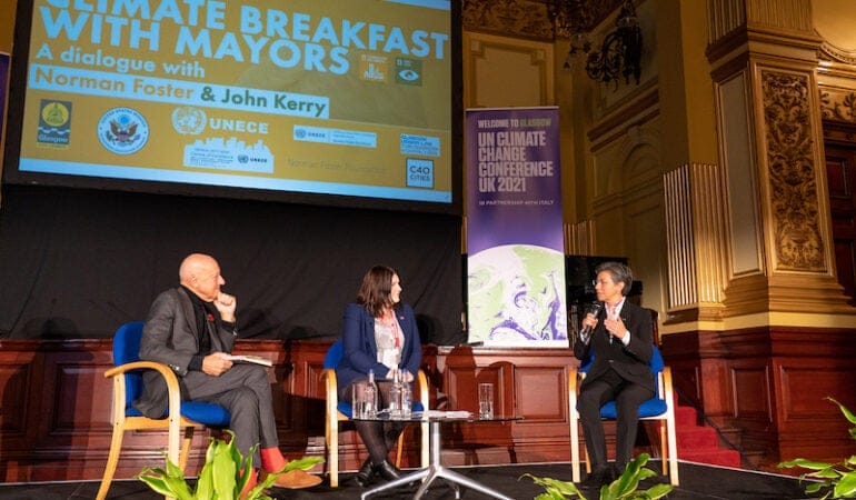
López spoke with Senior Fellow Anthony Flint by video as she was on her way to the COP26 climate summit in Glasgow in the fall; they were joined by Martim Smolka, director of the Lincoln Institute’s Program on Latin America and the Caribbean.  

Their discussion, edited for length and clarity, is the final installment of a special 75th anniversary Mayor’s Desk series, spotlighting the chief executives of cities that share a history with the Lincoln Institute. It is also available as a Land Matters podcast

ANTHONY FLINT: Your victory suggests that residents are ready for serious action with regard to the environment and climate change. Do you feel you have a mandate, and what are your top priorities in terms of climate? 

CLAUDIA LÓPEZ: Well, there is no doubt that I have a clear mandate from Bogotá’s people. During my campaign, I [made a public commitment] to environment and climate change issues. We have a deep social debt and a deep environmental debt that we have to pay. After the pandemic, the social debt will be harder to address than the environmental debt, because the pandemic has doubled unemployment and poverty in my city. On the other hand, on the environmental issues, I am still very optimistic that post-pandemic opportunities will increase. 

We have to adapt, that’s our mandate. In the context of Colombia, we have three general issues. One of them, and the major contributor to climate change, is deforestation. This is an issue mainly for rural Colombia, and is by far the largest contributor of Colombia to the environmental crisis and the climate emergency. The second factor is fossil fuels. Transportation is the second largest contributor of Colombia to the climate emergency. The third is related to waste management. Bogotá has a great impact in transportation, and we have a great impact in waste management.  

What are we doing? Migrating from a monodependent diesel bus system toward a multimodal system based on a metro, a regional train system, cable system, and also buses . . . [and] transforming waste management . . . into a recycling, green, circular economy, so that we transform waste into clean energy. Making the city greener. Hardening rural and green areas, that’s basically what building cities is about. What we need to do in the 21st century, I think, is the opposite. We need to take advantage of every public space that we have, making every effort not only to plant trees, not only to plant gardens, but to transform urban areas that we had before, gray areas that we had before, into green areas. 

We’re lucky that we have the legal mandate to propose a new master plan, the POT [Plan de Ordenamiento Territorial]. We can include these changes and investments, not in a four-year-term government plan, but in a 14-year city plan. We are trying to take advantage of this moment. 

AF: This year marks the centenary of the Colombian value capture tool contribución de valorización, or betterment contributions. What is your vision for building on that tradition? 

CL: I think that’s critical. The most important financial tool we have for sustainable development is land value capture. In our POT, we are including not only the traditional betterment contribution, but also many other ways to use land value capture. [Ed. note: Betterment contributions are fees paid by property owners or developers to defray the cost of public improvements or services from which they benefit.] 

We have at least seven different tools, financial tools, all related. Basically, we [determine] the value that’s going to be generated by a transformation of land use and we agree with the developer, so that the developers don’t pay us in cash, as in the betterment contribution, but pay [by] building the infrastructure and the urban and social equipment that new development will need. 

This is not about having lovely maps with marvelous plans, this is about having the money to redistribute the cost and benefit of sharing and receiving. This is actually what I think urban planning is: making sure that either through public investments or through land value capture or through private investments, we ensure an equitable and sustainable share of the cost and benefits of building the city. That’s the role of the government, and that’s what we’re trying to achieve here. 

AF: I’d like to turn now to the topic of crime, and ask you how has the problem of crime had an effect on the perception of the city and public space in the city in particular? 

CL: It has a huge impact, of course. The more crime you have in public spaces, as a fact or as a perception, the less well-being you have as a city. What makes a city safer? The first thing I think is to make the city sustainable, and that means greener, and that means more equitable. 

My top priority to make Bogotá safer is not to add cameras and technologies. It is to make sure that Bogotá has the capacity to provide fair and legal employment for our population, particularly for our youth. I think that the social roots of security are more important. 

One thing that I’m very excited and very proud that we’re building into our POT and our land use development plan is that we are including criteria for women and caregivers as criteria for urban development in our city. If you can make a city safer for women, if you can make a city safer for kids, that will be a city safer for everyone. 

Now the second thing, as important as transportation, infrastructure, and social infrastructure in the 21st century, is digital infrastructure. We are going to extend fibra óptica, the best, fastest internet, to every neighborhood in our city, to every school in our city. That’s crucial to make a more sustainable, more equitable, and safer city. At this moment in the post-pandemic time, we’re having a severe backlash in insecurity in our cities. It’s not only in Bogotá, it’s global. Unfortunately, higher unemployment and higher poverty always correlate with higher insecurity. 

AF: What are the policies that are working to make life better in informal settlement, such as upgrading or infrastructure, and what in your view needs to change? 

CL: We have at least three innovations included in our land use plan that I’m very proud of. As you know, in Latin America, roughly half of our cities has been built informally. This land use development plan is the first development plan that clearly assumes that, accepts that, and instead of doing a land use plan that is only useful for the formal city, for half of the city, this is a plan that recognizes that 45 percent of our city is informal. 

It creates an urban norm, urban rules, and urban institution to help people improve their homes in the informal city, and to improve their neighborhoods. It is including all people within the land use development plan. 

We have in Bogotá an institution called curaduría, which provides urban licensing and construction licenses. We are creating a public curaduría for the informal city. There’s no way that you can impose on half of the city an urban [standard] they don’t have any chance to meet. We [also] have the Plan Terrazas, which says, after we improve your first floor, after we improve it properly, then you can build your second floor, for example, or you can build some [space for] economic activity in your first floor. You will improve your housing, but you will [also] improve your income. For poor people, housing is not only the place they live, it’s also the place where they produce and they generate income. 

The second thing that I think is very important is that we created this caring system, particularly thinking about women. Half of the economy is informal. It’s not formal jobs with pension funds and health insurance. They don’t have care when you are sick or when you are [older]. Who takes care of the sick and elderly? It’s the unpaid women who do that: 1.2 million women in Bogotá don’t have jobs, don’t have education, don’t have time for themselves because they are caregivers. For the first time in Bogotá, we are reserving land for social infrastructure to provide institutional health care. For children, for women, for elders, for people with disabilities, so that we can relieve and free up time for women, so they can access time to rest. They don’t have a free week ever in their life. 

We’re trying to balance. I think the development in Bogotá has been incredibly unbalanced, with [much of] the advantage on the developer side. Of course, the developers need profitability, and we are trying to find the equilibrium point.  

AF: The Lincoln Institute’s work in Latin America, including Colombia, has been such a big part of our global reach. As we celebrate our 75th anniversary, could you reflect on how that presence has been helpful in the region? 

I think it has been incredibly helpful really. I [have worked] with the United Nations and with other organizations, and different governments in Latin America. There’s always a specialist or academic person or professional person who has been trained by the Lincoln Institute. There’s a huge network of people thinking, researching, innovating, putting out these debates, which is incredibly important. 

In my own experience, I cannot tell you how useful all the things that you taught me have been, on land value capture, for example, on land use development, on being aware of how land and urban value is created. Why this is a publicly created thing, and why we need to use all the instruments we have to capture that value and to redistribute it in a more equitable way to everybody in the city. To Martim Smolka, Maria Mercedes, and everybody in the Lincoln Institute, I cannot be more grateful, and the network of professionals and trainees and academic people and the research that they support on this topic, particularly in Latin America, is incredibly useful. 


This interview is also available as an episode of the Land Matters podcast.


Anthony Flint is a senior fellow at the Lincoln Institute, host of the Land Matters podcast, and a contributing editor to Land Lines

Image: Mayor López speaks at a climate event at the COP26 summit in Glasgow. Credit: Office of the Mayor.