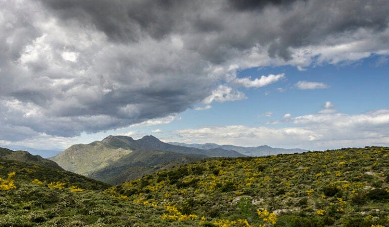
In the wake of major global agreements to protect biodiversity and address climate change, hundreds of leaders and practitioners gathered virtually for one of the world’s most significant international conferences on private and civic land conservation.
At the 3rd Global Congress of the International Land Conservation Network and Eurosite–European Land Conservation Network, leaders in the field discussed how to increase the scale of conservation work to meet ambitious global targets, such as protecting 30 percent of the earth’s land and water by 2030. The conference attracted more than 900 registrants from some 89 countries on six continents.
“Let’s step up to the responsibilities that we have to pass on, to our children’s children’s children and beyond, the beauty and the value of the earth,” International Land Conservation Network Director Jim Levitt said at the closing of the conference.
“The global private and civic land conservation community is diverse and multifaceted,” said Tilmann Disselhoff, president of Eurosite–European Land Conservation Network. “We can learn a lot from our colleagues around the world, but we don’t have to copy everything from one another. When we come across an interesting solution or a new idea from another part of the world, let’s adopt it, if it’s good. But let’s also adapt it to our needs.”
The conference focused on five themes: conservation finance, organization and governance, law and policy, land stewardship, and large landscape conservation. What follows are a few highlights (recordings of all sessions will be available online at no cost in the first quarter of 2022).
Conservation Finance
The scale and complexity of private and civic land conservation projects often requires a mix of financing, from both traditional investors and from those focused on social and environmental impacts. Complex projects need an effective intermediary who can balance the needs of multiple investors and incorporate the perspectives of other stakeholders, experts said in a session titled, “Blended Finance and the Role of Intermediaries.”
Intermediaries play several key roles. They articulate a project’s goals, establish key metrics for success, provide technical support, and communicate between different parties. While individual investors might care mostly about a single outcome such as sequestering carbon, intermediaries can provide a more complete picture of a project’s benefits.
“I’ve never seen a biodiversity or nature project that wasn’t also, on some level, a social project,” said Stephen Hart, a senior loan officer for the European Investment Bank.
Organization and Governance
“There’s no future in conservation unless we’re building meaningful relationships with the original holders of these lands.” That assertion by Nathan Cardinal of the Nature Conservancy of Canada (NCC) was part of a wide-ranging and sometimes deeply personal conversation, “Private Land Conservation and Indigenous Rights: Developing an Ethical Framework and Good Practices.”
Acknowledging that the contemporary conservation movement has benefited from generations of stewardship and land management by Indigenous communities, experts emphasized the urgency of supporting Indigenous rights—a theme that wove through other sessions as well—by taking actions including returning lands to their original owners, ensuring that Indigenous voices are at the table, and providing long-term funding opportunities. “Aboriginal people have managed this land for thousands and thousands of years,” said Cissy Gore-Birch, a Jaru/Kija woman with connection to Balanggarra, Nyikina, and Bunuba country who works as the National Aboriginal Engagement Manager for Bush Heritage Australia. “We are the protectors of the land, and the land speaks to us.”
Law and Policy
As global leaders set ambitious conservation goals, questions about how to reach that target are naturally arising. One answer might well be found in Other Effective Area-Based Conservation Measures, known as OECMs. The concept behind this emerging approach is to complement and connect traditional protected areas by identifying areas where conservation already occurs, though the land is primarily managed for other purposes.
Examples include school campuses, military grounds, cultural sites, and ranchlands. In “The Role of OECMs in an Integrated Conservation Landscape,” panelists agreed that OECMs hold great promise, but that their effective implementation will require more resources, conversation, and collaboration. “As a community of practice, sharing our experiences is going to be important,” said Lisa McLaughlin, vice president of conservation policy from Nature Conservancy of Canada. “. . . We need to keep that going with respect to sharing and learning—the good things, but also talking honestly about the mistakes and the barriers as well, so that we can all accelerate together and not have to learn in parallel.”
Land Stewardship and Management
Clare Cannon’s family manages a 6,500-acre sheep and cattle farm at Woomargama Station in New South Wales, Australia. They use two-thirds of that land to raise their livestock, but a few years ago the family set aside the rest—a mix of native grasslands and woodlands—to be managed by the Biodiversity Conservation Trust. In addition to protecting the land, that decision now seems likely to generate new income in the form of biodiversity payments authorized under Australia’s newly adopted National Stewardship Trading Platform.
Grasslands—known as prairies in North America, pampas in South America, and savannas in Africa—are increasingly being eyed as a climate solution for their ability to sequester carbon. By engaging in sustainable, lower-impact practices, farmers and ranchers from Australia to Colombia, Venezuela, and the United Kingdom can help maintain the integrity of grasslands; reduce the climate impacts of livestock by avoiding or minimizing activities required for conventional agriculture such as deforestation and the cultivation of resource-intensive fodder; and still succeed economically, explained panelists in “Stewarding Grasslands: Good for Grasslands, Good for Climate, Good for Farmers.”
Landscape-Scale Conservation and Restoration
As climate change disrupts natural systems around the world, land conservationists can use technology to target their work to help species adapt to changing conditions and maximize the reduction of greenhouse gases. In “Sustaining Nature Under Climate: New Science to Inform Conservation,” Mark Anderson, Director of Conservation Science for the Eastern U.S. for the Nature Conservancy, demonstrated his organization’s Resilient Land Mapping Tool, which uses geospatial data to identify the areas where conservation resources can achieve the greatest impact.
The tool, which covers the United States but carries the potential for expansion worldwide, analyzes biological, geophysical, and climate-related conditions—everything from sun exposure to soil characteristics—to determine which habitats will enable species to thrive in a warming world, which places currently contain the greatest stocks of stored carbon, and which have the greatest potential for future carbon sequestration.
The Nature Conservancy used the tool to identify what it calls a Resilient and Connected Network, comprising a third of the continental United States, to prioritize for conservation. The network currently stores 29 billion tons of carbon and sequesters an additional 236 million tons of carbon a year.
“That’s the equivalent of taking 188 million cars off the road every year. Why would we want to lose any of this network?” said Anderson, who is also the Lincoln Institute’s 2021–22 Kingsbury Browne Fellow.
Established in 2014, the Lincoln Institute’s International Land Conservation Network helps build capacity for private land conservation through research, training, and exchanges between conservationists from around the world. In February 2022, the Lincoln Institute and ILCN will publish a Policy Focus Report, From the Ground Up: How Land Trusts and Conservancies Are Providing Solutions to Climate Change, which will present case studies of organizations that are using land conservation as a tool for mitigating and adapting to climate change. The next Global Congress will take place in 2024.
Photograph: Marti Garcia via iStock/Getty Images.

El nuevo mapa de la cuenca del río Colorado del Centro Babbitt está disponible sin costo en formato PDF descargable y en papel.
¿Dónde está la cuenca del río Colorado? Cualquier principiante que aventure una somera búsqueda en Google se sorprenderá, y quizás se frustre, se confunda o un poco de ambas: no hay una respuesta sencilla a esa pregunta. El río Colorado serpentea por siete estados de los Estados Unidos y dos de México, y ofrece sus recursos a más de 40 millones de personas y 18.200 kilómetros cuadrados de campos agrícolas en el camino. Es una de las vías fluviales más complejas en cuanto a geografía, historia, política y cultura. De esto resulta que no sea sencillo crear un mapa preciso de la cuenca (la amplia superficie del suelo que drenan el río y sus afluentes).
Los mapas de la región que más se usan son muy variados, incluso en detalles básicos como los límites de la cuenca, y casi ninguno sigue el ritmo de la realidad cambiante: por ejemplo, que la vía fluvial está sobreexplotada y ya ni llega a su desembocadura en el mar. En el Babbitt Center, empezamos a oír un punto en común al trabajar con las partes interesadas del oeste del país para integrar la planificación y el agua: en repetidas ocasiones, la gente destacaba los errores en los mapas disponibles y sugería que se podrían tomar decisiones de gestión hídrica más efectivas si se intentara corregirlos. Pero parecía que nadie tenía la capacidad de hacerlo. Así, con la ayuda del flamante Centro de Soluciones Geoespaciales del Instituto Lincoln, nos embarcamos en un proyecto propio de mapeo.
Nuestro mapa de la cuenca del río Colorado, revisado por colegas, se acaba de publicar y se incluye en esta edición de Land Lines. Pretende corregir varios errores comunes en los mapas populares y, a la vez, ser un recurso actualizado para gestores hídricos, dirigentes de tribus y otras personas que se enfrentan a problemas cruciales relacionados con el crecimiento, la gestión de recursos, el cambio climático y la sostenibilidad. Es un mapa físico-político de toda la cuenca del río Colorado, que incluye la ubicación de los 30 pueblos tribales con reconocimiento federal; diques, embalses, canales y desvíos de y hacia otras cuencas; áreas de protección federal; y vías fluviales naturales con indicadores de caudal intermitente durante el año. Pondremos el mapa a disposición de forma gratuita, con la esperanza de que sea un recurso de consulta frecuente, tanto dentro de la cuenca como fuera de ella.
Desafíos, decisiones y criterios
Los mapas tienen pocas palabras, pero dicen mucho. Todos son subjetivos de alguna manera y afectan el modo en que la gente percibe ciertos lugares y fenómenos, y cómo piensa en ellos.
En el proceso de revisión de colegas del nuevo mapa, alguien nos preguntó si el objetivo era mostrar la cuenca “natural” o la moderna; es decir, la fabricada y definida según la ley. Esta pregunta, que parece sencilla, suscitó varios interrogantes fundamentales sobre qué es o qué sería en realidad una cuenca “natural”. Esto nos recordó el eterno dilema de los defensores de la restauración ecológica: ¿cuál es el estado pasado al que deberíamos intentar regresar?
En el caso del Colorado, la pregunta es: ¿cuándo fue “natural” la cuenca? ¿Antes de construir la represa Hoover, en la década de 1930? ¿Antes de erigir la represa Laguna, la primera que construyó el gobierno de los Estados Unidos, en 1905? ¿En el siglo XVIII? ¿Hace 500 años? ¿Hace un millón de años? En una era en que la dupla humano-naturaleza evolucionó y permite comprender mucho mejor los sistemas socioecológicos, es difícil responder estas preguntas.
Este dilema nos inquietó un buen tiempo. Por un lado, representar una cuenca “natural” prehumana es prácticamente imposible. Por el otro, sentíamos el impulso de representar más los aspectos previos a las represas de lo que solemos ver en los mapas convencionales, en los que, en general, se opta por el límite según los artilugios gubernamentales de los siglos XIX y XX.
Al final, luego de varias sesiones de revisión internas y externas, acordamos una representación que no intenta resolver la tensión entre lo “natural” y lo “humano”. Incluimos infraestructura, que muestra a las claras la naturaleza tan artificial de la cuenca actual. También incluimos la cuenca del Saltón y la de Laguna Salada, dos depresiones topográficas formadas por el Colorado. Ninguna forma parte del curso fabricado de hoy, y se suelen excluir de los mapas de la cuenca. No elegimos mostrarlas porque esperamos que el río Colorado se salga del canal en algún momento, ni porque pretendamos representar con exactitud cómo era el delta antes del siglo XX. Según lo que investigamos, el fenómeno de El Niño de la década de 1980 tuvo tal magnitud que el agua del delta inundado llegó al lecho seco del Laguna Salada, al punto que allí se pudo realizar pesca comercial. Por su parte, la gestión medioambiental del mar de Saltón, que está tan contaminado, es un dilema que ha aparecido en los últimos debates sobre el futuro de la gestión del Colorado. Estas zonas no son irrelevantes en lo político y lo hidrológico.
Nuestro mapa no pretende responder todas las preguntas sobre la cuenca. De muchas formas, nuestra contribución a la cartografía del río Colorado resalta las tensiones no resueltas que definen este sistema fluvial y seguirán impulsando el diálogo sobre la gestión y la conservación hídricas en la cuenca del río Colorado.
No hay una definición simple de la cuenca del río Colorado. Quizás ese sea el mensaje subyacente más importante de este nuevo mapa.
Para encargar un mapa o descargar el PDF, visite www.lincolninst.edu/publications/maps-infographics/map-colorado-river-basin. Para explorar nuestro StoryMap del río Colorado, visite www.lincolninst.edu/research-data/data/co-river-storymap.
Zachary Sugg es gerente sénior de programa en el Centro Babbitt para Políticas de Suelo y Agua.
Contenido relacionado

En mis cuatro décadas de fotógrafo aéreo, me ha interesado documentar la agricultura, porque tiene un modo de revelar pistas importantes sobre regiones, clima, topografía, suelo y el paso de las estaciones y el tiempo. Esta labor se centró cada vez más en el vínculo entre el uso del suelo y el cambio climático, a medida que en los transectos urbanos y rurales evolucionó de forma evidente el interés por acortar los kilómetros alimentarios (reducir la distancia entre productor y consumidor, con el fin de reducir las emisiones de carbono y minimizar las interrupciones en la cadena de suministro). Las imágenes de estas páginas representan los primeros pasos de una indagación sobre cómo está cambiando la producción de alimentos en zonas urbanas y sus alrededores en los Estados Unidos.
En los últimos años, es cada vez más evidente cómo se intensificó el cultivo a pequeña escala alrededor de Boston, Massachusetts. Desde el aire, he visto aparecer invernaderos de techo curvo en granjas pequeñas que pretenden suplir la demanda y ampliar la productividad; azoteas residenciales y comerciales grises convertidas en opulentos jardines; terrenos urbanos históricamente improductivos, como baldíos y patios, transformados en espacios cultivados. Cuando se suman, estas operaciones a pequeña escala parecen tener mucho potencial para aumentar la productividad mediante el poder de los incrementos. Los espacios verdes en zonas urbanas y cerca de ellas no solo ofrecen a las personas alimentos más frescos y accesibles. Dado que filtran el agua pluvial, absorben dióxido de carbono y promueven otros beneficios medioambientales, también pueden hacer de las ciudades lugares más saludables y resistentes.
A pesar de estos cambios prometedores, lo que se conoce como el movimiento localívoro ha logrado crear una sensación de pertenencia y de comunidad, y enseñar sobre cuestiones alimentarias, más que mejorar la seguridad o acortar los kilómetros alimentarios en una escala suficiente como para contrarrestar el cambio climático. Si bien en la última década la demanda y el entusiasmo por los alimentos locales aumentaron, se estima que el 90 por ciento de la comida de la zona metropolitana de Boston proviene de fuera de la región, según Food Solutions New England (FSNE), una red regional con base en la Universidad de Nuevo Hampshire, cerca de allí. Pero los gestores de políticas, inversionistas, productores rurales y emprendedores de la zona se están esforzando por cambiarlo, y FSNE está abogando por un “50 hacia 60”: 50 por ciento de los alimentos producidos en la región hacia 2060.
Una tendencia que podría ayudar a alcanzar esta meta, y que también se puede ver desde el aire, es la agricultura de interior. Las granjas de interior suelen encontrarse en vecindarios industriales infravalorados, y usan tecnologías como hidroponía e iluminación LED para poder cultivar durante todo el año. Las empresas que las respaldan demuestran cada vez más que la falta de espacios abiertos no tiene por qué ser una limitación para producir alimentos. En 2020, esta industria atrajo US$ 1.900 millones en capital de riesgo a nivel mundial: el triple de lo que se invirtió en 2019.
En Boston se encuentran algunas de las empresas que más están creciendo. Por ejemplo, Freight Farms democratiza más la cercanía a la producción porque usa contenedores modernizados que se pueden acomodar bajo autopistas elevadas o junto a comedores escolares. En 30 metros cuadrados, estos contenedores producen lo mismo que una hectárea de cultivo. Este tipo de soluciones innovadoras nos dan una idea de cómo puede ser el cultivo alternativo, mientras el cambio climático degrada las tierras agrícolas y reduce el suministro de agua. Sin embargo, el método tiene sus desventajas: puede requerir mucha electricidad y, si bien la producción se suele vender como “local”, en ciertos sentidos replica la centralización y la influencia corporativa que irrita desde hace mucho a los defensores de la agricultura local y regional.
Como fotógrafo aéreo, espero que siempre se integre cierta forma de producción alimentaria de exteriores en nuestros paisajes. Los veamos desde el suelo o desde el aire, las granjas y los campos nos ayudan a comprender los elementos clave del mundo natural que nos sustenta, nos ayudan a conectarnos con el planeta y nos impulsan a proteger estos lugares. Pero desde el cielo se hace cada vez más evidente que se están repensando los sistemas agrícolas, y que necesitaremos muchos enfoques distintos para que los “alimentos locales” evolucionen y lleguen a ser un modelo equitativo de soberanía alimentaria regional.

La región metropolitana de Boston importa el 90 por ciento del alimento desde fuera de la región. Arriba, los furgones y las unidades refrigeradas forman fila en los depósitos de New England Produce Center, en Chelsea, al norte del centro de Boston. Este complejo es uno de los mercados mayoristas de productos agrícolas más grandes del mundo; recibe cargamentos de todos los rincones de los Estados Unidos y de otros países. Luego, los productos de redistribuyen a puntos de venta de toda Nueva Inglaterra y el sudeste de Canadá. Crédito: Alex MacLean.

Los famosos jardines Fenway Victory Gardens, junto al río Muddy, en Back Bay, Boston, están conformados por más de 500 parcelas que son vestigio de tierras que en la Segunda Guerra Mundial se usaron para producir alimentos. Fenway fue uno de los más de 20 millones de jardines de la victoria del país que ayudaron a cultivar cerca del 40 por ciento de la producción nacional en el punto más álgido de la guerra. Esta historia demuestra el potencial de adaptación y la capacidad de producir alimentos locales a gran escala. Crédito: Alex MacLean.

Las cuatro estaciones del jardín comunitario de la Primera Iglesia Parroquial, en Lincoln, Massachusetts. Los cambios que tienen lugar en el jardín durante el año marcan el paso del tiempo y generan conciencia sobre la transición entre las estaciones. Los feligreses cultivan parcelas individuales y, en conjunto, una parcela de donaciones que ofrece un promedio de 300 kilos de comida al año a refugios para personas sin hogar y comedores comunitarios de la zona de Boston. Crédito: Alex MacLean.

Mill City Grows gestiona cuatro granjas, entre ellas 1,1 hectáreas que alquila a la ciudad de Lowell, y distribuye los productos en mercados móviles, un programa de Agricultura de Respaldo Comunitario y donaciones. Crédito: Alex MacLean.

En 2011 la ciudad de Lawrence ayudó a fundar el jardín Cross and Cedar Street. Lo atienden residentes locales y se ubica en dos baldíos donde antes había viviendas deterioradas. Los lechos elevados protegen a las plantaciones de los riesgos del suelo contaminado. Crédito: Alex MacLean.

El jardín comunitario Nightingale, en Dorchester, Massachusetts, pertenece a la organización estatal de conservación The Trustees y forma parte de una iniciativa de la ciudad para aumentar el acceso a productos agrícolas locales y lograr que los jardines comunitarios sean una parte destacada de los espacios urbanos no construidos. Crédito: Alex MacLean.

Las terrazas plantadas encima del Esplananade, un complejo de condiminios en Cambridge, Massachusetts, demuestran el potencial de los espacios de techo comerciales para acomodar la agricultura urbana. Crédito: Alex MacLean.

Los gallineros móviles y las jaulas de contención se mueven todos los días en las granjas comunitarias Codman, en Lincoln, Massachusetts; es una de las prácticas sostenibles que logra producir entre 800 y 1.200 huevos a la semana. La granja está a 24 kilómetros al noroeste de Boston, data de 1754 y cuenta con 7 hectáreas. Otras 50 hectáreas de campos y pastizales desperdigados por la ciudad abastecen el heno para el ganado y ofrecen espacios abiertos a las zonas circundantes. Crédito: Alex MacLean.

Más del 95 por ciento de las frutas y verduras que se consumen en la costa este proviene de California y Arizona, y suele tardar más de una semana en llegar. Little Leaf Farms realiza cultivos hidropónicos durante todo el año para reducir la dependencia en la costa oeste, en un invernadero de 4 hectáreas en Daven, Massachusetts, a 65 kilómetros al oeste de Boston. El proceso de cultivo está totalmente automatizado; las plantas se siembran y se cosechan sin contacto humano. Hasta ahora, la empresa obtuvo un financiamiento de US$ 90 millones mediante deudas y capital propio para ampliar sus operaciones por la costa este; empezará por Pensilvania y Carolina del Norte. Crédito: Alex MacLean.

Freight Farms fabrica invernaderos hidropónicos verticales dentro de contenedores de carga de 12 metros. Estos contenedores están equipados con controles climáticos precisos e iluminación optimizada para determinadas plantas y, en 30 metros cuadrados, pueden producir lo mismo que una hectárea de terrenos de cultivo convencionales. Los invernaderos móviles se pueden colocar en cualquier parte, como debajo de autopistas o junto a escuelas. Crédito: Alex MacLean.

Gotham Green (la estructura blanca en el extremo inferior izquierdo de la imagen) se construyó donde solía haber un terreno abandonado contaminado en Providence, Rhode Island. Hoy provee a Nueva Inglaterra de frutas, verduras y especias hidropónicas durante todo el año. El invernadero cuenta con electricidad de fuentes renovables y consume un 95 por ciento menos de agua y utiliza un 97 por ciento menos de suelo que la agricultura convencional. Crédito: Alex MacLean.

Gaining Ground Farm, en Concord, Massachusetts, cultiva alimentos para refugios y comedores de beneficencia de la zona de Boston. Mediante túneles altos, invernaderos de techo curvo y nutrición del suelo duplicó la producción en cuatro años. En 2020 cultivó y donó 57.800 kilos de alimentos, comparados con 28.015 kilos en 2016. En esta fotografía, tomada en 2016, se muestran los primeros invernaderos de techo curvo incorporados. Crédito: Alex MacLean.

En esta fotografía, tomada en 2020, se observa cómo se intensificó la producción en Gaining Ground Farm. Crédito: Alex MacLean.

Este jardín comunitario de Allston-Brighton, Massachusetts, se encuentra en un terreno que pertenece al Departamento Estatal de Conservación y Recreación. El follaje de mediados de octubre presagia el fin de la estación de cultivo y la llegada del invierno. Crédito: Alex MacLean.
Alex MacLean es piloto y fotógrafo con exhibiciones a nivel internacional; su trabajo se ha presentado en Land Lines y el libro Visualizing Density, del Instituto Lincoln. Se especializa en documentar cambios en el suelo provocados por la intervención humana y los procesos naturales.
Fotografía principal: Los jardines comunitarios de Boston fortalecieron el sentido de pertenencia en los vecindarios. El de Worcester Street, en South End, es uno de los 56 jardines comunitarios que pertenecen a The Trustees. Lo administran voluntarios y posee más de 130 parcelas disponibles para residentes, que se distribuyen por orden de llegada. Crédito: Alex MacLean.
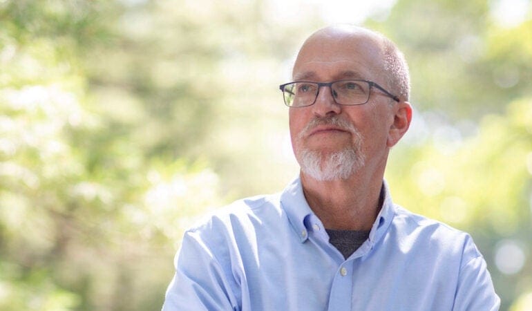
Mark Anderson, an ecologist who has conducted groundbreaking work to map climate-resilient lands and waters across the United States, has been named the new Kingsbury Browne Fellow at the Lincoln Institute of Land Policy and the recipient of the Kingsbury Browne Conservation Leadership Award from the Land Trust Alliance.
In his role as director of The Nature Conservancy’s Center for Resilient Conservation Science, Anderson oversees a team of scientists that has created detailed maps of areas whose topographies, elevations, and geologies are particularly suited for withstanding the impacts of climate change. These maps are used by government agencies, land trusts, and other organizations to prioritize conservation work. Anderson has also produced a deep body of scholarship in the field, including co-authorship of the National Vegetation Classification, an online inventory of plants and plant communities across the United States.
“Mark is a global leader in applying the science of Geographic Information Systems to the art of land conservation,” said Jim Levitt, director of the International Land Conservation Network at the Lincoln Institute. “His insight has been invaluable in lighting the path forward.”
“For years, Mark has been at the forefront of climate science and how to combine it effectively with ecology,” said Andrew Bowman, president and CEO of the Land Trust Alliance. “For his visionary climate work and his longstanding commitment to the land trust community, we are honored to name Mark this year’s Kingsbury Browne Conservation Leadership Award winner.”
The fellowship and award, given since 2006, are named for Kingsbury Browne, a Boston tax lawyer and conservationist who served as a Lincoln Fellow in 1980 and helped form the Land Trust Alliance in 1982.
Recent recipients of the fellowship include Fernando Lloveras San Miguel, executive director of the Conservation Trust of Puerto Rico; Jane Difley, who led the Society for the Protection of New Hampshire Forests for 23 years; Michael Whitfield, executive director of the Heart of the Rockies Initiative; and Will Rogers, head of the Trust for Public Land.
Photograph by DJ Glisson, II / Firefly Imageworks.
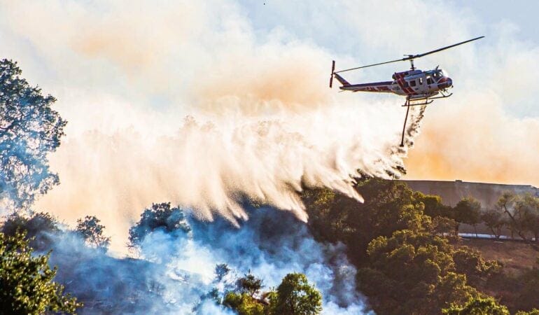
In this summer of 2021, land is being ravaged. Wildfires burn in the western United States, Canada and elsewhere, destroying whole towns and sending smoke across the continent. Meanwhile, the Amazon rainforest has been scorched so extensively for ranching and agriculture that it now emits more carbon than it absorbs.
These alarming events, and the UN’s latest report on rapidly accelerating climate change, underscore the critical role of land, land management, and land conservation in confronting the climate crisis, says Jim Levitt, director of the International Land Conservation Network at the Lincoln Institute of Land Policy.
Sequestering carbon, mitigating heat islands and disasters, maintaining biodiversity, managing water resources stressed by drought—all are crucial jobs that land performs incredibly well, says Levitt, the guest on the latest episode of the Land Matters podcast. And that is why conserving and better managing forests, wilderness areas, and working landscapes is so important now, he says.
“I don’t want to sugarcoat this—it’s going to be a very challenging task,” he says. “It’s a situation, as many people have said before me, that will require all hands on deck.”
Levitt, author of the book From Walden to Wall Street, details latest and best practices in legal structures and conservation finance to step up land protection globally. Land conservation has been part of the Lincoln Institute’s portfolio for decades, but it has special relevance today in the context of global warming.
As part of the 75th anniversary year, the Lincoln Institute is taking a look at a wide range of programs and how they have evolved over the years—and how they are being applied now to some of the world’s most serious problems.
You can listen to the show and subscribe to Land Matters on Apple Podcasts, Google Podcasts, Spotify, Stitcher, or wherever you listen to podcasts.
Anthony Flint is a senior fellow at the Lincoln Institute of Land Policy, host of the Land Matters podcast, and a contributing editor of Land Lines.
Photograph: California and other states in the U.S. West are enduring longer wildfire seasons, a trend fueled by climate change. Credit: CAL FIRE via Flickr CC BY-NC 2.0.
Related Content
How Land Conservation Reduces Climate Change
Bridging the Divide: Why Integrating Land and Water Planning Is Critical to a Sustainable Future
Sustainably Managed Land and Water Resources, one of six strategic goals
Workshop Report on Biodiversity and Climate Change, a report of the Intergovernmental Science-Policy Platform on Biodiversity and Ecosystem Services and Intergovernmental Panel on Climate Change

Across four decades as an aerial photographer, I have been drawn to documenting agriculture for the way it reveals important clues about region, climate, topography, soil, and the passage of seasons and time. This work has increasingly focused on the connections between land use and climate change, as attention to shortening food miles—reducing the distance between producers and consumers, with the goal of lowering carbon emissions and minimizing supply chain disruptions—visibly plays out across rural–urban transects. The images in these pages represent the first steps in an inquiry into how food production in and around urban areas in the United States is changing.
In recent years, the intensification of small-scale growing in the region around Boston, Massachusetts, has been increasingly apparent. From the air, I’ve seen hoop houses spring up on small farms seeking to meet demand and expand productivity; I’ve seen drab commercial and residential rooftops become vibrant gardens; I’ve seen historically nonproductive urban land like vacant lots and lawns become cultivated spaces. When added up, these small-scale operations seem to hold real potential for productivity gains through the power of increments. Green spaces in and near urban areas don’t just provide people with fresher, more accessible food; by filtering stormwater, absorbing carbon dioxide, and providing other environmental benefits, they can also make cities healthier, more resilient places.
Despite these promising changes, what is commonly understood as the locavore movement has done more to create a sense of place, build community, and educate around food than it has to increase food security or shorten food miles at the scale necessary to confront climate change. While demand and enthusiasm for local food has grown over the last decade, an estimated 90 percent of food in the Boston metro area comes from outside the region, according to Food Solutions New England (FSNE), a regional network based at the nearby University of New Hampshire. But policy makers, investors, farmers, and entrepreneurs in the area are working to change that, and FSNE is advocating for “50 by 60”—referring to the percentage of food that could be regionally sourced by 2060.
One trend that could help reach that goal, also visible from the air, is indoor farming. Most commonly located in undervalued industrial neighborhoods, indoor farms use technologies like hydroponics and LED lighting to enable year-round cultivation. The companies behind them are increasingly demonstrating that a lack of open space does not have to be a constraint on food production. The indoor farming industry attracted $1.9 billion in global venture capital in 2020, three times the amount committed in 2019.
Boston is home to some of the companies gaining the most momentum. Freight Farms, for instance, further democratizes proximity to production through the use of retrofitted shipping containers that can be tucked beneath elevated highways or squat next to school cafeterias. In 320 square feet, these containers yield as much produce as two cultivated acres. Such innovative solutions give insight into what alternative growing can look like as climate change degrades farmland and shrinks water supplies. However, indoor farming has its drawbacks; it can be energy intensive and, although its yields are often marketed as “local,” in some senses it replicates the centralization and corporate influence against which local and regional agriculture advocates have long chafed.
As an aerial photographer, I hope some form of outdoor food production will always be integrated into our landscapes. Whether viewed from the ground or from the air, farms and fields help us understand the key elements of the natural world that sustain us, providing a connection to the planet and an impetus to protect these places. But from above, it is increasingly apparent that a reimagining of agricultural systems is underway, and that we will need many different approaches for “local food” to evolve into an equitable model of regional food sovereignty.
The Boston metro region imports 90 percent of its food from outside the region. Above, box trucks and refrigerated trailer units line the New England Produce Center warehouses in Chelsea, just north of downtown Boston. Among the largest wholesale produce markets in the world, the complex receives shipments from across the United States and internationally. Produce is then redistributed to food outlets throughout New England and southeastern Canada. Credit: Alex MacLean.
The renowned Fenway Victory Gardens along the Muddy River in Boston’s Back Bay are made up of over 500 plots that remain on land that was dedicated to food production during World War II. Fenway was one of over 20 million victory gardens across the country that contributed to growing roughly 40 percent of the nation’s produce at the height of the war. The history speaks to the potential to adapt and to grow local produce on a large scale. Credit: Alex MacLean.
The community garden at the First Parish Church in Lincoln, Massachusetts, seen in four seasons. Changes in the garden throughout the year are a time marker that affirms our awareness as we transition through seasons. Parishioners grow individual plots and collectively grow a donation plot that provides an average of 600 pounds of food each year to Boston-area homeless shelters and soup kitchens. Credit: Alex MacLean.
The Largest of Mill City Grows’ four farms, “Big Farm” is situated on 2.8 acres leased from the city of Lowell, Massachusetts. The food from these farms is distributed through mobile markets, a Community Supported Agriculture farm share program, and donations. In working toward local food justice, Mill City Grows also partners with schools to support educational and community growing initiatives. Credit: Alex MacLean.
The city of Lawrence, Massachusetts, helped establish the Cross and Cedar Street Garden in 2011. The garden, which is tended by local residents, occupies two vacant lots where dilapidated housing had been torn down. Raised beds help protect against the hazards of contaminated soil. Credit: Alex MacLean.
The Nightingale Community Garden in Dorchester, Massachusetts, owned by statewide conservation organization The Trustees, is part of a citywide initiative to increase access to local produce, and to make community gardens a prominent feature of unbuilt urban spaces. Credit: Alex MacLean.
Planted terraces on top of The Esplanade, a condominium complex in Cambridge, Massachusetts, demonstrate the potential for commercial roof spaces to accommodate urban agriculture. Credit: Alex MacLean.
Chicken tractors and containment pens are moved each day at Codman Community Farms in Lincoln, Massachusetts, one of the sustainable practices that goes into producing 800 to 1200 eggs per week. Located 15 miles northwest of Boston and dating back to 1754, the farm sits on 18 acres. An additional 120 acres of fields and pastures scattered throughout the town provide hay for livestock and open spaces for those living in the surrounding area. Credit: Alex MacLean.
Over 95 percent of greens consumed on the East Coast come from California and Arizona, often spending over a week in transit. Little Leaf Farms is working to disrupt reliance on West Coast produce through year-round hydroponic growing in a 10-acre greenhouse in Devens, Massachusetts, 40 miles west of Boston. The growing process is entirely automated; greens are planted and harvested without touching human hands. The company’s success thus far has brought in $90 million in debt and equity financing to expand operations down the East Coast, beginning in Pennsylvania and North Carolina. Credit: Alex MacLean.
Freight Farms manufactures vertical hydroponic greenhouses inside 40-foot shipping containers. Equipped with precise climate control and optimized lighting for select plants, the containers can yield up to two acres of conventionally grown produce in 320 square feet. The mobile greenhouses can be placed anywhere, such as beneath highway underpasses or adjacent to schools. Credit: Alex MacLean.
Built on what was once a contaminated brownfield site in Providence, Rhode Island, Gotham Greens—the white structure at bottom left of image—provides New England with year-round hydroponically grown greens and herbs. The greenhouse is powered by renewable electricity and uses 95 percent less water and 97 percent less land than conventional agriculture. Credit: Alex MacLean.
Gaining Ground Farm in Concord, Massachusetts, grows produce for Boston-area shelters and food pantries. Using high tunnels, hoop houses, row covers, and soil nourishment, Gaining Ground has increased production by over 100 percent over a four-year period. In 2020, Gaining Ground grew and donated 127,429 pounds of produce, compared to 61,764 in 2016. This photograph, taken in 2016, shows the farm’s early adoption of hoop houses. Credit: Alex MacLean.
This photograph, taken in 2020, shows the intensification of production at Gaining Ground Farm in Concord, Massachusetts. Gaining Ground, which grows produce for Boston-area shelters and food pantries, more than doubled the amount of food it grew and donated between 2016 and 2020. Credit: Alex MacLean.
This community garden in Allston-Brighton, Massachusetts, is on land owned by the state Department of Conservation and Recreation. The mid-October foliage foretells the end of the growing season and the onset of winter. Credit: Alex MacLean.
Alex MacLean is a pilot and internationally exhibited photographer whose work has appeared in Land Lines and the Lincoln Institute book Visualizing Density. He specializes in documenting changes to the land brought about by human intervention and natural processes.
Lead Image: Boston’s community gardens have created a stronger sense of place within city neighborhoods. The Worcester Street Community Garden in Boston’s South End is one of 56 community gardens owned by The Trustees. Managed by volunteers, the Worcester Street garden has more than 130 plots available to Boston residents on a first-come, first-served basis. Credit: Alex MacLean.
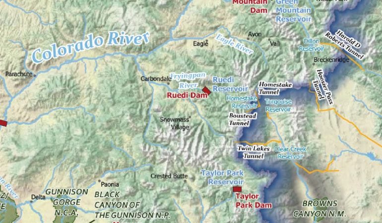
The Babbitt Center’s new Colorado River Basin map is available at no cost as a downloadable pdf and as a hard copy.
Where is the Colorado River Basin? A novice attempting a cursory Google search will be surprised—and perhaps frustrated, confused, or a little of both—to find that there is no simple answer to that question. Winding through seven U.S. states and two states in Mexico—and supporting over 40 million people and 4.5 million acres of agriculture along the way—the Colorado River is one of our most geographically, historically, politically, and culturally complex waterways. As a result, creating an accurate map of the basin—the vast area of land drained by the river and its tributaries—is not a simple undertaking.
Commonly used maps of the region vary widely, even on basic details like the boundaries of the basin, and most haven’t kept up with changing realities—like the fact that the overtapped waterway no longer reaches its outlet at the sea. At the Babbitt Center, we began to hear a common refrain as we worked on water and planning integration efforts with stakeholders throughout the West: people frequently pointed out the flaws in available maps and suggested that addressing them could contribute to more effective water management decisions, but no one seemed to have the capacity to fix them. So, with the help of the Lincoln Institute’s newly established Center for Geospatial Solutions, we embarked on a mapping project of our own.
Our newly published peer-reviewed Colorado River Basin map seeks to correct several common errors in popular maps while providing an updated resource for water managers, tribal leaders, and others confronting critical issues related to growth, resource management, climate change, and sustainability. It is a physical and political map of the entire Colorado River Basin, including the location of the 30 federally recognized tribal nations; dams, reservoirs, transbasin diversions, and canals; federal protected areas; and natural waterways with indications of year-round or intermittent streamflow. We are making the map freely available with the hope that it will become a widely used resource, both within the basin and beyond.
Challenges, Choices, and Rationale
Even though they have few words, maps still speak. All maps are somewhat subjective, and they influence how people perceive and think about places and phenomena. During the peer review process for our new map, one reviewer asked whether our purpose was to show the “natural” basin or the modern, aka engineered and legally defined, basin. This seemingly simple question raised several fundamental questions about what a “natural” basin actually is or would be. This struck us as akin to a perennial question facing ecological restoration advocates: to what past condition should one try to restore a landscape?
In the case of the Colorado, this question becomes: when was the basin “natural”? Before the construction of Hoover Dam in the 1930s? Before Laguna Dam, the first dam built by the U.S. government, went up in 1905? The 18th century? 500 years ago? A million years ago? In an era when the human–natural binary has evolved into a more enlightened understanding of socioecological systems, these questions are difficult to answer.
We struggled with this quandary for some time. On the one hand, representing a prehuman “natural” basin is practically impossible. On the other hand, we felt an impulse to represent more of the pre-dam aspects of the basin than we typically see in conventional maps, which often privilege the boundary based on governmental contrivances of the 19th and 20th centuries.
Ultimately, after multiple internal and external review sessions, we agreed on a representation that does not attempt to resolve the “natural” versus “human” tension. We included infrastructure, clearly showing the highly engineered nature of the modern basin. We also included the Salton Basin and Laguna Salada Basin, two topographical depressions that were formed by the Colorado. Both are separate from the river’s modern engineered course, and often excluded from maps of the basin. We didn’t choose to show them because we expect the Colorado River to jump its channel any time soon, nor because we presume to accurately represent how the delta looked prior to the 20th century. But from our research, we learned that the 1980s El Niño was of such magnitude that river water from the flooded lower delta reached back up into the dry bed of the Laguna Salada, making commercial fishing possible there. Environmental management of the heavily polluted Salton Sea, meanwhile, is a contested issue that has figured in recent discussions about future management of the Colorado. These areas are not hydrologically or politically irrelevant.
Our map doesn’t attempt to answer every question about the basin. In many ways, our contribution to Colorado River cartography highlights the unresolved tensions that define this river system and will continue to drive the discourse around water management and conservation in the Colorado Basin.
There is no simple definition of the Colorado River Basin. That might be the most important underlying message of this new map.
Zachary Sugg is a senior program manager at the Babbitt Center for Land and Water Policy.
Related Content
