Topic: Land Conservation

Workshop on Emerging Innovations in Conservation Finance

September 27, 2016 - September 29, 2016

Santiago, Chile

Offered in English

Watch the Recording


It is a particularly important and auspicious time for the land conservation community in Chile, and across the Americas, to consider the distance traveled over the past several decades and the tremendous challenges they will face over the balance of the twenty-first century. The significance of the moment in Chile is underscored by two ongoing initiatives:

  1. The passage by the Chilean Congress of the Derecho Real de Conservación, which now allows private landowners to protect their land in perpetuity, and
  2. A project now being negotiated by the Government of Chile and Tompkins Conservation that may protect as many as 10 million acres as new or expanded National Parks.

Even in the context of these historic intitiatives, the challenges facing the land conservation communities in Chile and around the globe are very large and complex. Massive amounts of human and financial capital will be required over the remainder of the twenty-first century to fund land conservation initiatives for a range of purposes, including green and gray infrastructure necessary to address:

  • Very rapidly growing demand for renewable energy resources, requiring increased levels of diligence to assure that developers will properly mitigate environmental impacts
  • Accelerating sea-level rise and increasingly intense storm activity, and
  • Changing quantity and quality of fresh water available to human and natural ecosystems leading to increased demand for desalination and water treatment facilities.

Governments alone will be unlikely to supply the trillions of dollars of capital needed to adequately address these and myriad associated challenges to natural systems. It will take some of the world’s best talent, most inventive technologies, and not least, financial ingenuity, coming from the public, private, NGO and academic sectors, to help pass along to future generations the green and biodiverse biosphere now facing ongoing existential threats.

The aim of this workshop is to build on and sharpen concepts that are making, or have the potential to make, a substantial impact on conservation finance in the Western Hemisphere and beyond. These objectives, in turn, serve the larger mission of the International Land Conservation Network (ILCN), which is to connect organizations and people around the world that are accelerating private and civic sector action to protect and steward land and water resources. 

Partners of this workshop include: Las Majadas de Pirque, Lincoln Institute of Land Policy, David Rockefeller Center for Latin American Studies (DRCLAS), Harvard University, Fundacion Robles de Cantillana, Templado, and Que Pasa.


Details

Date
September 27, 2016 - September 29, 2016
Location
Las Majadas de Pirque
Santiago, Chile
Language
English

Keywords

Climate Mitigation, Conservation, Environmental Management, Land Use Planning, Municipal Fiscal Health, Public Finance, Resilience, Value Capture, Water

Ciudad y universidad unidas por la conservación

Douglas L. Givens, July 1, 2013

No es casualidad que la Universidad de Kenyon, en Gambier, Ohio, aparezca en gran cantidad de listas de los más hermosos campus universitarios de los Estados Unidos. Cuando el obispo Philander Chase fundó esta universidad en la cumbre de una colina arbolada en el año 1824, su visión era lograr un entorno rural sereno que promoviera el pensamiento serio y la buena conducta. Durante 189 años, la universidad y todos aquellos que han pasado por ella han valorado este entorno. Los ritmos atemporales que presenta el paisaje permiten obtener vistas agradables que alimentan el espíritu en cada estación, y tanto los estudiantes como el cuerpo docente utilizan las hectáreas rurales adyacentes al campus para realizar trabajos de campo relacionados con diferentes disciplinas, desde la sociología hasta la química, pasando por la biología. Aun mucho después de graduarse, los exalumnos de la universidad recuerdan el campus, los campos y bosques circundantes y el curso serpenteante del río Kokosing, un pintoresco río del estado de Ohio. Como parte integrante de la experiencia en Kenyon, es precisamente este entorno el que atrae el interés de los posibles estudiantes y sus padres, ya que implica mucho más que un conjunto de hermosos bienes naturales: representa el pasado, el presente y el futuro para Kenyon.

En la década de 1820, Chase adquirió originalmente unas 1.600 hectáreas para la universidad y el pueblo de Gambier, además de otras 1.600 hectáreas adicionales, lo que representó una inversión total de US$18.000. No obstante, en los cinco años siguientes a su fundación, Kenyon comenzó a vender las hectáreas en las que había invertido debido a las dificultades económicas que estaba atravesando. Para principios de la década de 1970, los terrenos de la universidad se habían reducido a menos de 300 hectáreas.

Hacia la última década del siglo XX, era evidente que la universidad no podía dar por hecho su encantador entorno natural. En primer lugar, el propietario de un inmueble ubicado sobre el río Kokosing directamente enfrente de la entrada a Kenyon anunció sus planes para establecer un parque para vehículos recreativos. La universidad compró la propiedad por una prima significativa y, posteriormente, compró unas 90 hectáreas adicionales con el fin de detener las propuestas de desarrollar un distrito de negocios a lo largo de la autopista estatal que conduce a Gambier. Al mismo tiempo, el crecimiento y el desarrollo estaban modificando el paisaje en amplios sectores de la zona rural del condado de Knox. A medida que aumentaba la cantidad de subastas de granjas, ventas de terrenos, subdivisiones realizadas de manera atropellada y desarrollos comerciales, quedó claro que debían tomarse medidas al respecto.

La Philander Chase Corporation al rescate

En 1995, la universidad se encontraba en la primera etapa de una campaña de 5 años para recaudar fondos que comprendía una meta de 1 millón de dólares para la “adquisición de terrenos con el fin de preservar el entorno que [la universidad] tanto aprecia”. La primera donación para la preservación provino de un exalumno que, en 1997, visitó el predio un soleado fin de semana de primavera. Después de caminar hasta la cumbre de una colina que daba al valle del río Kokosing para ver el entorno que Kenyon deseaba proteger, este exalumno transfirió 1 millón de dólares a la universidad. Hacia fines de la campaña, en el año 2000, la universidad había recaudado más de 3 millones de dólares, es decir, había triplicado la meta establecida para preservar el espacio abierto.

Esta campaña demostró que los exalumnos y otros donantes consideraban el tema de la conservación del suelo muy importante en sus listas de donaciones benéficas y que la protección de los terrenos alrededor de la universidad continuaría atrayendo la lealtad y las donaciones de los exalumnos de Kenyon. Al mismo tiempo, los programas estatales y federales estaban comenzando a brindar un financiamiento significativo para la conservación del suelo. Debido a que la universidad no reunía los requisitos para recibir dicha asistencia, resultó crucial establecer una entidad especial.


Recuadro 1: Catalizadores de la conservación

La historia de la Universidad de Kenyon en cuanto a la protección de las granjas y campos circundantes al campus universitario representa un caso ejemplar de una institución académica que cataliza medidas de conservación de paisajes a gran escala. Como tal, esta historia es sólo una entre más de una docena de casos compilados por el Instituto Lincoln en un libro que se publicará próximamente, “Catalizadores de la Conservación”, editado por James Levitt, fellow del Instituto Lincoln. Levitt comenta que “este libro nos dará una idea de las prácticas llevadas a cabo por universidades, facultades y organizaciones de investigación independientes en todo el mundo, que van más allá de su misión de enseñanza e investigación para aplicar su reconocida experiencia en la conservación del suelo, que, en muchos casos, se realiza literalmente ‘in situ’”.

Lo que resulta extraordinario en estos casos no es sólo su impacto sino también la amplitud el alcance de la diversidad organizacional y geográfica que representan. Las organizaciones académicas y de investigación están catalizando estas iniciativas mucho más allá de la base de operaciones de Kenyon en Gambier, Ohio, hacia lugares tan remotos como Australia, las islas caribeñas de Trinidad y Tobago y el bosque boreal canadiense. Las iniciativas, por lo general, abarcan una amplia gama de intereses que representan a los sectores público, privado, sin fines de lucro, y académico y de investigación, e involucran una gran variedad de disciplinas de las ciencias naturales, las ciencias sociales, los estudios profesionales y las humanidades. El estudio y la divulgación de las buenas prácticas en cuanto a la conservación del suelo a gran escala son el tema central de dos proyectos actuales del Instituto Lincoln y sus contrapartes en la iniciativa conjunta formada a tal fin con la Red Profesional para la Conservación de Paisajes a Gran Escala (www.largelandscapenetwork.org) y la Red de Catalizadores de Conservación (www.conservationcatalysts.net).


En el año 2000, la universidad creó la Philander Chase Corporation (PCC), una entidad sin fines de lucro independiente, con una misión simple: “Preservar y mantener los terrenos agrícolas, los espacios abiertos, los lugares pintorescos y los paisajes característicos que rodean a Universidad de Kenyon y a Gambier, en Ohio”. La estructura de organización de la PCC, consistente en un directorio formado por 15 miembros, es única entre los fideicomisos de suelo. La PCC es una organización de categoría 501(c)3 y Kenyon College es el único miembro, según las disposiciones establecidas en la ley de entidades sin fines de lucro de Ohio. Aunque la organización es una entidad que funciona por separado a instancias de su directorio, Kenyon College es la organización de control y ratifica la elección de los directores de la PCC. Tanto el presidente de Kenyon como el presidente del directorio de la PCC son, ex officio, miembros respectivos del directorio de la otra organización.

Uno de los objetivos de la PCC consiste además en evitar que los futuros directorios vendan hectáreas y en mejorar las relaciones entre la universidad y la ciudad. Aunque las interacciones entre Kenyon y la comunidad en la que está emplazada no presentaban mayores problemas, existía cierto grado de fricción, ya que, aun cuando la PCC funcionaba bajo los auspicios de la universidad, los residentes de la ciudad en general percibían a la PCC como una entidad por separado que comenzaba desde cero.

Asistencia de los socios locales

Tal como se sugirió anteriormente, la PCC tuvo la suerte de recibir el financiamiento en un momento especialmente oportuno, ya que sus intereses coincidían y se superponían con iniciativas similares que se estaban gestando en el estado de Ohio y en el condado de Knox, lo que brindó el marco y las estrategias que, posteriormente, ayudarían a la PCC a llevar a cabo sus tareas.

En 1996, el gobernador de ese entonces, George Voinovich, estableció una comisión bipartidaria denominada Unidad Especial para la Preservación de Terrenos Agrícolas de Ohio, formada por representantes del gobierno, del sector empresarial, del sector académico y del sector agrícola. En junio de 1997, esta unidad especial informó que, en los 45 años anteriores, se habían perdido más de 2,8 millones de hectáreas (el 33 por ciento de los terrenos agrícolas de Ohio) para su utilización en actividades no relacionadas con la agricultura. Dos recomendaciones específicas prepararon el camino hacia medidas de conservación más amplias: la creación de la Oficina para la Preservación de Terrenos Agrícolas, perteneciente al Departamento de Agricultura de Ohio, y una declaración de principios en la que se establecía el compromiso del estado de proteger sus terrenos agrícolas productivos de una recalificación para usos no agrícolas que sería irreversible.

El estado anunció, además, la creación de un programa de Subsidio en Bloque para el Desarrollo Comunitario de 10.000 dólares con el fin de apoyar los planes municipales de “preservación de terrenos agrícolas”, lo que desembocó en la creación de la Unidad Especial para la Preservación de Terrenos Agrícolas del Condado de Knox en el año 1988. Me desempeñé en la unidad especial de este condado, donde me encomendaron “evaluar el estado de la producción agrícola en el condado, analizar alternativas para el desarrollo sin planificación y presentar recomendaciones para la preservación de los terrenos agrícolas del condado de Knox”.

En el año 2000, el electorado estatal aprobó la creación del Fondo Limpio de Ohio, un programa de bonos de 400 millones de dólares destinado a preservar las áreas naturales y los terrenos agrícolas, proteger los arroyos, generar oportunidades de recreación al aire libre y revitalizar áreas urbanas mediante la recuperación de terrenos contaminados abandonados para un uso productivo. Este fondo (que el electorado renovó en el año 2008) dedicó 25 millones de dólares al Programa de Compra de Derechos de Servidumbre Agrícola de Ohio, administrado por el Departamento de Agricultura de Ohio, para ser utilizados durante un período de cuatro años.

Otro desarrollo clave a nivel del condado que se dio en esos momentos fue la creación del Fideicomiso Conservacionista de Owl Creek, un fideicomiso de suelo privado sin fines de lucro que trabaja junto con los propietarios para conservar los terrenos agrícolas, los corredores fluviales, las áreas protegidas de acuíferos y cuencas, los hábitats de vida silvestre, los bosques y otras áreas particularmente sensibles desde el punto de vista ecológico de la región central de Ohio, entre la que se cuenta el condado de Knox.

Desde sus inicios, la PCC determinó que, para lograr el éxito, sería fundamental crear buenas asociaciones de trabajo, por lo que entabló relaciones con los encargados de elaborar políticas a nivel del pueblo, la ciudad, el condado y el estado. Desde los Comisionados del Condado de Knox hasta el Distrito de Conservación del Suelo y el Agua, pasando por la Comisión de Planificación Regional, la PCC estableció y ha mantenido relaciones productivas. También resultó de vital importancia que, en mi carácter de director gerente de la PCC, fuera también un participante activo en varias de estas organizaciones.

Estrategias de preservación de la PCC

En medio de este entorno dinámico, la PCC comenzó a funcionar. Antes de la creación de la PCC existían varios informes y numerosas recomendaciones a nivel municipal, pero la PCC actuó como uno de los primeros catalizadores para tomar medidas en todo el condado. Al estar en consonancia con la filosofía de la PPC de ayudar a los demás, el Programa de Compra de Derechos de Servidumbre Agrícola de Ohio recientemente establecido brindó la oportunidad perfecta para que la PCC se relacionara con la comunidad agrícola local con el fin de ayudarlos a proteger sus tierras de los proyectos de desarrollo perjudiciales.

Según el Programa de Compra de Derechos de Servidumbre Agrícola de Ohio, los propietarios de terrenos no podían solicitar derechos de servidumbre directamente, sino que un condado, pueblo, municipio o fideicomiso de suelo debía solicitar dichos derechos en nombre de los propietarios. Poco tiempo después de publicarse las pautas en el año 2001, dos agricultores locales solicitaron a la PCC que actuara en calidad de auspiciante local. El estado recompensaba a los solicitantes que con-stituían terrenos más grandes al unir propiedades adyacentes, por lo que los agricultores reclutaron a sus vecinos y se organizaron para asistir a talleres auspiciados por la PCC con la ayuda de la Oficina para la Preservación de Terrenos Agrícolas. Durante el primer año del programa, la PCC ocupó el tercer lugar entre las fuentes más grandes de solicitudes en todo el estado. Sólo se financiaron 24 solicitudes, y la PCC recibió uno de los derechos de servidumbre tan codiciados.

Al año siguiente, la PCC se las ingenió para ayudar a aumentar los puntajes de los agricultores en la parte expositiva de las solicitudes. Los solicitantes auspiciados por la PCC obtenían puntajes altos en las preguntas objetivas, pero la mayoría obtenía puntajes más bajos que otros solicitantes del estado en las cinco exposiciones. Por lo tanto, le pedí al presidente del departamento de Lengua inglesa de Kenyon (reconocido como uno de los mejores del país) que reclutara a unos 20 estudiantes para que ayudaran a los agricultores a escribir sus exposiciones. Los estudiantes se reunieron con los agricultores en sus hogares, los entrevistaron y los ayudaron a elaborar exposiciones persuasivas. Este trabajo conjunto tuvo un éxito rotundo. Los agricultores disfrutaron de poder conocer a los estudiantes de Kenyon, a los estudiantes les encantó visitar las granjas y conversar con los agricultores y, en los años siguientes, las solicitudes de los agricultores obtuvieron los puntajes más altos en las exposiciones.

Las propiedades bajo protección permanente cercanas a la granja de un solicitante obtenían puntos adicionales, por lo que la PCC obtuvo de la universidad un derecho de servidumbre de conservación en el Centro Medioambiental de la Familia Brown, de 153 hectáreas. En forma similar, la PCC pidió al Fideicomiso Conservacionista de Owl Creek que solicitara un financiamiento a los Fondos Limpios de Ohio con el fin de adquirir un derecho de servidumbre sobre terrenos de propiedad de la PCC. El resultado fue positivo para las tres partes involucradas: la PCC obtuvo dinero en efectivo por la venta de los derechos de servidumbre y conservó la propiedad de los terrenos; el Fideicomiso Conservacionista de Owl Creek recibió el derecho de servidumbre; y los solicitantes de derechos de servidumbre agrícola obtuvieron puntos adicionales.

La PCC impulsó los puntajes de los solicitantes locales aumentando también los aportes que igualaran a la cantidad de subsidios estatales. Ohio financia solamente el 75 por ciento del valor total de los derechos de servidumbre y el 25 por ciento restante debe provenir del propietario o de alguna otra fuente. Si los solicitantes deciden voluntariamente pagar más del 25 por ciento (lo que reduciría la obligación del estado) el estado otorga entonces puntos adicionales a dichos solicitantes. Así, mediante el uso de su propio dinero y persuadiendo a los Comisionados del Condado de Knox de que aportaran unos 300.000 dólares para apoyar el programa, la PCC logró que muchas más solicitudes se tramitaran con éxito.

Con el correr de los años, la PCC también aumentó los puntajes de los solicitantes cuyas propiedades reunían los requisitos para lograr la designación de “Granjas Centenarias” por parte del Departamento de Agricultura de Ohio, mediante la cual se honra a las familias que demuestran haber sido propietarias de sus tierras en forma continua por al menos 100 años. Las Granjas Centenarias recibieron puntos adicionales y, gracias al impulso y la guía de la PCC, 5 de las 18 Granjas Centenarias del condado de Knox solicitaron con éxito derechos de servidumbre y lograron conservar sus tierras.

A la vez que ayudaba a los agricultores locales a proteger sus propiedades, la PCC también se dedicó a crear un parque del condado. Con dinero generado por la campaña de recaudación de fondos de la universidad y otras donaciones posteriores se adquirieron tres propiedades por un total de 82 hectáreas, que luego se revendieron, sujetas a las restricciones contenidas en las escrituras respectivas. Una de estas propiedades, la granja Prescott de 68 hectáreas, ubicada entre Gambier y Mount Vernon, resultó ser muy importante para Kenyon, ya que allí se origina el arroyo Wolf Run, que desemboca en el río Kokosing y pasa por el Centro Medio-ambiental de la Familia Brown. Una empresa de Pensilvania dedicada a los desarrollos ya había comprado terrenos justo enfrente de la granja Prescott, en donde tenía la intención de construir 225 viviendas. Antes de que esta empresa desarrolladora pudiera adquirir también la granja, la PCC la compró a 626.000 dólares.

Un año más tarde, la PCC aceptó revender la granja al Distrito del Parque del Condado de Knox con la condición de que dicho distrito obtuviera subsidios estatales para adquirir la propiedad y establecer el primer parque del condado de Knox. Dado que los fondos otorgados por el estado requerían que el distrito también aportara sus propios fondos (una suma de dinero que el distrito no poseía), la PCC ayudó a convencer a la Fundación Comunitaria de Mount Vernon y a los Comisionados del Condado de Knox para que donaran los terrenos de su propiedad que eran adyacentes a la granja, a fin de satisfacer el requisito de fondos aportados por el distrito. El plan funcionó. El distrito del parque obtuvo el financiamiento y adquirió la propiedad de la PCC, el condado de Knox logró crear el nuevo Parque Regional Wolf Run de 116 hectáreas, y la zona de nacimiento del arroyo Wolf Run quedó protegida de los proyectos de desarrollo.

Aunque ciertos casos de éxito ocurrieron sin financiamiento alguno, muchos de los logros fueron el resultado directo de la disponibilidad de dinero. Además de las donaciones de exalumnos y amigos durante dos campañas impulsadas por la universidad, la PCC se aseguró de recibir fondos adicionales provenientes de fuentes estatales, federales y del condado, que superaron los 2,1 millones de dólares. La noción original de que los exalumnos y otros donantes podrían estar interesados en “preservar la naturaleza en la experiencia de Kenyon” demostró una vez más ser correcto.

Universidades y facultades como catalizadores de la conservación

La PCC, tal como se ha desarrollado, es un modelo que presenta la estructura legal y las herramientas necesarias para actuar como un catalizador efectivo de medidas de conservación. Para el año 2013, la PCC había comprado un total de 93 hectáreas que administra y alquila a los agricultores; había facilitado la creación de 35 derechos de servidumbre que abarcan 1.700 hectáreas; y, junto con el Fideicomiso Conservacionista de Owl Creek, había protegido un total de 2.730 hectáreas en el condado de Knox. Del total de 137.190 hectáreas del condado, la cantidad restante de 66.640 hectáreas sin proteger supone una enorme oportunidad para la comunidad conservacionista del suelo local.

Aunque se están llevando a cabo medidas conservacionistas de grandes proporciones tanto a nivel nacional como internacional, las actividades de conservación locales cumplen una función invaluable y tienen mucho que aportar a las actividades a mayor escala. Según el Censo de la Alianza de Fideicomisos de Suelo de 2010, los 1.723 fideicomisos de suelo activos que funcionan en los Estados Unidos han logrado conservar, en conjunto, un total de 19 millones de hectáreas. Existen 7.500 instituciones educativas terciarias en los Estados Unidos. Si solamente el 10 por ciento de dichas instituciones se involucrara en la conservación del suelo utilizando un modelo similar al de la PCC, esto representaría un gran paso adelante del movimiento conservacionista.

Cada institución que adoptara el modelo de la PCC tendría su propio entorno de características únicas. No obstante, el modelo puede aplicarse en forma amplia, ya que cada elemento que formó parte de la creación de la PCC es absolutamente replicable en cualquier institución educativa del país.

La Philander Chase Corporation comenzó a funcionar en un tiempo en que existía una creciente preocupación en torno a la erosión del paisaje rural que se fue dando con cada operación realizada. El objetivo era local, ya que estaba relacionado con Kenyon College y sus alrededores. Sin embargo, la experiencia y los objetivos de la PCC pronto fueron compartidos por agencias aliadas y con intereses coincidentes del condado de Knox y otros lugares, lo que posibilitó la existencia de oportunidades de mayor envergadura. Esta experiencia demuestra que lo que ocurrió aquí puede darse en cualquier otro lugar.


Sobre el autor

Doug Givens fue el director gerente fundador de la Philander Chase Corporation. Givens también se desempeñó como presidente del Comité de Preservación de Terrenos Agrícolas, perteneciente a la Comisión de Planificación Regional del Condado de Knox, y fue miembro de la Junta Asesora para la Preservación de Terrenos Agrícolas de Ohio. Además, Givens fue fideicomisario fundador del Fideicomiso Conservacionista de Owl Creek y presidente del Fondo Brown. Actualmente, Givens se desempeña como vicepresidente, director y miembro del comité ejecutivo de Scranton-Averell Company (un holding de bienes raíces), como director de Bradford & Carter Company (una empresa dedicada al desarrollo inmobiliario) y como director de la Fundación George B. Storer. Trabajó en la oficina de desarrollo de Kenyon College durante 28 años y se jubiló en calidad de vicepresidente en el año 2000. Givens obtuvo su título de grado y su maestría por la Universidad de Indiana, y se doctoró en Derecho por el Kenyon College. 


Recursos

A Place with a View for the Future. www.kenyon.edu/x44947.xml.

Knox County, Ohio. 1998. Knox County Comprehensive Plan: Focus 2100 Advanced.

———. 1999. Knox County Farmland Preservation Taskforce Report.

———. 2003. Cost of Community Services Study.

Land Lords. https://orgsync.com/35905/chapter.

Ohio Farmland Preservation Task Force. 1997. Ohio Farmland Preservation Task Force Findings and Recommendation: Report to Governor George V. Voinovich. Ohio Issue 1. Environmental Bond Act. 2000.

Owl Creek Conservancy. www.owlcreekconservancy.org.

Philander Chase Corporation. www.kenyon.edu/philanderchase.xml.

Philander Chase Corporation Articles of Incorporation. www2.sos.state.oh.us/reports/rwservlet?imgc&Din=200013300715.

Rural Life Center, Kenyon College. http://rurallife.kenyon.edu.

Town-Gown Conservation at Kenyon College

Douglas L. Givens, July 1, 2013

It is no accident that Kenyon College, in Gambier, Ohio, appears on so many lists of America’s most beautiful campuses. Since Bishop Philander Chase founded the college on a wooded hilltop in 1824, he envisioned a serene rural environment that would promote serious thought and good conduct. For 189 years, the college and those who have found their way to it have valued this setting. Timeless rhythms in the landscape afford views that please the eye and nourish the spirit in every season, and students and faculty members use the rural acres adjacent to the campus for fieldwork in a variety of disciplines ranging from sociology to biology and chemistry. Long after graduation, alumni remember the campus, the surrounding fields and forests, and the twists and turns of the Kokosing State Scenic River. Integral to the Kenyon experience, it is this environment that captures the interest of prospective students and their parents. More than beautiful natural assets, they represent the past, present, and future for Kenyon.

In the 1820s, Chase originally purchased 4,000 acres for the college and the village of Gambier plus an additional 4,000 acres as an investment for a total of $18,000. Within five years of its founding, however, Kenyon began selling the investment acreage in response to financial difficulties. By the early 1970s, the college’s land holdings had dwindled to fewer than 750 acres.

By the final decade of the 20th century, it was clear that the college could not take its charmed setting for granted. First, the owner of a property on the Kokosing River and directly across from the entrance to Kenyon announced plans to establish a recreational-vehicle park. The college purchased the property for a substantial premium and soon thereafter bought an additional 225 acres in order to quash proposals for a business district along the state highway that leads to Gambier. Concurrently, growth and development were changing the landscape in broad swaths of Knox County’s rural countryside. As farm auctions, land sales, pell-mell subdivisions, and commercial developments accelerated, it became clear that action was required.

Philander Chase Corporation to the Rescue

In 1995, the college was in the early stage of a five-year capital campaign that included a $1 million goal for “land acquisition to preserve the surroundings [the college] so cherishes.” The first preservation gift came from an alumnus visiting one sunny spring weekend in 1997. After walking to a hilltop overlooking the Kokosing River valley, to see what Kenyon needed to protect, he wired $1 million to the college. By the end of the campaign, in 2000, the college had raised more than $3 million—three times the goal for open space preservation.

The campaign showed that alumni and other donors ranked land conservation high on their charitable giving list, and the protection of land around the college would continue to enlist the loyalty and charity of Kenyon alumni. At the same time, state and federal programs were beginning to provide meaningful funding for land conservation. Because the college was ineligible to receive such assistance, the establishment of a special entity was crucial.

In 2000, the school formed the Philander Chase Corporation (PCC) as a separately incorporated nonprofit entity with a simple mission: “To preserve and maintain the farmland, open spaces, scenic views, and characteristic landscapes surrounding Kenyon College and Gambier, Ohio.” With its own 15-member board of directors, PCC’s organizational structure is unique among land trusts. It is a membership 501(c)3 organization, and Kenyon College is the sole member under provisions of Ohio nonprofit law. Even though the corporation is a separate entity operating under the direction of its board, Kenyon College is the controlling organization and ratifies the election of the corporation’s directors. The president of Kenyon and chair of PCC are ex officio members of one another’s boards.

PCC also serves to prevent future boards from selling off acreage and to improve town-gown relations. While interactions between Kenyon and the surrounding community were not a major problem, there was some friction; although PCC functioned under the college’s auspices, local residents generally perceived it as a separate entity with a clean slate.

Aid from Local Partners

As suggested above, PCC was lucky to have been founded at an especially opportune time, when its concerns coincided and overlapped with similar initiatives taking shape in the state of Ohio and in Knox County, providing the framework and strategies that would later help PCC carry out its work.

In 1996, then-Governor George Voinovich commissioned a bi-partisan Ohio Farmland Preservation Task Force consisting of representatives from government, business, academia, and agricultural interests. In June 1997, the task force reported that in the previous 45 years, more than seven million acres (33 percent of Ohio farmland) had been lost to nonagricultural uses. Two specific recommendations set the stage for broader conservation efforts: the creation of an Office of Farmland Preservation within the Ohio Department of Agriculture and a policy statement declaring the state’s commitment to protect its productive agricultural land from irretrievable conversion to nonagricultural uses.

The state also announced a $10,000 Community Development Block Grant program to support local “farmland preservation” plans, which led to the formation of the Knox County Farmland Preservation Task Force in 1998. I served on the local task force, charged with “evaluating the state of agricultural production in the county, exploring alternatives to unplanned development, and making recommendations for the preservation of the farmlands in Knox County.”

In 2000, state voters approved The Clean Ohio Fund, a $400 million bond program to preserve natural areas and farmland, protect streams, create outdoor recreational opportunities, and revitalize urban areas by returning contaminated brownfields to productive use. The fund (renewed by voters in 2008) dedicated $25 million, to be spent over a four-year period, to the Ohio Agricultural Easement Purchase Program administered through the Ohio Department of Agriculture.

Another key county-level development at that time was the establishment of the Owl Creek Conservancy. A nonprofit private land trust, the conservancy works with landowners to conserve farmlands, stream corridors, aquifer- and watershed-protection areas, wildlife habitats, woodlands, and other ecologically sensitive areas of central Ohio including Knox County.

From the beginning, PCC determined that good working partnerships would be essential for success, and so it forged ties with policy makers at the village, township, county, and state levels. From the Knox County Commissioners to the Regional Planning Commission to the Soil and Water Conservation District, PCC established and continued to nurture productive relationships. It was also critical that, as the managing director of PCC, I was an active participant in many of these organizations.


Box 1: Conservation Catalysts

The story of Kenyon College’s protection of the farms and fields near its campus is an exemplary case of an academic institution catalyzing large landscape conservation. As such, it is one of more than a dozen narratives being compiled by the Lincoln Institute in a forthcoming book, Conservation Catalysts, edited by Lincoln Institute fellow James Levitt. He reports that “the volume will give us a picture of the practice of universities, colleges, and independent research organizations around the globe that are going beyond their research and teaching missions and applying land conservation expertise, in many cases quite literally, ‘on the ground.’”

What is remarkable about these cases is not only their impact, but also the span of organizational and geographic diversity they represent. Academic and research organizations are catalyzing these initiatives well beyond Kenyon’s base in Gambier, Ohio, to places as widespread as Australia, the Caribbean islands of Trinidad and Tobago, and the Canadian boreal forest. The initiatives often encompass a broad range of interests representing the public, private, nonprofit, and academic/research sectors and involve a wide variety of disciplines in the natural sciences, social sciences, professional studies, and the humanities. The study and sharing of best practices in large landscape conservation is the focus of two ongoing efforts of the Lincoln Institute and its joint venture partners, the Practitioner’s Network for Large Landscape Conservation (www.largelandscapenetwork.org) and the Conservation Catalysts Network (www.conservationcatalysts.net).


PCC’s Preservation Strategies

Amid this dynamic environment, PCC began its operations. Before its establishment, there were reports and numerous recommendations at the local level, but PCC was an early catalyst for countywide action. In keeping with PCC’s philosophy of helping others, the newly established Ohio Agricultural Easement Purchase Program provided the local farming community to help them protect their land from adverse development.

Under the Ohio Agriculture Easement Purchase Program, landowners could not directly apply for easements; a county, township, municipality, or land trust had to apply on their behalf. Shortly after the guidelines were published in 2001, two local farmers asked PCC to act as their local sponsor. The state rewarded applicants who formed larger blocks with nearby properties, so the farmers recruited their neighbors and rallied many of them to attend workshops hosted by PCC with help from the Office of Farmland Preservation. In the program’s first year, PCC was the third largest source of applications statewide. Only 24 applications were funded; PCC received one of the coveted easements.

The following year, PCC ingeniously helped raise local farmers’ scores on the essay portion of the application. PCC’s applicants scored highly on the objective questions, but most scored lower than other applicants statewide on the five essays. So I asked the chair of Kenyon’s English department, renowned as one of the nation’s best, to enlist about 20 students to assist farmers in writing their essays. Students met with the farmers in their homes, interviewed them, and helped them craft compelling essays. The effort was a rousing success. The farmers enjoyed getting to know Kenyon students, the students loved visiting the farms and talking with the farmers, and in following years their applications earned top essay scores.

Permanently protected property in close proximity to an applicant’s farm garnered additional points, so PCC secured a conservation easement from the college on the 380-acre Brown Family Environmental Center. In a similar manner, PCC asked the Owl Creek Conservancy to apply for Clean Ohio Funds to purchase an easement on PCC-owned land. The result was a threefold win: PCC received cash for selling the easement and continued to own the land, the Owl Creek Conservancy held the easement, and agricultural easement applicants received additional points.

PCC boosted local applicants’ scores by increasing its local match of state subsidies as well. Ohio funds only 75 percent of an easement’s total value; the remaining 25 percent must come from the landowner or another source. If applicants volunteer to pay more than 25 percent, lowering the state’s obligation, the state awards “bonus” points to the applicant. By using its own money and persuading the Knox County Commissioners to contribute nearly $300,000 to support the program, PCC ensured more successful applications.

Over the years, PCC also raised the scores of applicants whose property qualified for the Ohio Department of Agriculture’s Century Farm designation, honoring families who demonstrated continuous family ownership for at least 100 years. Century Farms received extra points, and, with encouragement and guidance from PCC, five of Knox County’s 18 Century Farms successfully applied for easements and conserved their land.

While helping local farmers protect their properties, PCC helped create a county park at the same time. Using money generated by the college’s fundraising campaign and subsequent gifts, three properties totaling 202 acres were purchased and then resold subject to deed restrictions. One of these properties, the 168-acre Prescott farm between Gambier and Mount Vernon, was especially important to Kenyon as the source of Wolf Run Creek, which flows into the Kokosing River and through the Brown Family Environmental Center. A development company from Pennsylvania had already purchased land across the road from the Prescott farm and planned to build 225 homes there. Before the developer could purchase the farm as well, PCC bought it for $626,000.

A year later, PCC agreed to resell the farm to the Knox County Park District only if the district obtained state subsidies to acquire the property and establish Knox County’s first park. Because state funding required matching grants—money the district did not have—PCC helped persuade the Mount Vernon Community Foundation and the County Commissioners to donate land they owned adjacent to the farm to satisfy the matching fund requirement. The plan worked. The park district got the funding and purchased the property from PCC, Knox County had a new 288-acre Wolf Run Regional Park, and the source of Wolf Run was protected from development.

While some successes happened without funding, many of the accomplishments directly resulted from the availability of money. In addition to donations from alumni and friends during two college campaigns, PCC secured additional funding from state, federal, and county sources in excess of $2.1 million. The original notion that alumni and other donors might be interested in “preserving the nature of the Kenyon experience” proved to be correct again.

Colleges and Universities as Conservation Catalysts

PCC, as it has developed, is a model with the legal structure and tools needed to be an effective conservation catalyst. By 2013, PCC had outright purchased 230 acres that it manages and leases to farmers, facilitated the creation of 35 easements encompassing 4,216 acres, and, with the Owl Creek Conservancy, protected a total of 6,746 acres in Knox County. Of the county’s 339,000 total acres, those remaining 164,666 unprotected acres provide a tremendous opportunity for the local land conservation community.

While large landscape conservation is taking place nationally and internationally, local conservation activities have a valuable role to play and a great deal to contribute to grander-scale activity. According to the Land Trust Alliance 2010 Census, the 1,723 active land trusts operating in the United States had collectively conserved 47 million acres. There are 7,500 post-secondary educational institutions in the United States. If only 10 percent of these institutions engaged in land conservation using a model similar to PCC’s, it could be a major step forward in the conservation movement.

Each institution where the PCC model might be adopted would have its own unique environment. Nevertheless, the model is widely applicable; every element that led to the formation of PCC is eminently replicable at any educational institution in the country.

The Philander Chase Corporation began at a time when there was growing concern about the deal-by-deal erosion of the rural landscape. The goal was local: it related to Kenyon College and its environs. But PCC’s experience and aims were soon shared by overlapping and allied agencies in Knox County and beyond, leading to and suggesting larger possibilities. This experience demonstrates that what happened here can happen elsewhere.


About the Author

Doug Givens was the founding managing director of the Philander Chase Corporation. Givens also served as chair of the Farmland Preservation Committee of the Knox County Regional Planning Commission and member of the State of Ohio Farmland Preservation Advisory Board. He was a founding trustee of the Owl Creek Conservancy and president of the Brown Fund. Mr. Givens is currently the vice president, director, and member of the executive committee of the Scranton-Averell Company (a land holding company); a director of the Bradford & Carter Company (a real estate development company); and a director of the George B. Storer Foundation. For 28 years, he worked in the development office at Kenyon College, retiring from the vice presidency in 2000. He earned his bachelor’s and master’s degrees at Indiana University and received a doctor of laws degree from Kenyon College. 


Resources

A Place with a View for the Future. www.kenyon.edu/x44947.xml

Knox County, Ohio. 1998. Knox County Comprehensive Plan: Focus 2100 Advanced.

———. 1999. Knox County Farmland Preservation Taskforce Report.

———. 2003. Cost of Community Services Study.

Land Lords. https://orgsync.com/35905/chapter

Ohio Farmland Preservation Task Force. 1997. Ohio Farmland Preservation Task Force Findings and Recommendation: Report to Governor George V. Voinovich. Ohio Issue 1. Environmental Bond Act. 2000.

Owl Creek Conservancy. www.owlcreekconservancy.org

Philander Chase Corporation. www.kenyon.edu/philanderchase.xml

Philander Chase Corporation Articles of Incorporation. www2.sos.state.oh.us/reports/rwservlet?imgc&Din=200013300715

Rural Life Center, Kenyon College. http://rurallife.kenyon.edu

A New Generation of Leadership in the Land Trust Movement

March 29, 2016 | 12:00 p.m. - 1:30 p.m.

Cambridge, MA United States

Free, offered in English

Watch the Recording


Jean Hocker, who led the Land Trust Alliance through its early rapid growth, has deep perspective and insight into historic trends in the field land conservation in the private and non-profit sectors in the United States. As the recipient of the 2014 Kingsbury Browne Award from the Land Trust Alliance and a Kingsbury Browne Fellowship at the Lincoln Institute of Land Policy, she took several months to survey two generations of land trust leaders: the generation which emerged during the early years of the Land Trust Alliance and helped establish land trusts as a powerful catalyst for land conservation across the nation; and the younger generation of leaders who are taking over to manage a far more developed set of organizations that face complex challenges, ranging from climate change mitigation to easement defense. Her talk will consider how lessons learned by the older generation, and the new skills and perspectives brought to the table by the new generation, can be shared and leveraged to advance the effectiveness of land trusts across the continent.

Jean Hocker is president of Conservation Service Company, LLC, a consulting firm that draws on her long experience with land conservation and nonprofit organizations. From 1987 to 2002, she was President and CEO of the Land Trust Alliance, and subsequently served five years as a member of the Land Trust Accreditation Commission. From 1980 to 1987, she led the Jackson Hole Land Trust in Wyoming as its founding executive director. Jean is the 2014 recipient of the Land Trust Alliance’s Kingsbury Browne Leadership Award and is a Kingsbury Browne Fellow at the Lincoln Institute of Land Policy. She chairs the board of the Wilderness Land Trust and serves on councils of the National Parks Conservation Association and the Grand Teton National Park Foundation. She has been a board member of the Lincoln Institute and the University of Wyoming’s Ruckelshaus Institute of Environment and Natural Resources. A Phi Beta Kappa graduate of Boston University, Jean and her husband Phil have long enjoyed the outdoors as hikers, backpackers, and canoeists.


Details

Date
March 29, 2016
Time
12:00 p.m. - 1:30 p.m.
Registration Period
March 18, 2016 - March 29, 2016
Location
Lincoln Institute of Land Policy
113 Brattle Street
Cambridge, MA United States
Language
English
Cost
Free

Keywords

Conservation, Land Trusts

The Super Ditch

Can Water Become a Cash Crop in the West?
By Scott Campbell, October 1, 2015

Peter Nichols is an avid outdoorsman and one of Colorado’s leading water law attorneys. It’s not uncommon to see him enter the lobby of his Boulder office at Berg Hill Greenleaf & Ruscitti—a room with stone, hardwoods, and a sharp-dressed receptionist—in wrinkled attorney attire and a pair of worn river sandals. By his own reckoning, being a water law attorney is his sixth career. “Ski bum was my first,” he says. Then came a job with the Colorado General Assembly, positions helping western communities deal with rapid energy development, and water rights consulting work with energy companies themselves. In 2001, Nichols returned to the University of Colorado, where he received his M.P.A. in 1982, to earn his J.D., with a focus on water law. He has been setting precedents in Colorado watersheds ever since.

One of his proudest accomplishments, he says, was a 2013 Colorado Supreme Court case that affirmed the prerogative of conservation groups to encumber water rights in conservation easements, to address ecological and supply problems in Colorado’s rivers. So was giving a presentation that inspired the Colorado Interbasin Compact Committee, which oversees development of the Colorado Water Plan—a historic blueprint for collaborative, statewide water management in the face of rapid population growth. But of all his accomplishments, his work in Colorado’s Arkansas River Basin is the most important, he says. It’s “the crucible” for how the West is going to handle the severe water shortages projected across the rapidly growing Rocky Mountain region.

“The problem began here,” he says, “and if we’re going to solve it, we’re going to have to solve it here.” The problem he is referring to is an urban water acquisition trend known as buy-and-dry.

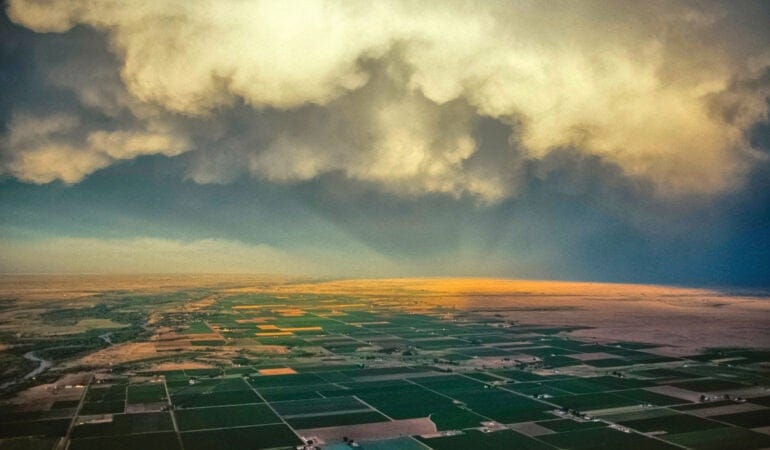
In a buy-and-dry acquisition, a municipal water utility will meet a city’s growing demand for water by purchasing interests in irrigated agricultural land, permanently fallowing that land, and diverting its water into the taps of city residents. On Colorado’s Arkansas River—where no water is available for new uses and there is a constant call for additional supplies—buy-and-dry tactics have diminished farmland across the basin. In the Lower Arkansas Valley, where the Arkansas River courses through Colorado’s eastern prairie, agricultural communities in some counties have been absolutely devastated.

Nichols says, “the Colorado Water Plan is very focused on eliminating buy-and-dry.” The question is how to do it. “We can’t stop cities from getting the water they need, but maybe we can change the rules [of the game], so it’s not a free-for-all.” The most promising game changer, he believes, is the Super Ditch.

Launch of the Super Ditch

West of the 100th meridian, where supplemental irrigation is required to grow food, irrigation ditches are a common means of delivering water from a river, lake, or reservoir to users along its course. In the Lower Arkansas Valley, there are approximately 20 major mutual irrigation ditch systems. The Super Ditch, however, is not a real ditch. Rather, it’s a corporation—the Lower Arkansas Valley Super Ditch Company, Inc.—set up to provide leased agricultural water to cities as an alternative to the buy-and-dry trend. It represents seven ditch companies operating eight ditches between two reservoirs, the Pueblo and the John Martin.

The Super Ditch began leasing water for the first time this year, through a small pilot project. But it was incorporated in 2008, with the assistance of the Lower Arkansas Valley Water Conservancy District (LAVWCD), a special district established by voters in 2002. Those who voted for the district, whether they owned water or not, were tired of seeing what they considered “their river” diverted to cities more than 100 miles away—some of which lay in completely different river basins. Even urban voters in the City of Pueblo, a steel town on the Arkansas River (population 108,000), sided with rural farmers in the face of economic hardships. “Not one more drop!” became a rallying cry against water leaving the valley.

Nichols serves as special counsel to the LAVWCD and helped the district develop the Super Ditch concept. Inspiration came from California, where the Palo Verde Irrigation District launched a long-term fallowing-leasing program with the Metropolitan Water District of Southern California (MWD) in 2005. The contract between the two entities seeks to supply 27 southern California coastal communities, including San Diego and Los Angeles, with 3.63 million acre-feet of Colorado River water from one ditch over a 35-year period. Participating farmers stop irrigating for a designated period of time, fallow their fields, and receive payment for their water, which bypasses their farms on its journey to MWD customers.

The LAVWCD sought to create a similar project, predicated on a rotational fallowing-leasing concept, but the Super Ditch was a much more sophisticated undertaking. Facilitating work with seven different mutual ditch companies, each with its own board and governance structure, was fraught with challenges. The cumbersome nature of Colorado water law, and the powerful market mechanisms and path dependencies that guide urban water acquisition strategies in the state complicated matters further. Colorado municipalities are hesitant to rely on water leasing, and for good reason. Certainty of supply is critical, and the temporary nature of leasing versus the permanent nature of ownership is unsettling to most urban water providers. What happens if the population grows by 50,000 people, and the leased water those people are relying upon is no longer available—or is sold to a competing water provider?

Nichols tried to develop the Super Ditch concept in ways that addressed these concerns. Supplies from different farmers are pooled by the Super Ditch, and provided to cities under long-term lease contracts. To guarantee that leased supplies are available once the lease period ends, the LAVWCD began working with farmers to place conservation easements on participating farms—protecting them from development and tying the water to the land in perpetuity to ensure future production potential. While enabling temporary transfers, the easements eliminate the possibility of any permanent water severance, diversion, or change in use. In other words: no buy-and-dry.

Conservation easements have protected the fabric of agricultural communities across Colorado and around the nation. An easement-protected land base creates assurances that the future production potential of an agricultural community will be maintained in the face of land conversion threats stemming from urban sprawl, oil and gas development, or municipal buy-and-dry. With the land base protected, related agricultural industries are able to invest in the region with confidence. That, in turn, has a net positive impact on Main Street.

In May 2015, the Super Ditch delivered its first water supplies: five farms on the Catlin Canal provided 500 acre-feet of water to the city of Fountain (pop 27,000), the city of Security (pop 18,000), and the town of Fowler (pop 1,200). Fountain Water Resource Engineer Michael Fink says, “the city took delivery without a hitch,” adding that the long-term success of the program depends on ensuring that the Super Ditch doesn’t advance a supply-side economic model.

Nichols says that’s not a problem. “Cities can lease [from farmers] three in 10 years or 30 percent of the time. They have the responsibility to let farmers know in advance [when they will be leasing]. But for the most part, cities don’t need water in dry years, they need it the year after to refill storage [reservoirs].”

By fallowing one-third of their fields three out of every ten years, farmers “rest” 100 percent of their land once in a ten-year period—a process that supports recommended practices in crop rotation and soil management, while allowing water itself to become a cash crop. Nichols reports that with three-out-of-ten-year crop rotation, a demand of 25,000 acre-feet of water can be met by involving 40 percent of the irrigators. Some farmers believe that as many as 80 percent will want to participate. Participants will certainly be needed: the supply gap in the Arkansas River Basin is projected to grow to 88,000 acre-feet or more by 2050. The litmus test for success will be if large cities responsible for the majority of buy-and-dry activity—Aurora (population 346,000) and Colorado Springs (population 440,000)—sign on to the program. “Municipal acceptance of leasing rather than buying,” Nichols says, “remains the principle challenge.”

From Pioneer to Buy-and-Dry

In the Lower Arkansas Valley, water has divided communities for much of the 20th century. In the 19th century, it divided entire nations. The river here delineated three international boundaries over time: between Spain and the United States following the Adams–Onís Treaty of 1819, which codified the border of the Louisiana Purchase between the two countries; between Mexico and the United States following Mexican independence from Spain in 1821; and between the Republic of Texas and the U.S. before Texas’s annexation in 1845. Two years after the Adams–Onís Treaty was signed, the Santa Fe Trail was established along the river’s course, bringing traders, soldiers, miners, and settlers into Colorado. Those pioneers developed some of Colorado’s earliest settlements—and, with them, water diversion projects along the river’s banks.

The West is dry, and even though the Arkansas River is the Mississippi River’s second longest tributary, it carries very little water in Colorado. Consider how quickly waters in the Lower Arkansas Valley were appropriated. Following the earliest appropriation in 1861, the Homestead Act of 1862 was enacted. More water rights were developed with settlement. By 1874, the last water rights decree still in priority 100 percent of the time (meaning there is always enough water in the river to serve it) was established—two years before Colorado gained statehood in 1876.

Water rights that were appropriated in 1887 are in priority less than 50 percent of the time today. Water rights from 1896 are in priority less than 10 percent of the time. This means that a modern farmer in the Arkansas Valley with an 1896 water right established by his great-grandfather will be able to irrigate just 10 percent of the time given average precipitation. The rest of the time, when there is a “call on the river”—meaning there is not enough water in the system to serve all rights holders—he must desist from diverting water to his fields, so that more senior water-rights holders can use it.

With the Arkansas River overappropriated before the turn of the century, cities began purchasing water from farmers as early as the 1890s. But shortages or conflicts were also addressed through the development of trans-basin diversion projects (which moved water from other river basins into the Arkansas) or storage projects (which sought to capture surplus water behind dams during high flow periods). These projects reached their thresholds in the 1970s. It was then that cities began seriously looking to irrigated lands.

During the 1970s and ’80s, Colorado Springs and Aurora, working with corporate landholders and the City of Pueblo, acquired interests in 55,000 acres of farmland served by the Colorado Canal. The cities subsequently diverted nearly 70,000 acre-feet of water for municipal use, drying up the vast majority of Crowley County. Crowley became the buy-and-dry poster child, and continues to hold that undistinguished title today. Poverty rates exceed 35 percent. Main streets are shadows of the communities that existed there in the mid-20th century. Noxious weed infestation and dust storms are common on dried-up lands. Restoring these farms to native prairie is not only expensive but, in practice, ranges from difficult to impossible.

Today, the losses of irrigated agriculture from water sales in the Lower Arkansas Valley exceed 100,000 acres, representing more than 150,000 acre-feet of water annually. Some farms continue operations by temporarily leasing land or water from the cities they sold to, but those leases will soon expire, advancing even greater losses. In a region that historically irrigated 320,000 acres of farmland, one-third of the tilled ground is now dry, few if any economically viable land use alternatives exist, and people are wondering if a tipping point is coming that will mark the collapse of irrigated agriculture in the area.

“As in much of the West, agriculture is at the heart of this region’s cultural heritage,” says Summer Waters, director of Western Lands and Communities, a joint program of the Sonoran Institute and Lincoln Institute of Land Policy. “However, we have entered an era in which cities are becoming part of our legacy too. This leaves us with a question that we have to answer collectively: what will the new West look like?”

“Ideally, both cities and agricultural areas will be able to co-exist in the new West,” Waters says. “The key to striking that balance lies in how we manage our water supplies. The Super Ditch concept is an innovative way to build flexibility into our water systems, and flexibility is critical in times when supply is uncertain.”

A Promising Pepper in an Unpromising Place

Mike Bartolo is visibly frustrated. He worries that water transfers will displace agriculture. “We’re losing some of the best growing land in the state,” he says. “These are prime soils that don’t exist in other places. How do you create certainty in the industry [when this is going on]? That’s the question.”

Bartolo, who holds a Ph.D. in plant physiology from the University of Minnesota, is a member of the water faculty at Colorado State University (CSU) and a senior research scientist at CSU’s Arkansas Valley Research Center. He sits on the Super Ditch board of directors, representing the Bessemer Ditch (one of the eight participating ditches), where he is a shareholder. With an 1861 water right, the Bessemer provides one of the most senior and reliable sources of water to farms anywhere in the Lower Arkansas Valley, and it irrigates some of the valley’s best lands. Bartolo is still grieving the 2009 loss of 28 percent of the water in the ditch—sold by farmers he knows to the Pueblo Board of Water Works (PBWW), the utility that provides municipal water to the City of Pueblo.

According to Nichols, there have been occasions when cities strategically approached farmers during the worst of times—when some combination of recession, drought, low commodities prices, overleveraging, or other factors forced their hand. But it is equally true that retiring farmers have assembled collectives to negotiate bulk water sales to cities. The Bessemer Ditch shareholders who sold 5,540 shares to PBWW for $10,150 per share (a share of Bessemer ditch water irrigates approximately one acre) were largely retiring farmers without heirs, responding to falling commodity prices and looking to capitalize on the increasing value of water following the severe drought of 2002. The eventual sale in 2009 netted them more than $56 million. Consider that dry land in this region often sells for less than $300 per acre, and you get a sense of where land values lie: in the water. Wanting to protect other producers and the agricultural fabric of the communities served by the Bessemer, Bartolo tried to convince farmers not to sell—to no avail. “I said, ‘let’s look at other options, at conservation easements, at the Super Ditch,’ but you have to realize how long these sellers had been working on this. Even if they were open to alternatives, my ideas were pie in the sky compared to the cash offer they had in hand.” (The Super Ditch was established but not operational at that time.)

Growers in the region have a great deal of respect for Bartolo. He’s a fourth-generation farmer, credited with developing the Mosco variety of Mirasol green chile pepper—the most popular variety of green chile grown locally and a centerpiece at the Pueblo Chile & Frijoles Festival, which draws more than 100,000 Coloradans each year. Whole Foods recently decided to stock stores with Mosco chiles from the Arkansas Valley rather than Hatch chiles from New Mexico—a blow to the pride of New Mexicans, whose state vegetable is the chile pepper.

Bartolo developed the Mosco chile from seeds his father gathered at the home of Mike’s uncle, Harry Mosco, following his death in 1988. Mike planted the seeds. “One plant I grew was different,” he says. “It had better yield, bigger fruit, and meatier flesh, which made it easier to roast.” Mike made single plant selections beginning with that plant. He isolated the characteristics he wanted and repeated the process, developing the chile over a fifteen-year period.

Many celebrated produce items come out of the Lower Arkansas Valley, Rocky Ford cantaloupes and Mosco chiles being principle among them. Mike has grown them all. Still, when it comes to changing the playing field, as the Super Ditch is looking to do, Mike concedes there is a lot of work ahead. “It has become politically incorrect for cities to buy-and-dry, but that hasn’t stopped other speculators [from playing the role municipal water utilities were playing].” Earlier this year, Pure Cycle, a water and wastewater services company that leases 14,600 acres of land on the Fort Lyon Canal to tenant farmers, sold the farms to an affiliate of C&A Companies and Resource Land Holdings, LLC. C&A is a company with plans to provide Arkansas River water to Front Range cities to the north. “These alternative transfer mechanisms have to be really well defined, and they have to have a history behind them to be able to compete,” Bartolo says. They need to be, he adds, just as adept and quick at providing cash in hand as an outright water sale.

Water as Cash Crop

The value of water out West is only increasing. In the Lower Arkansas Valley, a lot of wealth is embedded in the water farmers own. It seems ironic that communities in possession of such a valuable asset are confronted with poverty and decline. More puzzling still is the fact that farmers are liquidating an asset whose value only continues to grow. Ask any investment advisor, “Would you dispose of an asset predicted to continue increasing in value?” and he or she is likely to say “no . . . unless I had no other choice, or unless there was no other way to see returns from that asset.”

When it comes to water, the problem right now is that there is a strict dichotomy of choices. Farmers who own it have limited means to earn money from it except by: (1) growing food with it and planning for returns based on commodities prices, or (2) selling it and cashing out on its current value. Part of the reason choices are limited has to do with the cumbersome nature of Colorado water law. A lease of water from farm to city can necessitate a change-of-use case in the water courts. A change case involves engineering studies and legal expertise and can run tens of thousands of dollars. The change case proponent must demonstrate to the courts that third-party water rights holders, such as downstream farmers who rely on the same ditch, will not be harmed. If the courts or third parties challenge that premise, the cost of the change case can escalate into the hundreds of thousands of dollars. Going through this process for a temporary lease, coupled with cities’ desires to guarantee permanency of supply in the face of growth, is another factor that has historically limited water leasing.

The Super Ditch, through legislation advanced by Nichols in 2013, enabled these checks and balances to take place through a much more efficient administrative process overseen by the Colorado Water Conservation Board (CWCB). Now, Bartolo and Nichols hope to see what happens when farmers have more than two choices. Their belief is that if farmers can retain water ownership, grow food, and realize earnings from “commodity water” at the same time—as they would from other types of assets—the economic outlook for the Lower Arkansas Valley will change.

This outlook is borne out by economic studies. As the Super Ditch concept was gaining steam in 2007, CH2M Hill agricultural economist George Oamek compared different options for farmers: sell water, continue to farm, or continue to farm while participating in a rotational fallowing-leasing program. His projections indicated that, over a 40-year horizon, farmers who sold their water would earn more than farmers who continued to farm, but farmers who continued to farm and participated in the fallowing-leasing program stood to gain the most of all. In a comment to the Pueblo Chieftain following the study, Oamek said that the Super Ditch could ensure the best price for farmers: “In economics, you look at collaboration as a way to draw out a higher price.”

For the same reason, however, the fallowing-leasing concept is a tough sell to large cities.

Following Oamek’s principle of collaboration, cities have been working together to acquire agricultural water supplies at low prices. City skepticism is heightened by inflationary concerns. If water cost is only going to increase, why not purchase supplies now, while prices are low, in order to keep utility rates down?

To address this matter, Nichols looked at different mechanisms for establishing price escalators that would protect buyers and sellers, including:

1. a market-based escalator, based upon other water conveyances;
2. an escalator based upon average municipal water impact fee increases over time;
3. an escalator based upon average municipal water rate increases over time; and
4. a cost-based escalator, as measured by the Consumer Price Index (CPI) and the Producer Price Index (PPI).

The pilot project with Fountain, Security, and Fowler guarantees pricing stability by adjusting the lease price every five years according to the percent change in the Colorado Municipal League’s Index of Colorado Utility Costs.

At $500 an acre-foot, the current Super Ditch lease will earn the five participating farmers a quarter of a million dollars this year in addition to the revenues they will earn from crop production on non-fallowed lands. Some of these crops, such as forage, are low-value crops, and the water lease provides good income in lieu of growing them. Others, like melons and chiles, are high-value crops. Bartolo is excited about the retention of these agricultural revenues, which he thinks will create a ripple effect across the valley’s many communities: “Two acre-feet of water grows an acre of chile—that’s 1,000 bushels,” he says, “which brings in $10,000 to $15,000 in revenue at the farm gate level.”

Although municipal water prices are increasing, considering the shortages the West faces, they’re still low by most counts. Cities have sought to keep prices low by acquiring as much water as they can, as early as they can, while keeping within the bounds of Colorado’s anti-speculation doctrine.

By blurring the lines around the “types” of water that drive prices—both at the tap (utilities prices) and at the head gate (commodities prices)—the Super Ditch may launch a disruptive innovation that could alter the price of water in ways that better reflect Western realities. If farmers retain control of water and lease to cities, prices will adjust according to increasing demand in a field of diversified ownership. That’s a new type of competition in the market, and that’s not a bad thing. Urban growth won’t have to correspond with rural decline. And a glass of water will still be the cheapest beverage to wash down a plate of locally grown chile rellenos.


Scott Campbell is an award-winning conservation planner and consultant whose assembles diverse teams to solve complex environmental, social, and economic problems. Scott was the 2015 Lincoln Loeb Fellow at Harvard University’s Graduate School of Design and a joint fellow at the Lincoln Institute of Land Policy. Prior to his fellowship, Scott directed one of the country’s largest land trusts, the William J. Palmer Parks Foundation.

Photograph: John Wark/Airphoto NA