Topic: Tecnología e instrumentos

Habitat Conservation Plans

A New Tool to Resolve Land Use Conflicts
Timothy Beatley, Septiembre 1, 1995

As sprawling, low-density development patterns consume thousands of acres of natural habitat, the force of urban growth is increasingly bumping up against the need to protect biodiversity. The fastest growing states and regions in the South and West are also those with high numbers of endemic species, and species endangered or threatened with extinction.

One tool that has emerged for reconciling species-development conflicts is the habitat conservation plan (HCP). Authorized under Section 10 of the federal Endangered Species Act (ESA), HCPs allow for limited “take” of listed species in exchange for certain measures to protect and restore habitat. These plans vary in their geographical scope from a single parcel or landowner to large areas involving many landowners and multiple governmental jurisdictions.

The HCP mechanism grew out of a controversy over development plans on San Bruno Mountain in the Bay Area of California that threatened several species of butterflies, including the federally listed mission blue. A collaborative planning process generated a biological study of the butterflies’ habitat needs and a conservation plan that allowed some development in designated nodes while setting aside about 87 percent of the butterfly habitat as permanent open space. The HCP also included a funding component, procedures for carefully monitoring development and minimizing its impact, and a long-term program of habitat restoration.

The positive experience of San Bruno led to a 1982 amendment to the ESA specifically allowing HCPs. Since then, their use has grown slowly but steadily. About 40 plans have been approved by the U.S. Fish and Wildlife Service, and another 150 are in progress, most of them initiated in the last five years.

The Typical HCP Process

Regional habitat conservation plans usually follow a similar process. They start with the formation of a steering committee with representation from the environmental community, landowners and developers, local governments, and state and federal resource management agencies, among others. Frequently, consultants are hired to prepare background biological and land use studies as well as the actual plan and accompanying environmental documentation. The content of these plans can vary substantially depending on the species and potential threats at issue, but most create habitat preserves through fee-simple acquisition or land dedication. Plans also include provisions for habitat management, ecological restoration, and research and monitoring. Much of the deliberation in preparing a plan centers on how much habitat must be preserved, the boundaries and configuration of proposed preserves, how funds will be generated to finance the plan, and which entities or organizations will have management responsibility for the protected habitat once secured.

While the HCP process has encountered problems, the experience to date suggests it can be a viable and constructive mechanism for resolving species-development conflicts. For the development community, the stick of ESA brings them to the table and keeps them there, realizing that without a strong plan any development might be jeopardized. For the environmental community, the plan represents a way to generate funds to acquire habitat that would be difficult to raise otherwise. The HCP process, thus, provides a useful pressure valve under the ESA–a tool to provide flexibility in what is frequently criticized as being an overly rigid and inflexible law.

Successes and Concerns

From the perspective of preserving biodiversity, the plans, even those not officially adopted or approved, have lead to the acquisition of important habitat. The Coachella Valley HCP in California sets aside three preserves totaling nearly 17,000 acres of desert habitat to protect the fringe-toed lizard. Other plans preserve biologically rich hardwood hammocks in the Florida Keys, desert tortoise habitat in Nevada, and forested habitat for the northern spotted owl in California. The ambitious Balcones Canyonlands Conservation Plan in Austin, Texas, would protect more than 75,000 acres of land, including a newly created 46,000 acre national wildlife refuge. Though this plan has encountered political and financial obstacles, more than 20,000 acres have already been secured.

One of the key concerns about HCPs is the effectiveness of their conservation strategies, especially whether the amount of habitat set aside is sufficient to ensure the survival of threatened species. The long-term ecological viability of preserves is another problem, because many will become mere “postage stamps” surrounded by development. These concerns suggest that more habitat should be protected, that preserves should be configured in larger, regional blocks, and that plans should seek to protect multiple rather than single species within broad ecosystem functions. The Balcones example suggests a positive direction for future HCPs in its emphasis on a regional, multi-species approach, including endangered migratory songbirds, cave-adapted invertebrates and plant species.

Another criticism of HCPs is that they have failed to change the ways we allow development to occur because they generally accept the current pattern of low-density sprawl and wasteful land consumption. In addition, it often takes four or five years before a plan can be prepared and approved. Even given that seemingly long timeframe, plans are often based on limited biological knowledge.

One of the most difficult issues in the HCP process is funding. Habitat acquisition in fast-urbanizing areas is extremely expensive. The Coachella Valley plan cost $25 million; the Balcones plan could cost more than $200 million. Most plans are funded through a combination of federal, state and local funds, with some private funding. At the local level the plans usually impose a mitigation fee assessed on new development in habitat areas ranging from a few hundred dollars per acre to the $1950 per acre in the case of the Stephens’ kangaroo rat HCP in Southern California.

Ideas for future funding sources include the creation of habitat acquisition revolving funds (similar to state revolving funds for financing local sewage treatment plant construction) and the use of special taxing districts designed to capture land value increases of property located adjacent to habitat preserves. Greater reliance needs to be placed on less expensive alternatives than fee-simple acquisition, such as transfers of development rights, tradable conservation credits, mandatory clustering and other development controls.

The Future of HCPs

The considerable progress in habitat conservation made through this mechanism to balance development and conservation could be halted if current proposals in Congress to substantially weaken ESA prevail. Clearly it is the “teeth” of ESA that gets opposing parties to the bargaining table. Without a strong ESA, there will be little reason to expect this form of collaborative habitat conservation to occur.

The experience to date suggests that flexibility does exist under current law, and that the problems encountered with HCPs do require some fine tuning. The challenge is to make the HCP process an even more effective tool for conserving biodiversity. At the same time, if habitat conservation is incorporated into local comprehensive plans, then new development can be steered away from important habitat areas and public investment decisions can minimize potential species-development conflicts.

Timothy Beatley is chair of the Department of Urban and Environmental Planning in the School of Architecture at the University of Virginia and the author of Habitat Conservation Planning: Endangered Species and Urban Growth, University of Texas Press, 1994. He spoke at the Institute’s May 1995 meeting of the Land Conservation in New England Study Group.

Additional information in printed newletter:
Map: Balcones Canyonlands, Austin, Texas. Source: Adapted from maps by Butler/EH&A Team, City of Austin Environmental and Conservation Services, Balcones Canyonlands Conservation Plan, Preapplication Draft, Austin, 1992

Informe del presidente

La evolución de las herramientas de planificación computarizadas
Gregory K. Ingram, Abril 1, 2012

La utilización de modelos computarizados en la planificación del uso del suelo y el transporte y para analizar los mercados de viviendas urbanas tiene una larga y variable historia. Una aplicación pionera de modelo computarizado a gran escala que relacionaba el uso del suelo con el transporte urbano fue el Estudio sobre el Transporte en el Área de Chicago de 1960. Este estudio utilizaba un modelo con desglose espacial que incluía una detallada red de transporte y abarcaba los clásicos pasos de uso del suelo, generación de viajes, elección de la modalidad y asignación de redes de toda la planificación de transporte urbano.

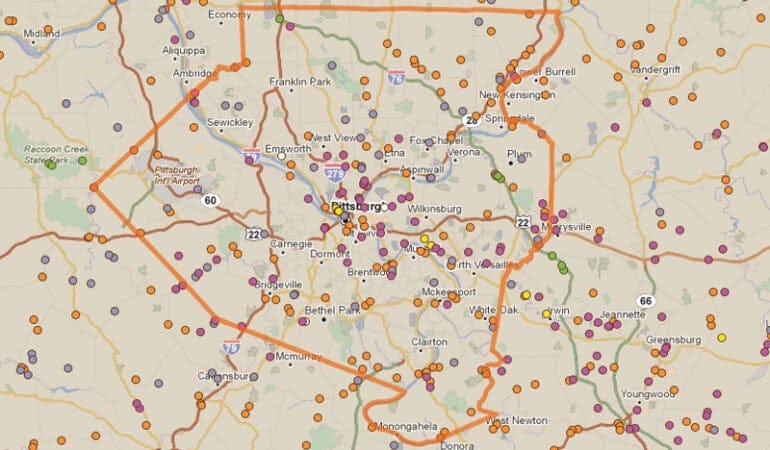
Un modelo de gran repercusión, con un enfoque más analítico para predecir patrones de uso del suelo, fue el formulado por Ira Lowry en 1964 para Pittsburgh, en el que se empleaba la teoría de base económica para distribuir la actividad económica orientada a la exportación. Luego se utilizó la distribución de residencias y empleo comunitario dentro del área metropolitana para obtener patrones de desplazamiento por razones de trabajo y compras.

A comienzos de la década de 1970 se prestó más atención a los modelos con desglose espacial para los mercados de viviendas urbanas, tales como el Modelo de Vivienda del Instituto Urbano (que representaba los cambios ocurridos en el mercado de la vivienda durante una década) y el Modelo de Simulación Urbana de la Oficina Nacional de Investigación Económica (un modelo microanalítico que proyectaba anualmente el comportamiento de los miembros de 85.000 hogares según el lugar de trabajo y la ubicación residencial). Ambos modelos se utilizaron para analizar el impacto de los programas de asignación de viviendas y se aplicaron más en el análisis de políticas que en la planificación.

A finales de la década de 1970, el énfasis se puso en el desarrollo y la aplicación de bocetos de modelos de planificación, en especial en los referidos al transporte. Aunque estos modelos seguían presentando un desglose espacial, utilizaban decenas (en lugar de centenas) de zonas de tránsito, y las redes de transporte se representaban con menor detalle. Estos modelos fueron adaptados para representar los resultados relacionados con el transporte más allá de los flujos de las redes, tales como emisiones vehiculares, exposición de la población a la contaminación del aire, kilómetros de viaje por vehículo y consumo de energía. En la década de 1980, estos modelos más pequeños pasaron a gestionarse desde computadoras centrales a computadoras personales, lo que facilitó su aplicación. Las necesidades de datos continuaban siendo muy importantes, pero muchos de los modelos utilizaban de manera más sistemática los datos provenientes de censos con desglose espacial que se encontraban disponibles, por lo que se vieron facilitadas la transferencia y la calibración de modelos entre los diferentes lugares.

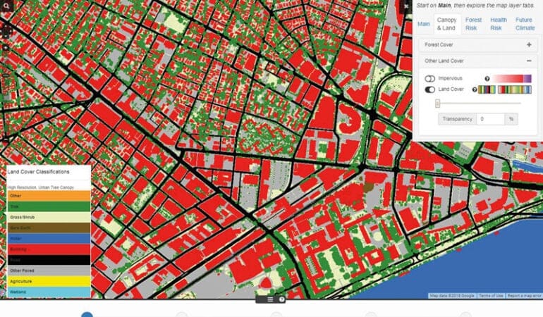
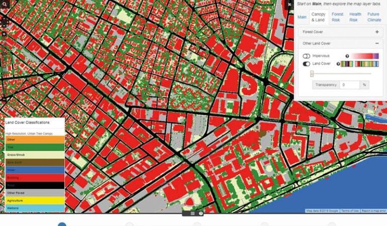
En las dos últimas décadas, la llegada de sistemas de información geográfica (SIG) y el desarrollo de programas de representación visual de datos en tres dimensiones han ido transformando la manera en que se utilizan las computadoras a la hora de llevar a cabo una planificación. Los datos compatibles con SIG hoy están disponibles gracias a los satélites, las fuentes encargadas de realizar censos y las agencias gubernamentales. Los municipios locales se han adaptado rápidamente a fin de combinar sus datos catastrales con información sobre actividad delictiva, transporte y demografía, y dichos archivos de datos municipales con frecuencia se encuentran disponibles en Internet. Aunque resulta evidente que se ha incrementado la disponibilidad de datos provenientes de SIG, la gran variedad de formatos, definiciones y tipos de cobertura puede representar un desafío a la hora de combinar la información de diferentes fuentes en un conjunto unificado de datos para una región metropolitana.

La utilización de visualizaciones en tres dimensiones de datos con desglose espacial ha transformado la presentación de los datos y los resultados de los modelos. Estas técnicas, tales como los mapas en 3D a nivel metropolitano y la capacidad de “volar” a través de una calle o barrio a nivel del proyecto, facilitan la consulta popular. Además, resulta mucho más fácil para aquellos que no son especialistas comprender y participar en el proceso e interpretar los resultados de escenarios de planificación alternativos.

Junto con los avances en cuanto a los datos y a la presentación de los mismos, los programas de computación son en la actualidad más fáciles de usar y se encuentran cada vez más disponibles en plataformas de código abierto. Aunque los códigos de muchas de las primeras herramientas de planificación computarizadas han estado a disposición del público en general, la utilización de dichas herramientas generalmente ha requerido tener conocimientos avanzados de programación. A medida que una mayor cantidad de estas herramientas se presenten en formatos fáciles de usar e integradas a otros módulos, la utilización de métodos computarizados para comparar y contrastar escenarios de desarrollo alternativos se hará cada vez más accesible. De hecho, actualmente muchas agencias de planificación son capaces de usar las herramientas de planificación de escenarios con el fin de producir posibles futuros alternativos que brinden un fundamento para el debate y la consulta popular, con el objetivo de identificar cuáles son los resultados deseables y cuáles deben evitarse.

Tal como se informa en este número de Land Lines, el Instituto Lincoln apoya el uso de distintas herramientas de planificación para investigar y evaluar la efectividad de las políticas que apuntan a mejorar los resultados referentes al desarrollo del suelo.

Charting Progress

PolicyMap Democratizes Data Analysis
By Alex Ulam, Octubre 1, 2015

Housing costs are spiraling upward in many areas throughout the United States, cutting down on the ability of Americans to save and leading to the gentrification of formerly affordable neighborhoods. However, as with many public policy challenges, it is not always immediately apparent where problems are the most acute. This became clear to Helen Campbell, an analyst in Los Angeles’s Housing + Community Investment Department, late on a Friday afternoon in July. An information request from the mayor’s office led her to discover that a large part of the San Fernando Valley in L.A. was home to the nation’s highest rental cost burden, which the U.S. Department of Housing and Urban Development (HUD) defines as a situation where families are paying more than 30 percent of their income on renting a home.

Los Angeles officials knew they had areas where home owners and renters were struggling to pay for housing, says Campbell, but they had no idea how severe the situation was or even where it was most pronounced. The mayor’s office needed authoritative data on this troubling trend for a lobbying effort to preserve the HOME Investment Partnerships Program (HOME), the largest federal block grant program for affordable housing. Currently, in Washington, DC, lawmakers are considering a Senate bill that would eviscerate the program.

If Campbell had used conventional geographic information software (GIS), it would have taken her an inordinate amount of time to analyze the city’s housing cost burden. But she was able to access the necessary information quickly by typing several simple queries into PolicyMap—a unique web-based software program that is changing the way that planning data is gathered and displayed. “If we didn’t have PolicyMap, we simply would have said no to the request,” Campbell says, “It would have taken too many hours to do the work.”

When Campbell ran her PolicyMap search, she discovered that the 29th Congressional District, part of which is situated within the city of Los Angeles, was, out of all of the 435 congressional districts in the country, number one in terms of rental cost burden and number three in terms of home owner cost burden. Those rankings for the 29th Congressional District, which includes a large part of the San Fernando Valley, translate into 62.9 percent of renters and slightly more than 50 percent of home owners there suffering from a housing cost burden. “We thought that South L.A. or Northeast L.A. would have higher rent burdens, but you have Valley as being the higher rent burden,” Campbell says.

Public Data for All

Since its launch in 2007, PolicyMap has grown into the largest geographic database on the web, and become the go-to public information resource for financial institutions, universities, nonprofits, and close to 2,500 government agencies. The online tool currently has more than 37,000 indicators, on categories ranging from crime to grocery store access, making the world of public data significantly easier to parse. Last year, the site had 434,000 unique visitors. Most of the data housed on PolicyMap is free, but proprietary data is available from various providers through paid subscriptions. Overall, PolicyMap’s easy-to-use mapping tools have helped democratize data analysis by making the process relatively affordable for nonprofits and local governments, which usually don’t have the resources to hire teams of GIS specialists. The site can help anyone in the public policy world avoid getting stuck on the wrong side of the widening digital divide.

One of the website’s most notable attributes is its capacity to simultaneously display various types of indicators, such as Superfund Sites, neighborhood income levels, or developments built with low-income housing tax credits. That capacity can facilitate contemporary planning initiatives, like the Obama administration’s Promise Zone or Choice Neighborhood programs, which require interagency collaboration and emphasize coordination of various types of investments in underserved areas.

PolicyMap also allows users to chart the effectiveness of particular programs over a period of time, helping them reap rewards or cut their losses down the road. Although government money is primarily doled out through formulas, there has been a marked increase in competitive grant programs that require progress reports and data that details evidence of needs. When it comes to competitive grants, according to Lincoln Institute President and CEO George W. McCarthy, “cities that have better data, and put together more polished proposals, are obviously going to have an advantage over those that don’t.”

The Starting Point

PolicyMap is the brainchild of The Reinvestment Fund (TRF), a Philadelphia-based Community Development Financial Institution (CDFI), which has $839 million in capital under management, and which invests in low-wealth people and neighborhoods. The organization finances a wide array of community building blocks, such as affordable housing developments, daycare centers, and grocery stores. PolicyMap was born out of TRF’s need to track how these community programs were working on the ground.

In the early 2000s, TRF began exploring ways to map and understand the impact of its own investments. “We were looking at where we were making investments over time,” says PolicyMap President Maggie McCullough, who was then a researcher with TRF’s Policy Department. “We also wanted to know what kind of impact we were making—how we had changed the markets in which we were working.”

In 2005, the state of Pennsylvania hired TRF to collect and map a vast amount of data on housing prices, foreclosures, and incomes. The project’s goal was to enable officials to think more strategically about how state money was being spent on housing throughout the state. But even with a contract worth almost $200,000, there were limitations to what TRF could do. The data and maps were trapped in a fixed format on a disk. “After we handed the disk over,” McCullough says, “I remember thinking that it was going to be like a paper report that sat on a shelf and was never going to get updated.”

That epiphany inspired McCullough and others at TRF to brainstorm on how to build a dynamic web-based mapping platform—one that would allow datasets to be refreshed and enable users to upload their own databases. In developing PolicyMap, McCullough was able to draw on her background as one of the pioneers in designing web portals for public information. In the 1990s, she was part of the team that built the U.S. Department of Housing and Urban Development’s (HUD) initial web presence. “My experience [at] HUD made me realize that if people [other than] researchers needed or wanted to understand data, we had to make it easier to understand,” says McCullough. “We had to give data indicators common names and simple descriptions, just like we had to give HUD programs common names.”

McCullough wanted PolicyMap to serve the entire country, unlike other data initiatives that focused on local geographies. Upon PolicyMap’s launch in 2007, “there really wasn’t any online GIS,” McCullough explains. “You could get driving directions and find a local restaurant with Google Maps, but a lot of that GIS software was locked on desktops. We wanted to create something that the public could access simply, over the web.”

The first dataset that TRF loaded onto PolicyMap in 2007 was comprised of reports from the Home Mortgage Disclosure Act (HMDA), the government’s most important data source for spotting predatory and discriminatory lending. At the time, the housing bubble was bursting, and officials from government and law enforcement were scrambling to get a grip on the burgeoning crisis; the HMDA data was one of the first places where they would look for information. But HMDA data wasn’t arranged in GIS user-friendly format, making certain types of searches extremely difficult. For example, if a researcher with a background in GIS wanted to zero in on a section of Detroit where she suspected there might have been a flood of high-cost loans, there was no online tool available to extract the HMDA data for that particular area.

PolicyMap’s initial success making data publicly available helped attract prominent paying customers—including the Federal Reserve Board in Washington, DC, which was in charge of collecting the HMDA data at the time. In addition to loading all of the HMDA data for mapping purposes and making it available to the general public, McCullough’s team custom-built a reporting tool within PolicyMap for the Fed that enabled its staffers to pull out HMDA data for any locale they wanted to study. Says McCullough, “We had made it easier for [The Fed] to access its own data.”

Leveling the Playing Field

Big lenders and real estate investors typically have in their toolkits subscriptions that can cost in the six figures for access to services that provide proprietary information such as property evaluation reports and in-depth market research. But many community-based organizations and local governments can’t afford to buy such licensed data. And even if they could afford expensive subscriptions, many community organizations and local governments lack the staffers or GIS capabilities to use it on interactive maps.

Take NeighborWorks, a national network of 240 community-based organizations that doesn’t have a GIS specialist on staff. Harry Segal, a performance and planning specialist at NeighborWorks America, says that PolicyMap has changed the equation for his network by giving them access to data and mapping tools that they couldn’t otherwise afford. “Any developer, public or private, trying to move into a new neighborhood has to court the powers that be and demonstrate an understanding of local market conditions,” Segal says. “It’s much more difficult for nonprofit organizations to compile this sort of data.” Without PolicyMap, he says, “the juice almost isn’t worth the squeeze.”

NeighborWorks’ PolicyMap subscription, which costs $5,000 per year, provides access to this kind of proprietary data and allows the organization’s members to query different sections of a map for information on a variety of indicators such as the average income of residents within a certain neighborhood and the level of high-cost mortgages that have been made there. This ability to look at different geographic scales empowers local community groups that are trying to access funding or call attention to predatory lending in their neighborhoods. “We have a couple of organizations in upstate New York. If you are looking at statistics on that region, they are going to be heavily skewed by New York City,” Segal says. “But with PolicyMap, we can pull up data by census tract or block group.”

Some city agencies also lack the capability to design or maintain the types of databases that they can now get through a PolicyMap subscription. “I am the only person here who has GIS capabilities,” says Sara Eaves, a planning and policy analyst for the San Antonio Housing Authority. She adds that PolicyMap allows many people in her office to perform tasks that would otherwise require specialized training. Through their PolicyMap subscription, the San Antonio Housing Authority also makes data publicly available about schools, residential vacancy rates, neighborhood income levels, and other information that a city resident might want to consider when deciding where to buy a house or rent an apartment. “We could maintain similar databases in-house, but we don’t have the resources. PolicyMap has allowed us to put interactive maps on our website, which is making the information available not just internally, but to the general public as well.”

Streamlining the Process for Cities and Community Groups

Many policy analysts use both full-blown GIS software, such as Esri, and the simplified GIS tools available on PolicyMap. Campbell from the Los Angeles Department of Housing + Community Development says that Esri offers the ability to do forecasts and run certain types of complex analyses that are not possible with PolicyMap. But she notes that PolicyMap saves her time and makes it easier to explain her research to laypeople. “I like PolicyMap because it is just based on facts and it is irrefutable,” she says, whereas Esri contains predictions about the future. “Sometimes, when you hand someone a community analysis report with Esri data, it may be too much information for them to digest. There will be 2005, 2010, and 2015 information. But for the 2020 information, there is a formula for how they created that forecast, which we may not need, and which may be wrong.”

PolicyMap is also flexible enough to respond to users’ changing needs. As data requirements have become larger and more complex, long-time PolicyMap customers have requested new tools to help improve efficiency. For instance, Melissa Long, the deputy director of Philadelphia’s Office of Housing and Community Development, had been using PolicyMap to display aggregated and cleaned-up census data. But several years ago, she realized that her agency needed more comprehensive analytic tools in order to apply for the increasing number of grants that are being awarded on a competitive basis.

“We needed a lot of neighborhood demographic information, and we needed to know what types of city programs were being deployed,” Long says, noting that having city data available on PolicyMap has improved the coordination among different city agencies and better positioned the city to apply for competitive grants.

Long says the tools that PolicyMap has developed for Philadelphia will enable the city to monitor its progress while implementing a Choice Neighborhoods Implementation Grant, which supports locally driven strategies to address struggling neighborhoods with distressed public or HUD-assisted housing. “The grant covers a five-year period. If we look and see that our neighborhood stabilization proposal is not working,” she says, “then we can make midterm grant corrections.”

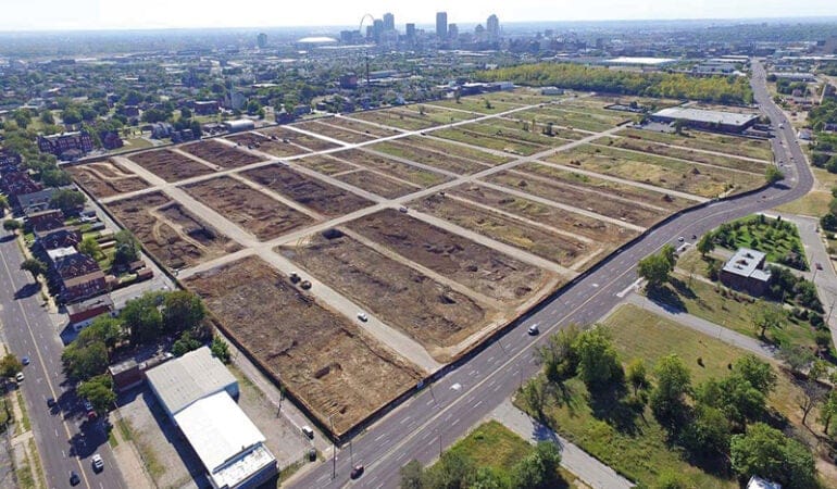
Being able to map different types of data simultaneously also lets researchers chart the co-benefits from a particular investment. For example, two different programs in Philadelphia involve cleaning up and greening vacant lots. PolicyMap lets users see the lots rehabilitated by both programs simultaneously, and study whether they have improved the quality of life in surrounding neighborhoods. Philadelphia’s contract with PolicyMap has made it possible to overlay data from multiple studies—such as one from University of Pennsylvania’s Wharton School that showed how real estate values rose 17 percent on average around the cleaned-up lots, and another that showed how gun crime dropped significantly in the areas around them. A third co-benefit is the several hundred summer jobs that are tied to keeping the rehabilitated lots in good shape. “You cannot just look at housing alone,” Long says. One has to consider “all the other things going on in a neighborhood.”

One of PolicyMap’s most popular analytic tools is the Market Value Analysis (MVA), which TRF developed for Philadelphia and has replicated in about 18 other cities. MVAs evaluate the strength of different areas of a city by looking at color-coded sections of a map that denote assigned values, which range from “Distressed” to “Regional Choice,” which is the highest rating. The rankings are established using a technique called Cluster Analysis, which evaluates census blocks based on groups of indicators, such as home sale activity, vacancy rates, and foreclosures. When you click on any section of the map, a table pops up to reveal the data that was used to determine the ranking for that specific area. The Regional Choice Neighborhoods, McCullough says, are generally defined by strong sales values, low vacancy rates, and a mixture of home owners and renters.

Those MVAs provide government agencies and nonprofits the information they need to address an area’s specific problems, says the Lincoln Institute’s McCarthy. “You want to get the best bang for your buck from public money,” he says. “In the really terrible neighborhoods, that might mean investing in large-scale demolition to accelerate the reuse of properties. In a transitional neighborhood, you might want to acquire abandoned homes and fix them up.”

The Road Ahead

The PolicyMap team often releases new indices and new tools right on the heels of court decisions and agency rulings This past July, for instance, McCullough and her team released the Racially and Ethnically Concentrated Areas of Poverty (RCAP/ECAP) index, which is used to identify U.S. Census tracts that have both a high proportion of nonwhite individuals and people living below the poverty line. McCullough says that her team anticipated the Supreme Court’s ruling in June on “disparate impacts” in housing practices and, several months earlier, had started developing the index to help individuals and organizations understand the issues related to the court’s decision. “The timing was great,” she says. “When [the Supreme Court decision] happened, we were ready to go.”

PolicyMap is still missing major data sets that McCullough would like to upload, to help researchers get a better picture on critical issues facing the country. For example, McCullough says that she has long wanted to incorporate national foreclosure data as part of PolicyMap’s efforts to track factors influencing home sale prices, but it’s difficult to find comprehensive and authoritative foreclosure data sets. Plus, it’s still prohibitively expensive to purchase licenses for the foreclosure data from private vendors. PolicyMap clients have also expressed interest in accessing credit scores—some of the most difficult data to obtain. “We couldn’t even get permission from the credit-score agencies to license the data,” McCullough says. “And if we were going to get it from them, it would be aggregated at a high geography, [like] at a statewide level.”

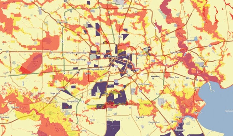
Meanwhile, PolicyMap will get one of its biggest-ever data resources this coming October, with the first segment of a project tentatively titled “State of the Nation’s Land,” subsidized by the Lincoln Institute. “State of the Nation’s Land” will include a collection of 18 huge databases from 150 different government agencies, covering criteria such as heavily polluted sites, public investments in land, flood zones, and zoning information.

The Lincoln Institute project is intended to help government agencies do their jobs better and provide average citizens with tools they can use to hold their elected officials more accountable. It should also shed more light on some our country’s most vexing problems, like the persistence of poverty in certain areas or reverse redlining, when minority consumers are targeted for loans on unfavorable terms. Ultimately, however—as with the discovery that the San Fernando Valley is in fact the most unaffordable place to live in the country relative to local residents’ income—we cannot even anticipate some of the most interesting facts and trends that will be unearthed in the future, as more researchers get savvy about navigating PolicyMap.

“Every time I get into PolicyMap, I start looking at new things,” says McCarthy. “There is a whole process of discovery that I go through, and it’s very illuminating.”

Alex Ulam is a journalist who focuses on architecture, landscape architecture, urban planning issues, and housing.

Land and Biodiversity Conservation

A Leadership Dialogue
James N. Levitt, Julio 1, 2002

The Lincoln Institute, with the Land Trust Alliance and the National Park Service Conservation Study Institute, is working with two dozen senior conservation practitioners from public, private, nonprofit and academic organizations across the nation to consider the grand challenges facing the North American land and biodiversity conservation community in the twenty-first century. The conservationists, who shared ideas electronically for several months prior to their March 2002 meeting in Cambridge, explored emerging and needed conservation innovations that may prove commensurate with the challenges. Organized by James Levitt of Harvard’s Kennedy School of Government, Armando Carbonell of the Lincoln Institute and Fara Courtney, an environmental consultant based in Gloucester, Massachusetts, the group exchanged ideas through presentations, case studies and working groups. E.O. Wilson, the distinguished author and biodiversity scholar at Harvard University, addressed the session and participated in the discussions. This article presents several highlights of that leadership dialogue on conservation in the twenty-first century (C21).

“We have entered the twenty-first century, the century of the environment. The question of the century is, how can we best shift to a culture of permanence, both for ourselves and for the biosphere that sustains us?” E.O. Wilson

The Historical Context

Ask almost any American concerned with natural resources, “How and when did we start practicing conservation in this country?” In most cases, the response involves the role of the federal government at the turn of the twentieth century under President Teddy Roosevelt. While Roosevelt and his close associate Gifford Pinchot do stand as giants in the history of conservation in this nation, the record shows that Americans have a remarkable tradition of conservation that stretches back at least to the early days of the Republic.

Individuals and organizations in the private, nonprofit, public and academic sectors have throughout our history brought landmark conservation innovations to life, and they continue to do so. They have focused their attention on sites that span the urban-rural continuum, from city parks to remote wildernesses. In the context of repeated waves of immigration and population growth, a chain of stunning technological advances and a pattern of long-term economic growth, American conservation innovators have acted creatively and often with considerable passion to protect and manage natural and scenic wonders, working landscapes, native wildlife and recreational open space for their own benefit, for the benefit of the public at large, and for the benefit of future generations.

Consider the history of the land trust movement. Thomas Jefferson set an early precedent for private and nongovernmental protection of natural beauty in America. In 1773, three years before he penned the Declaration of American Independence, Jefferson purchased a parcel of land known as Natural Bridge near the Blue Ridge Mountains. He treasured the parcel throughout his adult life, inviting writers, painters and dignitaries to visit the site and record its wonders. By 1815 he wrote to William Caruthers to say that he held Natural Bridge “to some degree as a public trust, and would on no consideration permit the bridge to be injured, defaced or blocked from public view.”

Some 60 years after Jefferson’s death, Charles Eliot, son of the president of Harvard University and a protégé of Frederick Law Olmsted, took another historic step toward the nongovernmental protection of open space. He proposed the formation of a private association to hold parcels of land for the enjoyment of the citizens of Massachusetts, particularly the less affluent residents of Boston who needed an escape from the “poisonous” atmosphere of the crowded city so closely associated with the technological progress and demographic turmoil of the Gilded Age. With a charter from the Commonwealth granted in 1891, that organization, now known as The Trustees of Reservations, became the first statewide nongovernmental land trust.

Eliot’s innovation has proved to be truly outstanding, a landmark conservation innovation that meets all the criteria for outstanding innovations in the public interest set out by the Innovations in American Government program at Harvard’s Kennedy School of Government. The notion behind the Trustees has proved to be novel in conception, measurably effective, significant in addressing an important issue of public concern, and transferable to a large number of organizations around the world. Furthermore, and critically important in the field of conservation, Eliot’s innovation has demonstrated its ability to endure and remain vibrant after more than a century. The Trustees’ current director of land conservation, Wesley Ward, emphasizes that nongovernmental conservation organizations will continue to be called upon in the twenty-first century to “provide leadership by identifying challenges, advocating effective responses and providing relevant models of conservation and stewardship.”

The Lincoln Institute played an important role in the resurgent growth of the land trust movement in the early 1980s, when it focused its resources as an academic institution on how an exchange of information among several dozen land trusts in the U.S. might strengthen conservation standards and practices throughout the entire land conservation community. Jean Hocker, at that time organizing the Jackson Hole Land Trust, remembers well the early discussions convened at Lincoln House by Boston-area lawyer Kingsbury Browne. She explains that emerging from those deliberations was the idea that “we ought to form a new organization called the Land Trust Exchange that could help us all do our jobs better.” Hocker moved to Washington, DC, in 1987 to run the group, which became known as the Land Trust Alliance (LTA). Under her leadership, the organization led the land trust movement into a period of rapid growth and enduring achievement. In 2002, there are more than 1,200 local and regional land trusts in the U.S. that have helped to protect more than six million acres of open space. Furthermore, the LTA’s annual Rally is a now a high point of the year for more than a thousand land conservation volunteers and professionals spread across the continent and beyond who convene to share their best ideas.

The Trustees’ long history of conservation innovation and achievement is paralleled by the histories of many other public, nonprofit, academic and private sectors organizations represented by C21 participants. Nora Mitchell and Michael Soukup of the National Park Service underscore the significance of America’s creation of the world’s first national park at Yellowstone in 1872, an innovation of worldwide significance that was in part the brainchild of two private railroad entrepreneurs, Jay Cooke and Frederick Billings. Laura Johnson, president of the Massachusetts Audubon Society, takes justifiable pride in the achievement of her organization’s “Founding Mothers,” two women who established the nation’s oldest continuously operating Audubon society in 1896 and catalyzed the campaign that led to the signing of the first international migratory bird treaty. Robert Cook, director of Harvard’s Arnold Arboretum, explains the pivotal role of that institution in the emergence of American forestry policy as far back as the1870s. And Keith Ross of the New England Forestry Foundation, who spearheaded the precedent-setting effort concluded in 2000 to place a conservation easement on more than 760,000 acres of forest land owned by the Pingree family in Maine, emphasizes that the family’s private forest stewardship practices date back to the 1840s.

Complex Conservation Challenges

Notwithstanding the conservation community’s collective record of achievement, the land and biodiversity conservationists at the C21 meeting foresee grand challenges of extraordinary complexity and difficulty in the coming 50 to 100 years. In the context of expected growth in North American and world populations, changes in demographic patterns and ongoing technological development, as well as systemic changes in climate and other earth systems, they express deep concern regarding myriad potential changes on the landscape. These may include the accelerating loss of open space; intensified landscape fragmentation; further degradation of wildlife habitat; alarming declines in the viability of a wide range of biological species; and potentially significant stresses to earth systems that provide essential ecosystem services. Will Rogers, president of the Trust for Public Land, notes, “from a conservation viewpoint, the pace of growth and development is rapidly running us out of time.”

The concern of many C21 participants regarding the potential impact of growing human populations starts with the straightforward projection of the U.S. Census Bureau that the population of the U.S. will grow from some 280 million Americans in 2000 to about 400 million by 2050. Beyond the numbers, it is critical for conservation planners to understand that the diversity of the American population is forecast to change significantly, with particularly strong growth in the ranks of Hispanic Americans and Asian Americans. Jamie Hoyte, an authority on conservation and diversity at Harvard University, explains, “one of the most significant challenges we face is broadening and diversifying the community of conservation-minded citizens. Those who advocate for conservation must do so in a way that speaks to people of all backgrounds and races, demonstrating an understanding of the needs of a broad range of people.” Robert Perschel of the Wilderness Society expands on the idea, advising that we need to “enter into a new dialogue with the American people … to touch the hearts and spirits and wisdom of our citizenry.”

C21 participants also pointed out that new conservation initiatives are likely to be launched in the context of continuing economic growth and personal affluence. For perspective, note that real U.S. gross domestic product (GDP) grew more than five-fold between 1950 and 2000, and many economists expect to see comparable growth in coming decades. To protect open space and biodiversity in the midst of such great affluence, conservationists will need to leverage the nation’s economic power. According to Chip Collins of The Forestland Group, “North America’s economic growth has helped fuel the loss of biodiversity. At the same time, North America has led the world in the development and implementation of conservation strategies in large measure because of the extraordinary growth and vigor of its economy. One of the great challenges will be to manage this seeming dichotomy by effectively harnessing the private sector and redirecting its immense capital power base toward constructive conservation initiatives. The private sector, in stride with its nonprofit, public and academic counterparts, must be a full and constructive partner.”

As in the past, new and increasingly powerful technologies are likely to continue to proliferate. While offering considerable social and economic benefits, the new technologies may also be closely associated with large-scale environmental disturbances. In the past half-century, for example, the spread of interstate highways has effectively stimulated the American economy but has also been associated with pervasive environmental disruptions such as urban and rural landscape fragmentation, the creation of unhealthy air quality conditions, and the generation of significant volumes of gases associated with global climate change. Similarly, more recently introduced networked technologies, such as the Internet and advanced wireless communications networks, appear to be enabling continued net migration of Americans to formerly remote and highly environmentally sensitive locations across the continent. Technology-related change is not limited to the U.S., of course. Larry Morris of the Quebec-Labrador Foundation explains that new communications and transportation networks are influencing where and how people live worldwide, from Atlantic Canada to the Middle East.

Biodiversity scientists E.O. Wilson of Harvard and Leonard Krishtalka of the University of Kansas point out that while emerging technologies may be associated with environmental disruptions in coming decades, the same technologies are also proving critical to advancing our understanding of the diversity of life on earth. Krishtalka explains that “researchers are now learning how to harness the vast store of authoritative biodiversity information in natural history museums worldwide (about three billion specimens of animals and plants) and integrate it with other earth systems data for predictive modeling of environmental phenomena.” Such a predictive model was recently built by researchers in Kansas, California and Mexico to examine the fate of a wide variety of Mexican species under a range of global warming scenarios. The outcome of this and similar studies should be particularly useful to organizations striving to prioritize land and habitat protection opportunities in ecosystems throughout the western hemisphere that may be facing significant disruption in future.

In sum, despite remarkable progress, conservationists are in no position or mood to rest. John Berry of the National Fish and Wildlife Foundation advises, “if our standard is that of the ancient Greeks, that is, to leave our nation ‘not only not less, but richer and more bountiful than it was transmitted to us,’ than we have not yet earned the laurel crown.”

A New Generation of Conservation Innovators

Inspired by the precedents set by creative American conservationists in the nineteenth and twentieth centuries, twenty-first century conservation practitioners are highly motivated to identify and implement new initiatives commensurate with the complex challenges of our day. C21 participants expressed interest in a wide variety of areas ripe for game-changing innovation, including the following.

Winning Hearts and Minds

Bill Weeks of The Nature Conservancy emphasizes that “the grandest challenge is to complete the task of getting the overwhelming majority of the public to care and act and vote like they care.” Rand Wentworth of the Land Trust Alliance agrees that conservationists should use the “tremendous power” of mass marketing to help create a national mandate for land conservation. Clare Swanger of the Taos Land Trust adds that the insight of mass marketers, but also of people living on the land, should be employed in such an effort. The outstanding question facing these conservationists is how to leverage modern marketing tools in a truly historic fashion. The aim would be to put together an effort comparable to the highly effective antismoking campaign of the last several decades, so as to build sustained momentum for the long-term protection and stewardship of “land for life.”

Building the Green Matrix

Addressing the multiple problems of open space consumption, loss of working landscapes, habitat fragmentation and biodiversity decline is a job that no single sector can tackle alone. Larry Selzer, president of the Conservation Fund and a proponent of smart conservation that balances economic returns with environmental principles, explains that effective action will require the cooperative efforts of landowners, policy makers and a wide diversity of individuals working across sectors. Furthermore, as Charles H.W. Foster of Harvard’s Kennedy School of Government points out, effective conservation efforts are at least as likely to take place at local and regional levels as at federal and international ones. Just how effective “green matrix” landscapes and organizational structures can be effectively assembled and maintained over the long term remains an area for thorough exploration and experimentation. Among other C21 participants, Peter Stein of the Lyme Timber Company, Jay Espy of the Maine Coast Heritage Trust, and Ian Bowles of the Kennedy School and the Moore Foundation are actively advancing the evolving art of assembling protected landscapes where economic and conservation goals can be pursued simultaneously.

Following Through with Stewardship

Achieving long-term conservation goals, of course, requires that once protection is gained for a given area a well-crafted stewardship plan, and in some cases an environmental restoration plan, must be conceived, agreed to by the relevant parties and then implemented. Getting this done has proved to be neither simple nor easy. Financing and organizing such stewardship efforts is too often overlooked during intense, short-fused campaigns to protect given parcels of land. Bringing a new level of attention and expertise to land and habitat stewardship and restoration efforts will be an ongoing challenge to the conservation community, particularly as its portfolio of protected lands grows in coming decades.

Fortunately, conservationists can point to some forward-looking stewardship efforts now underway. For example, Ralph Grossi, president of the American Farmland Trust, notes that the 2002 Farm Bill will provide significant levels of funding for USDA-sponsored stewardship efforts on agricultural lands. Similarly, Jaime Pinkham, a member of the Nez Perce Tribe in Idaho, offers eloquent testimony about how tribes can work with local, federal and other authorities to restore keystone species to entire ecosystems, as was accomplished with the gray wolf in the Northern Rockies. Still, there is room for a great deal of progress and innovation in this area.

Synthesizing Conservation Science

Conservation scientists E.O. Wilson, Leonard Krishtalka and Douglas Causey all underscore the argument that very significant progress can be made in the coming century to build large-scale syntheses in conservation biology and ecology. Wilson is particularly emphatic about the need to catalog all living species, a global work-in-progress that is only about 10-percent complete. The All Species Foundation that Wilson helped to form proposes to “complete the censusing of all the plants, animals and micro-organisms in the world in 25 years.” “Is this a pipe dream?,” asks Wilson, rhetorically. “No way,” he answers. “It is megascience backed by the same sort of technology drivers as the Human Genome Project. The important thing is to see the exploration of the biosphere as a crucial task.”

Gaining a comprehensive understanding of the biosphere and the ability to predict ecosystem outcomes under a variety of possible futures is indeed a grand challenge for conservation scientists. Kathy Fallon Lambert of the Hubbard Brook Research Foundation adds, “a complementary challenge is to find clear and concise ways to explain significant field and laboratory research findings to the general public and to key decision makers so that they can carry out policy debates with the best available scientific information.”

From our vantage point at the commencement of this century we cannot accurately predict just what future generations, 50 or 100 years from now, will judge to be our generation’s most significant conservation innovations, comparable to earlier creations of the world’s first statewide land trust or national park. We do know, however, that we face significant and complex conservation challenges, and our ideas for powerful innovation will only yield results if we act on them with great personal and organizational energy and intensity. There is no argument that the best time to begin such efforts is now.

James N. Levitt is director of the Internet and Conservation Project, Taubman Center for State and Local Government, Kennedy School of Government, Harvard University. His research focuses on the potentially constructive and disruptive impacts of new communications and transportation networks on land use and the practice of conservation, as well as opportunities for landmark conservation innovation in the twenty-first century.

Progress Toward Value-Based Taxation of Real Property in Lithuania

Kestutis Sabaliauskas and Albina Aleksiene, Octubre 1, 2002

The Republic of Lithuania, which declared its independence from the USSR in 1990, is the largest and the southernmost of the Baltic countries, with a total area of 65,300 sq. km. and a population of 3.5 million. Although the other Baltic countries introduced market value-based land taxes earlier, Lithuania anticipates that its up-to-date real property information system and administration network, managed by the State Land Cadastre and Register (SCLR), will speed its implementation. SLCR has been assigned the task of valuing property for taxation, and will utilize its computerized real property information system of land and building data for this purpose.

Tax systems in Lithuania, established early in the post-Soviet period, are gradually being reformed to accommodate development of democratic institutions and market economies, and to advance negotiations for entry into the European Union. The Lithuanian Governmental Action Program for 2001-2004 identified the introduction of market value-based taxes on land and buildings as a priority, contemplating an expanded tax base and a greater role for local government in fiscal decision-making.

Taxes on Land and Buildings

Currently there are two national taxes: a 1.5 percent land tax paid by landowners and 1.0 percent property tax on the value of property (excluding land) paid by corporations and other legal entities. The tax proceeds are returned to the municipalities, where in 2001 they provided on average just over 8 percent of municipal budgets. The revenue from the property tax was nearly 10 times higher than the revenue from the land tax, and has increased annually, representing 2.3 percent of national budget revenues. Neither tax has a market value base at present, although some market elements have been introduced gradually in the land tax base.

Development of the Mass Valuation System

Information Systems

Lithuania initiated development of computer-based real property data 10 years ago. Since establishment of the SLCR in 1997, a fully computerized Real Property Registration System links land parcels and buildings, and cadastre and register data into one unified system. The computer network covers the entire country and links counties and districts to the central databank, so that computerized registration of real property can take place in any branch office or client service bureau throughout the country. Analysis of the data permits monitoring of changes in the real property market, statistical analysis, and utilization of computer-assisted mass appraisal techniques. Figure 1 illustrates the current operation of the Real Property Register and flows of information on real property.

As of August 2002 nearly 4.7 million properties were registered, including more than 1 million land parcels, 615,000 buildings, 1.6 million auxiliary buildings, 950,000 flats and premises, and 395,000 engineering constructions. The central databank is expected eventually to register 6 million properties, including 2.3 million land parcels and 3.7 million buildings of different types.

Sales Data

The SLCR has been collecting real property sales information since 1998, and there are a sufficient number of transactions of flats, garages and land parcels to support mass valuation modeling based on market principles. The SLCR has created a databank of real property sales, and when a new real property unit is formed, it is inventoried and described in the Real Property Cadastre and all property rights are registered in the Real Property Register. At the conclusion of a transaction, a new owner registers the ownership in the register, but the data in the cadastre are not changed. When the transaction is registered the sale price indicated in the purchase-and-sale agreement is recorded into the database, allowing the price information to be supplemented by descriptive (cadastral) attributes. Table 1 shows the number of property sales registered during 1998-2001.

Mass Valuation Pilot Project

To prepare for the implementation of value-based real property taxation, the Ministry of Finance assigned to SLCR the task of undertaking a pilot project using mass valuation techniques. The results will be presented to the Ministry of Finance and other interested state institutions.

SLCR’s objectives are to complete the development of a real property mass valuation system to accomplish the following goals:

  • introduce data analysis and mass valuation technologies into practice;
  • prepare property mass valuation methods, corresponding to Lithuanian conditions;
  • train specialists to carry out mass valuation; and
  • propose improvements to the real property database and adaptations for purposes of mass valuation.

    At the conclusion, SLCR will be able to analyze various possibilities for introducing a computer-assisted mass appraisal (CAMA) system in Lithuania, and to prepare proposals regarding ad valorem property tax administration and relevant institutional infrastructure development. The project involves 40 property valuers from both SLCR’s central and branch offices, who have been trained by specialists within SLCR and international experts, including the Lincoln Institute, Organisation for Economic Co-operation (OECD), Swedesurvey and the Finnish National Land Survey.

Progress of Project Implementation

Property valuations have been nearly completed in the 11 municipalities selected as demonstration projects, one located in the territory of each SLCR branch office. The experience gained from these pilot projects will be valuable in extending the valuation throughout the entire country. Table 2 summarizes the progress made by SLCR and the Ministry of Finance in completing various steps in the implementation of the mass appraisal system.

Kestutis Sabaliauskas is director general of the State Land Cadastre and Register (SLCR) of Lithuania and Albina Aleksiene is chief of the Market Data Analysis Group.

A History of SLCR and Lincoln Institute Collaboration

The Lincoln Institute and the Lithuanian State Land Cadastre and Register (SLCR) have been collaborating on a series of seminars and research studies since 1997, in preparation for the introduction of market value-based taxation of real property in this Baltic country. A May 2001 Land Lines article, “Market Value-Based Taxation of Real Property,” reported on a weeklong course presented in February 2001 at the Lincoln Institute for a group of senior-level public officials from Lithuania. Participants included representatives from Parliament, the Prime Minister’s office and the Ministry of Finance; the United Nations Development Program provided financial support for the program. Their visit was important both in developing knowledge of real property taxation systems and in creating a working group of representatives from different governmental institutions who were eager to cooperate in establishing an up-to-date taxation system in Lithuania.

In November 2001, the Institute conducted a follow-up series of programs on market value-based taxation in Vilnius for representatives from institutions including the Government of the Republic of Lithuania, several ministries, the Tax Inspectorate, the Association of Municipalities, and the Lithuanian Association of Property Valuers. A second seminar, “Value-Based Taxation Of Real Property in the Baltic Countries: A Comparative Review,” drew participants from Estonia, Latvia and Lithuania to discuss the progress of property tax reforms and shared experiences in undertaking mass valuations. A third seminar, organized in cooperation with the Committee of Budget and Finance of the Lithuanian Parliament, attracted many members of Parliament and top-level governmental officials involved in shaping various aspects of tax policy: policy considerations in introducing a real property tax based on market value; the challenges and benefits of value-based taxation; and ways of implementing an efficient real property tax acceptable to the general public in Lithuania. Over 100 representatives of various institutions of Lithuania and the Baltic States attended one or more of these November seminars.

In May 2002 a faculty group organized and sponsored by the Lincoln Institute visited Lithuania for another series of meetings and briefings organized by SLCR to explore effective approaches to implementing value-based real property tax system. SLCR staff presented extensive information on its activities and readiness to perform mass valuations at central headquarters as well as local offices, where most property valuers work. One outcome of the May meetings is development of an educational program on mass valuation using Lithuania as a case study, which may be valuable to other countries in economic transition. This case will be presented during the next collaborative program to be held in Vilnius in 2003.

Lincoln Institute faculty participating in these programs are Joan Youngman, senior fellow and chairman of the Institute’s Department of Valuation and Taxation; Jane Malme, fellow of the Lincoln Institute; Richard Almy and Robert Gloudmans, partners in Almy, Gloudemans, Jacobs & Denne, Phoenix; and John Charman, consultant valuation surveyor, London.