In Denver, Mike Johnston Confronts Success: The City’s Popularity Has Made It Pricey

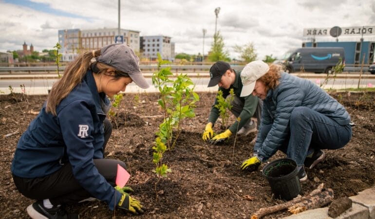
Denver Mayor Mike Johnston speaks with people at a homeless encampment. Johnston has made ending homelessness a goal of his administration. Credit: Denver Mayor's Office.
By Anthony Flint, July 9, 2025
Mike Johnston, a one-time high school English teacher, has been overseeing a significant boom in one of the most prominent cities in the Intermountain West. Denver has been attracting people and businesses with its temperate climate and outdoorsy quality of life, but this popularity has also caused growing pains, starting with increasingly high housing costs, homelessness, and recently some significant municipal budget woes.
Johnston has tackled the challenges one by one, beginning with a permitting process overhaul, steps to reduce costs in building, and tax abatements and other incentives, like a density bonus, to encourage more construction.
“We have a lot of people that want to move to Denver. That’s driving a lot of economic growth. We’re thrilled about it. It also drives lots of housing demand,” Johnston said in an interview for the Mayor’s Desk series, recorded on the Land Matters podcast. “The overarching theme is, we have to add a lot more housing supply.”
In the wide-ranging interview, Johnston also reflected on his aggressive campaign to clear out homeless encampments in the city. As part of this effort, officials have provided customized relocations to private transitional housing units with services and support for the unhoused.
“When you have high cost of housing cities, you get more people who can’t afford to pay that cost. That is just a mathematical fact. And so that means many of the cities that are growing and are in high demand, like the Denvers, or the San Franciscos, or the Austins, or Seattles, are the places where we see this struggle.”
The strategy of individualized housing solutions, while expensive, has been working, he said. “We think it can work for other cities, and we’ll share these lessons with anyone who’s willing to take them on, because we think we should set the expectation in every American city that street homelessness can be a solvable problem.”
He also expressed confidence that the state and the metropolitan region will have continued success fighting climate change, as federal policy backs away from addressing that global crisis. He said incentives for electrification, electric vehicle infrastructure, and energy-efficiency upgrades like heat pumps are contributing to the city’s goal of being carbon neutral by 2040.
“We don’t want to make it too expensive to do business in Denver, and yet we still want to be aggressively committed to hitting climate goals,” he said. “People do care. And there’s a lot we can do,” such as encouraging residents to take more trips by bike or walking, or to consolidate trips made in single occupancy vehicles.
“We want to encourage people to take more local action now, in the face of federal abandonment of [climate action] … we’ll keep setting our own targets for how our vehicles, our businesses, and our residents try to hit aggressive climate goals, knowing that we’re still all in this together, even if the President doesn’t want to make it a priority.”
Being mayor is the latest step in a professional journey that began with teaching English in the Mississippi Delta. From there, Johnston returned to Colorado to become a school principal, leading three different schools in the Denver Metro area. In 2009 he was elected to the Colorado State Senate, where he served two terms representing Northeast Denver. He was also a senior education advisor to President Obama and CEO of Gary Community Ventures, a philanthropic organization, where he led coalitions to pass the state’s first plan for universal preschool and spearheaded efforts to fund affordable housing and address homelessness statewide. He lives in East Denver with his wife Courtney, who is a chief deputy district attorney, and their three children.
Johnston, 50, was part of the Lincoln Institute mayor’s panel at the American Planning Association’s National Planning Conference in Denver this spring, along with Aaron Brockett and Jeni Arndt, mayors of the Colorado cities of Boulder and Fort Collins, respectively. Senior Fellow Anthony Flint caught up with him several weeks later for this interview, which will also be available in print and online in Land Lines magazine.
Listen to the show here or subscribe to Land Matters on Apple Podcasts, Spotify, Stitcher, YouTube, or wherever you listen to podcasts.
Further reading
Denver Mayor Mike Johnston’s latest affordable housing strategy: tax rebates for developers | Denverite
Will Denverites Come Back to the Newly Renovated 16th Street? | 5280
Opinion: Denver Parking Minimums Increase Housing Costs | Westword
Mayor says downtown Denver has made a ‘dramatic change’ | Denverite
Denver City Hall Takes a Page from NASA to Tackle Housing Barriers | Bloomberg CityLab
Zoning Report: Colorado | National Zoning Atlas
Who Should Pay to Fix the Sidewalk? | Bloomberg CityLab
Anthony Flint is a senior fellow at the Lincoln Institute of Land Policy, host of the Land Matters podcast, and a contributing editor of Land Lines.
Transcript
Anthony Flint: Welcome back to land matters, the podcast of the Lincoln Institute of Land Policy. I’m your host, Anthony Flint. On this show, we’re continuing our Mayor’s Desk series –- our Q&A’s with municipal chief executives from around the world — with Denver Mayor Mike Johnston, who was inaugurated as the 46th mayor of that city pretty much 2 years ago this summer in July 2023. It’s fair to say he’s been overseeing a significant boom in one of the most prominent cities in the Intermountain West, which has been attracting people and business with its temperate climate and outdoorsy quality of life. Yet Denver has had its growing pains, too, with increasingly high housing costs. We see modest bungalows in several neighborhoods in Denver, easily selling for a million dollars or more … a not-unrelated homelessness problem, and recently some significant municipal budget woes.
Mayor Johnson started his career as a high school English teacher in the Mississippi Delta, and returned home to Colorado to become a school principal, leading 3 different schools in the Denver Metro area. He later served as a senior education advisor to President Obama. In 2009 he was elected to the Colorado State Senate, where he served 2 terms representing Northeast Denver, working on issues, including immigration, gun safety and the clean energy transition. He later served as the CEO of Gary Community Ventures, a local philanthropic organization where he led coalitions to pass the State’s 1st plan for universal preschool and spearheaded efforts to fund affordable housing and address homelessness statewide. Mayor Johnston grew up in Colorado, speaks Spanish and lives in East Denver with his wife Courtney, who is a chief deputy district attorney and their 3 kids. Your honor, thank you for joining the conversation at Land Matters, and being part of the Mayor’s Desk series.
Mayor Mike Johnston: I’m delighted to be on. Thank you so much for having me.
Anthony Flint: Well, as I mentioned in the intro, like a lot of booming metropolitan regions, Denver is facing down a housing affordability problem. So, first question, what are the key elements for addressing this crisis?
Mayor Mike Johnston: You bet, Anthony, and again thank you for having me, and I think the opening frame for me which you mentioned … My dad used to say, the only thing worse than being hated is being loved, you know, and what we know for Denver is, we do have folks from all over the country and all over the world who want to move to Denver. And that is a great problem to have. I have friends who are mayors and cities facing very different challenges, which is declining populations and lots of vacant buildings, because people don’t want to move there. Denver is now, I think, the number 2 desired destination for people under age 30 in the United States. And so we have a lot of people that want to move to Denver. That’s driving a lot of economic growth. We’re thrilled about it. It also drives lots of housing demand.
So for us there are three big top priorities here. The overarching theme is, we have to add a lot more housing supply, as you know, but we think there are three ways to do that. One is to make it faster to build housing for us. That means an aggressive strategy on permitting reform to make our permitting system go from what was a two and a half to three-year process to now, what will be a commitment from us to have every permit only take 180 days of time in the city’s hands. We created a new citywide permitting office that unifies all of the functions of permitting that were spread across seven departments, now into one director, who reports directly to me so part of that is making it easier to build in Denver.
The second is reducing the costs of building wherever we can. And so we’re doing that, obviously making the process faster. Reduce the cost. But also we’re doing more to provide our own tax abatements and our own tax programs. We launched a middle class housing strategy this week. That’s focused on providing property tax abatements for up to 10 years in exchange for a 30 year, commitment on deed, restricted affordability for people that are middle class Denverites who need to be able to afford to live in the city. So we think those incentives matter. And then, of course, we are investing more in affordable housing. We know that the city can’t solve this alone, and the market can’t solve it alone. We need a partnership where we will invest city resources into projects where we can be hopefully a smaller and smaller part of the capital stack. But just enough of the stack to be able to buy long-term affordability in the form of deed restrictions. And so for us, it’s making the city build faster. It’s making costs cheaper. And it’s making more public investment with really clear public goals. We’ve set a clear public goal to bring on 3,000 affordable units every year, and provide access for 3,000 households to affordable units every year. That’s about twice the rate what the city was bringing on before we got into office. And so we know we have to be really aggressive about bringing on a lot more housing, a lot more quickly and a lot more affordably.
Anthony Flint: Your campaign to address homeless encampments in Denver triggered a little bit of backlash, including some criticism of the expense. Can you explain your approach, and how it might apply to other cities? And is there anything you would do differently?
Mayor Mike Johnston: Yeah, I think this is one that we are really excited about, because I think many Americans have given into the belief that homelessness is an unsolvable problem that we are just stuck with this as a component of modern life. And, as you said accurately, Anthony, what we know is homelessness exists in the greatest acuity in cities, not because there’s high rates of poverty, not because there’s high rates of unemployment, not because of the political ideology of those cities. It exists in direct correlation to the cost of housing. In those cities. When you have high cost of housing cities, you get more people who can’t afford to pay that cost. That is just a mathematical fact. And so that means many of the cities that are growing and are in high demand, like the Denver’s, or the San Francisco’s, or the Austins, or Seattle’s, are the places where we see this struggle. But what we have really seen is that this is a problem that can be solved by addressing those core needs. And so I’ll lead with the headline that … we set an ambitious goal to try to end street homelessness in my 1st term. Four years. That seems impossible. Well, I’ll tell you, we’re two years in right now, and we have now reduced our street homelessness in Denver by 45% in a little less than two years. That is … the largest reduction of street homelessness in any city in American history, over two years, of which we’re very proud. But it’s also a clear sign that halfway through the term. We’re halfway on the path of that goal. We think other cities should be ambitious. And believing that this is a solvable problem, let me talk about the way we’ve done this, which we think is also really scalable.
What we’ve done is first really focused on bringing on what we call transitional housing units which are dignified, individual private units. A lot of these are hotels we’ve bought and converted. They’re tiny home villages that we’ve built. But critically, it’s not shelter like sleeping on a gym floor with 100 people on a mat. It is a place where you have a locked door. You have privacy, you have access to showers and bathrooms and kitchens. You can store your stuff when you go to work for the day.
And we brought on wraparound services on each of these sites. So our first big effort was to bring on 1,000 units of transitional housing, you know, like many cities, previous Administration fought this battle, and took 2 or 3 years to fight, to put one tiny home village of about 40 units into one neighborhood with a number of lawsuits. We said, we have to bring on units at the scale of the problems. We brought on a thousand units, and (over) six months I did 60 town halls all across the city, talking to neighbors and all of those locations about why this would make such a big difference. We put wraparound services — mental health addiction, support, workforce training, long-term housing navigation — on each of those sites. So people don’t have to always return just to downtown to get those services. And once we brought those units on, then we went geographically to the places where encampments existed in Denver, and instead of sweeping those encampments from block to block, where they just show up in front of someone else’s house or someone else’s church or hospital, we would actually go to those encampments and resolve them. We would close that encampment entirely by moving all 50 people or 100 people. In one case we had almost 200 people in one encampment, closing those encampments, resolving them, moving all those folks into housing, and then importantly keeping that block or that region of the city permanently closed to future camping. So the result is, two years in, we’ve now closed every encampment in the city. We haven’t had a single tent inside of our downtown business district for more than a year and a half we have cut family homelessness by 83%. We’ve become the largest city ever to end street homelessness for veterans. We have no veterans anymore on the streets who can’t get access to housing, and, importantly, anyone can walk down any street or sidewalk or public park, and none of them have tents or encampments in them, so we’ve both made sure there’s a real change in the experience for residents of Denver and those people who are most at risk of starving to death, freezing to death, overdosing on the streets … we moved off of the streets into transitional housing that has really worked for us. We think it can work for other cities, and we’ll share these lessons with anyone who’s willing to take them on, because we think we should set the expectation in every American city that street homelessness can be a solvable problem.
Anthony Flint: Are you satisfied with the number of people using this very impressive and extensive light rail network in Denver Metro, and the number of people living essentially in transit oriented development? Or is the system facing growing pains, and if so, why? A related question … any lessons learned from the relatively light ridership on the free bus on the 16th Street Transit Mall, which is finally concluding its renovation after long delays? But first the light rail network, transit-oriented development … How is it going.
Mayor Mike Johnston: As you, said, Anthony, we’re not satisfied yet, and that is because, as you know, transit and housing have to be connected strategies. Housing is a transit strategy. If you’re mindful about actually building housing and building density of housing around our public transit networks. And so we had this great transit network built. We did not have density of housing around any of those spots. And so what we’re doing now is undertaking a series of very large catalytic investments in a number of areas around the city that are on these light rail lines. So we can build thousands and thousands of units of housing along that corridor. We just, for instance, acquired the largest piece of private property in city history to turn into a public park. It will be a 155-acre park. It is right next to a light rail stop, so we can now add housing and housing density all around that site — beautiful location, and people can get on light rail and get right to downtown or do a Broncos game or anything else. We just won a franchise expansion, the one franchise expansion for the National Women’s Soccer League, and so we’ll have a new women’s soccer franchise. We’re building a new women’s soccer stadium also at a TOD site that we’ll have on that campus … a lot of dense housing commercial activities also connected to public transit. We’re rebuilding our stock show in a historically Latino part of North Denver — Globeville, Elyria, Swansea — that’ll allow us to add about 60 acres of new housing, public spaces, commercial activation also all on public transit. So our belief is, you have to actually be deliberate about building real density around your public transit as much as you want to build your public transit around well traveled lines of travel in the city. And so that’s a big part of our strategy. When we add that density, we know most of the major cities like ours that aren’t yet a New York, or a DC, with a full functioning subway line. You can’t just throw in that infrastructure and hope the city accommodates because people have lots of places to go to. You have to build nodes of real density around the city. So even though you might have 3 or 4 different jobs over the next 10 years, those jobs can be concentrated among different regions, and your housing can, and your activities can (as well). So that’s our big strategy around that. And you’ll see us make historic investments in doing that in the next couple of years.
But a part of that is downtown, is our downtown strategy. And you mentioned our 16th Street bus that we have, that’s free downtown. We’re making the largest investment in our downtown, also of any city in the country, per capita. Right now, about $600 million through a tax increment financing system that will focus on one getting more people to live downtown. We want downtown to be a neighborhood, not just a business district. And so we’re going to add about 4,000 units of housing in our city center, using these funds that we have from our downtown Denver authority, because we know that means more people that will use that bus every day that we’ll get to and from work they will go to see friends. So that’s a big part of our strategy. We’re working on filling up about 7 million square feet of vacant office space — like many cities, have about 4 million of that, we will use with residential conversion. We think one of the most ambitious residential conversion plans in the country. The other 3 million we’ll use by bringing people back to the office, recruiting businesses to come downtown, stay downtown, we think the more we activate that location the more folks will use the public transit, and the more people can use the connected public transit of coming from a neighborhood in East Denver or North Denver, take the light rail down to downtown, use the 16th Street ride to get up and down 16th Street … we have the second largest theater complex in the country off of Broadway. We have 5 professional sports franchises in our city center. We have Michelin Star restaurants. We’ll have the Sundance film festival coming to Colorado. There’s so much to be attracted to seeing. We want to make it easy to get to downtown and around downtown, and this will do that.
Anthony Flint: Given the current municipal fiscal challenges in Denver, what is your thinking about alternative financing systems such as a land value tax or value capture, as seen in the 38th & Blake incentive overlay? I’m hoping you might explain the concept as you see it and how or whether its rationale makes sense to you.
Mayor Mike Johnston: We are interested in every incentive we can find to encourage folks to build more housing. The 38th and Blake overlay was really kind of a density bonus, where we allow folks to build higher buildings than what the zoning might allow in exchange for adding more affordable housing, and we are always looking at ways to incentivize folks to add more affordable housing. So we’re delighted to do that. I think that also links to the program I described briefly which is our our middle class housing program we launched yesterday, which is also focused on a property tax abatement. We’ll offer up to 10 years of property tax abatement for people that are going to build middle class affordable housing. So think about that as people making sixty to a hundred thousand a year as an individual … and that’s about a 10 year property tax abatement for a 30-year commitment of affordability. So that’s a great deal for us. We’re also looking at partnership on places where we have public land. We’re looking at working with city-owned land, working with Denver public schools where they have land, our regional transit system, if they have land. And so we’re always looking to contribute public land as a way to incentivize more affordability. But we want to do a all of the above strategy. But wherever we can add more housing without having to invest more dollars in these fiscal times that’s a big help
[Re-stated] Our belief is we want to do an all of the above strategy on every way we can incentivize people to build more affordable housing. So for us, that means we want to use city land. Whenever we can do that, we’ll use public land to be able to incentivize a deal. We’ll partner with other public agencies like the Denver public schools, or like the regional transit system or the State. That’s always a great way for us to incentivize. And that’s why we’ve used strategies like this middle class housing program we launched, which is a property tax abatement where folks can get 10 years of property tax abatement for a 30 year, commitment of deed, restricted affordability through a special limited partnership. So we’re going to use every strategy we have, particularly in tough economic times, and you don’t have big new dollars to invest in supporting affordable housing. We have to find other creative ways and density. Bonuses are a great way, and we’ll keep doing that as well as everything else we can.
Anthony Flint: Finally, how would you assess the progress of your climate action plans which I see includes incentives for electrification, electric vehicle infrastructure, hot and cold weather heat pumps, energy efficiency … Do you see a tangible embrace at the local level for addressing climate change, especially in the context of retrenchment at the federal level. I mean, just as a practical matter, the federal government is getting out of the climate business. So can cities and states take that over and be effective?
Mayor Mike Johnston: We don’t see any change at all in our city’s commitment to climate action or our conviction that this is a still existentially important effort for us to undertake. And so we are not slowing down at all. We’re not changing our path, and what we are doing is trying to make sure we’re committed to an aggressive vision to meet our climate goals, which for us is a 2040 plan to be entirely carbon free by 2040, to have 100% renewable energy. And also to make sure we’re driving economic growth. We want to do both. And so we don’t want to make it too expensive to do business in Denver, and yet we still want to be aggressively committed to hitting climate goals. And we’re doing that. We’ve done things like we had, I think, one of the nation-leading efforts on making our commercial buildings more energy efficient through a program we have called Energize Denver. We also had concerns from the business community about how to comply with the cost to make those adjustments to buildings. And so we spent a lot of time with our landowners and building owners and business leaders, and we revised that plan to both decrease the penalties, extend the amount of time folks can comply, put a cap on the overall amount of changes they have to make, which drops the cost dramatically for our business partners, but still keeps us on path to hit aggressive 2040 climate goals. So people do care. And there’s a lot we can do. There’s behavior change. We’re doing a whole campaign on behavior change, to encourage folks to take more trips by bike or walking … Can they consolidate or condense the number of single occupancy vehicle trips that they take. And so part of it is about awareness. Part of it’s about behavior change and part of it’s about a good policy on things like banning plastic bags. Obviously, and being able to incentivize more and more solar and wind. So we think this is purely a part of Denver’s brand. We want to be able to be a great city and a good city. We want to be able to have a great economy, and also have great connection to the natural environment of the outdoors. And so for us, it’s it’s good climate and good business, and we’ll continue to do both.
Anthony Flint: And local and state government taking this over, are you optimistic about that? The question is, can they really take this over, a planet-wide issue, and really be effective.
Mayor Mike Johnston: I think we don’t believe that we should give up here or step away. Our campaign, we call, do more or do less, but do something, whether it’s going to do more in the way of recycling, or less in the way of using a single occupancy vehicle or doing something in terms of being able to make decisions about where and how you use energy. We want to encourage people to take more local action now, in the face of federal abandonment of this. The things that we’ll need help on are the things that made a big difference. The federal tax credits on electrical vehicle purchases — those are big drivers of behavior change. I sponsored when I was in the Senate a state credit that does the same thing — provide incentives, tax incentives for electric vehicle purchases. Here we’re building out aggressively, charging station infrastructure to make it easier for us to convert our fleet vehicles to be electric to get more Ubers and Lyfts and Fedexes and Amazons and UPS (vehicles) to do the same. And to convince regular residents do the same. So we’ll keep building the infrastructure to do this. We’ll keep incentivizing people to do it. We’ll keep changing behavior to do it, and we’ll keep setting our own targets for how our vehicles, our businesses, and our residents try to hit aggressive climate goals, knowing that we’re still all in this together, even if the President doesn’t want to make it a priority.
Anthony Flint: Mike Johnston, Mayor of Denver, Colorado. Thank you once again for this conversation.
Mayor Mike Johnston: Thanks so much for having me, Anthony. It’s great to meet you.
Anthony Flint: You can learn more about all the issues we covered — strategies for affordable housing, sustainable urbanism, transit-oriented development, value capture, and of course, the challenge of climate change, pursuing both mitigation and resilience — all of that and more at the Lincoln Institute website, www.lincolninst.edu. While you’re there, scroll to the bottom and join our mailing list to get periodic updates on our work. And also on social media, the handle is @landpolicy. Finally, don’t forget to rate, share and subscribe to the Land Matters podcast. For now, I’m Anthony Flint, signing off until next time.
Subscribe to Land Matters on Apple Podcasts, Google Play, Spotify, Stitcher, or wherever you listen to podcasts