Topic: Uso de suelo y zonificación

Eventos

2024 Urban Economics and Public Finance Conference

Abril 19, 2024 - Abril 20, 2024

Cambridge, MA United States

Offered in inglés

The economic growth and development of urban areas are closely linked to local fiscal conditions. This research seminar offers a forum for new academic work on the interaction of these two areas. It provides an opportunity for specialists in each area to become better acquainted with recent developments and to explore their potential implications for synergy.


Detalles

Fecha(s)
Abril 19, 2024 - Abril 20, 2024
Time
8:30 a.m. - 12:15 p.m. (EDT, UTC-4)
Location
Lincoln Institute of Land Policy
Cambridge, MA United States
Idioma
inglés

Palabras clave

desarrollo económico, economía, vivienda, inequidad, uso de suelo, planificación de uso de suelo, valor del suelo, tributación del valor del suelo, gobierno local, tributación inmobilaria, finanzas públicas, orden espacial, tributación, urbano, valuación, impuesto a base de valores

Housing and Hope in Cincinnati

March 17, 2023

By Anthony Flint, March 17, 2023


In Cincinnati lately, good fortune extends well beyond the Bengals, the city’s football team, which has consistently been making the playoffs. The population is growing after years of decline, companies are increasingly interested thanks to its strategic location, and there’s even talk of southwestern Ohio becoming a climate haven.

But any resurgence in a postindustrial legacy city comes with downsides, as newly elected Cincinnati Mayor Aftab Pureval has been discovering: the potential displacement of established residents, and affordability that can vanish all too quickly.

One of Pureval’s first moves was to collaborate with the Port of Greater Cincinnati Development Authority to buy nearly 200 rental properties in low- and moderate-income neighborhoods, outbidding more than a dozen institutional investors that have been snapping up homes to rent them out for high profits. That sent an important signal, Pureval said in an interview for the Land Matters podcast: transitioning neighborhoods will be protected from the worst outcomes of market forces in play in Cincinnati.

“These out-of-town institutional investors … have no interest, frankly, in the wellbeing of Cincinnati or their tenants, buying up cheap single-family homes, not doing anything to invest in them, but overnight doubling or tripling the rents,” he said, noting a parallel effort to enforce code violations at many properties. “If you’re going to exercise predatory behavior in our community, well, we’re not going to stand for it, and we’re coming after you.”

Pureval, the half-Indian, half-Tibetan son of first-generation Americans, said affordability and displacement were his biggest concerns as Cincinnati—along with Pittsburgh, Cleveland, and other cities hard hit by steep declines in manufacturing and population—gets a fresh look as a desirable location. Cincinnati scored in the top 10 of cities least impacted by heat, drought, and sea-level rise in a recent Moody’s report.

“Right now, we are living through, in real-time, a paradigm shift,” spurred on by the pandemic and concerns about climate change, he said. “The way we live, work, and play is just completely changing. Remote work is … altering our economy and lifestyle throughout the entire country but particularly here in the Midwest. What I am convinced of due to this paradigm shift is because of climate change, because of the rising cost of living on the coast, there will be an inward migration.”

But, he said, “We have to preserve the families and the legacy communities that have been here, in the first place. No city in the country has figured out a way to grow without displacing. The market factors, the economic factors are so profound and so hard to influence, and the city’s resources are so limited. It’s really, really difficult.”

Joining a chorus of others all around the U.S., Pureval also said he supports reforming zoning and addressing other regulatory barriers that hinder multi-family housing and mixed-use and transit-oriented development.

An edited version of this interview will appear in print and online as part of the Mayor’s Desk series, our interviews with innovative chief executives of cities from around the world.

You can listen to the show and subscribe to Land Matters on Apple PodcastsGoogle PodcastsSpotifyStitcher, or wherever you listen to podcasts.

The show in its entirety can also be viewed as a video at the Lincoln Institute’s YouTube channel.


Anthony Flint is a senior fellow at the Lincoln Institute of Land Policy, host of the Land Matters podcast, and a contributing editor of Land Lines.

Lead image: Cincinnati Mayor Aftab Pureval. Credit: © Amanda Rossmann – USA TODAY NETWORK.


Further Reading

A Bid for Affordability: Notes from an Ambitious Housing Experiment in Cincinnati (Land Lines)

Activist House Flippers Take On Wall Street to Keep Homes From Investors (Wall Street Journal)

Meet Cincinnati Mayor Aftab Pureval (SpectrumNews1)

They Told Him to Change His Name. Now Crowds Are Shouting It. (Politico)

Which U.S. cities will fare best in a warming world—and which will be hit hardest? (Washington Post)

June 7, 2023

By Anthony Flint, June 7, 2023


There’s so much happening today in the world’s cities—from climate change to a massive shortage of affordable housing—that the job of the city planner has become a furiously busy one, requiring a singular talent for multitasking and managing the needs of increasingly divided constituencies.

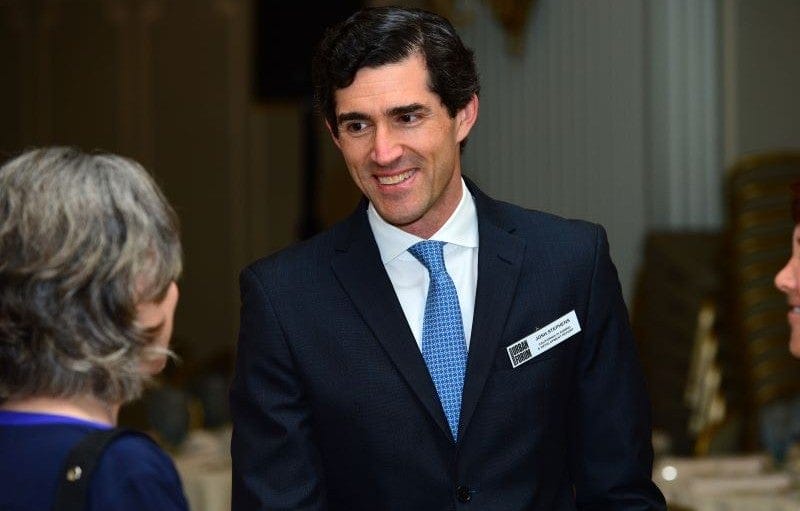
Planners have traditionally labored largely behind the scenes, but are emerging into a more visible role as they explain their work and try to keep the peace, said author Josh Stephens on the latest episode of the Land Matters podcast. Stephens interviewed 23 big-city planners for a new book, Planners Across America.

“Planning directors have huge influence over these cities . . . but they’re not necessarily well known. They are not on the level of a mayor or a city council person who are obviously elected officials, and by definition in the public spotlight; they’re not necessarily like a police chief who is always doing press conferences,” he said. “I think one thing that is very clear in these interviews is how earnest planning directors are about mediating, about figuring out what different stakeholders need and want, and are willing to tolerate.”

Acknowledging the distrust that has grown particularly in communities of color, over urban renewal, highways through urban neighborhoods, and exclusionary zoning, Stephens said planners realize the importance of “listening to people, especially people who have historically been left out of the planning conversation.”

At the same time, planners must confront established residents fighting growth, in what is presented as a virtuous grassroots rebellion but is actually the manifestation of NIMBYism, standing for “not in my backyard.”

“Many communities are empowered, and some of that power is unevenly distributed to the extent that some communities have louder voices, and some communities will invoke people like Jane Jacobs in ways that are not necessarily beneficial for the city as a whole, or might even be disingenuous,” Stephens said.

As he spoke with planners, Stephens found widespread acceptance of the idea that most cities need a massive infusion of new housing supply including multifamily housing—and even high-end housing—to help bring prices down as a matter of basic economics. That’s been the aim of several statewide mandates requiring local governments to modify zoning.

“We do need to add luxury housing in high-cost places to accommodate the people who can afford it. I think ideally, that frees up space, and frees up capital and opportunity, and sometimes public funds to then also build deed-restricted affordable housing, and hopefully maintain a supply of naturally occurring affordable housing,” he said.

“You look at where the prices are highest, and that’s where you need to add housing. You need to add it at every level. There’s an argument that there’s no such thing as trickle-down housing. I don’t buy that. I live in Los Angeles, and there’s more than enough money to go around. If you don’t build luxury housing, that doesn’t mean that wealthy and high-income people are not going to move to LA. They’re simply going to move into whatever the next best housing is. That pushes people down, and eventually some people are left with no place to live.”

However, he said, there will be more post-pandemic movement, from hot-market cities to legacy cities, for example, suggesting the contours of a national housing market. “People have moved from LA to Phoenix, from San Francisco to Boise or Reno or Vegas, and there are other equivalents around the country. I think it’s going to be really interesting in the next decade to see how this filters out,” he said.

Josh Stephens is contributing editor of the California Planning & Development Report and previously edited The Planning Report and the Metro Investment Report, monthly publications covering, respectively, land use and infrastructure in Southern California. Planners Across America was published by Planetizen Press in 2022.

City and regional planning has been a major focus of the Lincoln Institute for many decades, from the annual gathering of 30-plus professionals in the Big City Planning Directors Institute, held in partnership with the American Planning Association and the Graduate School of Design at Harvard University, to the more recent promotion of exploratory scenario planning.

You can listen to the show and subscribe to Land Matters on Apple PodcastsGoogle PodcastsSpotifyStitcher, or wherever you listen to podcasts.


Anthony Flint is a senior fellow at the Lincoln Institute of Land Policy, host of the Land Matters podcast, and a contributing editor of Land Lines.

Lead image: Josh Stephens. Credit: Rich Schmitt Photography/Westside Urban Forum.


Further Reading

Five Ways Urban Planners Are Addressing a Legacy of Inequity (Land Lines)

Seven Need-to-Know Trends for Planners in 2023 (Land Lines/APA)

A Day in the Life of the City Planner (Princeton Review)

Summer of Smoke and Swelter: The Science Behind Climate-Induced Wildfires

August 3, 2023

By Anthony Flint, August 3, 2023


Record-breaking heat, out-of-control wildfires, and eye-stinging smoke have made the impacts of climate change inescapable for millions of people this summer.

Heat, drought, high winds, and conditions on the ground are all making wildfires more intense, longer lasting, and more destructive, according to the National Oceanic and Atmospheric Administration, which notes that big wildfires require a number of factors to align, including temperature, humidity, and the lack of moisture in fuels such as trees, shrubs, grasses, and forest debris.

Containing the blazes is mostly a matter of land use management, says Canadian science journalist Edward Struzik, author of Firestorm: How Wildlife Will Shape Our Future and Dark Days at Noon: The Future of Fire, on this latest episode of the Land Matters podcast. The continual threat of fires also requires resilience-building techniques similar to those deployed to fend off floods and sea-level rise. “We have to learn to live with wildfire and the smoke that comes from wildfire. This isn’t going to go away,” said Struzik, a fellow at the Institute for Energy and Environmental Policy at Queen’s University in Kingston, Canada. “There’s a number of different ways that we can handle it. . . . We can do more prescribed burning where it’s appropriate. We can restore our wetlands, which would create natural buffers on the landscape. We can invest in science that provides firefighters with better tools and predicts where fire is likely to burn.”

Wildfires have become bigger, more intense, longer lasting, and more destructive for several reasons. Fires have long been nature’s way of regenerating forests, but Struzik blames the current situation on land management practices dating back to at least the 19th century: farmers burning and slashing their land, and mining companies doing the same, just to get at the mineral resources underground. The draining of wetlands took away potentially fire-stopping buffers. “If you think about it, a firefighter’s best friend really is a wetland, a swamp, a bog, a fen, a marsh,” Struzik said.

“Once [a fire] hits a wetland, it really doesn’t have anything to burn because things are just too wet and moist. We’ve essentially eliminated all those natural fire barriers over time and it’s bigger than an area the size of California. Fire now basically has its own way once it gets going.”

After the establishment of the Forest Service, the policy of prescribed or controlled burns attempted to mimic nature, but the practice became politically risky because many fires deliberately set veer out of control. Much of today’s wilderness has become a worst-case-scenario mix of dense, older forests, with abundant dry fuel on the forest floor due to high temperatures—all subject to the cascading effects of high winds, blazing heat, and fire-induced storms featuring dry lightning.

“Wildfire can actually create its own thunderstorm because of the amount of heat and vapor that it sucks up . . . and it rises up just like what would happen normally in a thunderstorm, and you get what they call a dirty thunderstorm that almost never produces any rain, but shoots out lightning,” Struzik said. “A great example of this was the Fort McMurray fire in the oil sands of Northern Alberta in 2016, where . . . the fires created their own thunderstorm and shot out lightning 20 miles in advance of the fire front. That’s how much energy there was, and [it] created a cluster of fires 20 miles away from the front of the fire. Firefighters at that time were thinking, ‘How do you manage this?’”

“They have their prediction scenarios or forecasting scenarios, but when you have a thunderstorm created by a wildfire, and it’s shooting out lighting 20 miles away, you’ve got a new rule book coming into play, and everybody’s adjusting to this. Also, I think that the other big thing for them is that you can no longer put people on the ground or in the air in a situation like that because it’s essentially like a small to moderate size volcano that’s blowing up. That’s how much energy there is.”

Wildfires allow forests to thin out, spread seeds, and spur regrowth that provides food and habitat for wildlife. But many of those benefits are obliviated in today’s megafires, which burn so intensely they destroy the nutrients deep in the ground, leaving behind a desert-like landscape where nothing regrows. In addition, the degraded forest loses its ability to soak up moisture and keep the soil stable, resulting in disastrous post-fire floods. Without trees to help absorb heavy rainfall, water rushes straight to rivers.

“Say a fire tears through the mountainsides in Colorado, which has happened a number of times. . . . You have all that ash, all that carbon on the ground,” Struzik said. “The thunderstorm comes in—and we are having more extreme thunderstorms for a variety of reasons and record heavy rainfalls in these spots—and it sweeps through, and then it just collects all that carbon and soot, puts it into the river, and actually threatens our drinking water supplies.

“There’s a great example of this in Waterton Lakes National Park on the Montana border. There’s a waterfall that most tourists come to see called Cameron Falls. A year after the fire following a thunderstorm, that crystal-clear mountain water that descended over the falls turned absolutely black,” he added.

The apocalyptic scenarios and feedback loops are almost certain to continue. And many of the near-term solutions lie in land.

“We’re using 20th-century strategies to deal with the 21st-century paradigm for which we’re not prepared,” Struzik said. “We’ve got to start thinking about other strategies. We’ve got to invest a lot more in science and predicting where these fires are likely to start . . . [with] a better understanding of the landscape. Where are the refugia from fires? Those areas that are unlikely to burn—or those areas that will slow or stop a fire— we should start looking at those areas from a conservation point of view, [to] protect those areas so that we don’t lose these natural barriers.”

Edward Struzik has been writing about scientific and environmental issues for more than 30 years and completed both the Atkinson Fellowship in Public Policy and the Knight Science Journalism Fellowship. His 2015 book, Future Arctic, focuses on climate change in the Canadian Arctic and its impacts on the rest of the world. He is on the board of directors for the Canadian Arctic Resources Committee, a citizens’ organization dedicated to the long-term environmental and social well-being of northern Canada and its peoples.

You can listen to the show and subscribe to Land Matters on Apple PodcastsGoogle PodcastsSpotifyStitcher, or wherever you listen to podcasts.


Anthony Flint is a senior fellow at the Lincoln Institute of Land Policy, host of the Land Matters podcast, and a contributing editor of Land Lines.

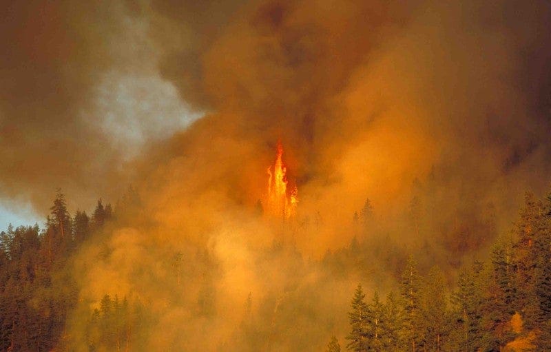
Lead image: Forest fire, Penticton, BC, Canada. Credit:  cfarish via iStock/Getty Images Plus.


Further Reading

The Second Wave: Why Floods Can Follow Wildfires, and How Communities Can Prepare (Land Lines)

‘Literally off the charts’: Canada’s Fire Season Sets Records—and Is Far from Over (Politico)

Big Heat and Big Oil (The New Yorker)

Can Mushrooms Prevent Megafires? (The Washington Post)

Ecosystem Collapse Could Occur “Surprisingly Quickly,” Study Finds (Slate)

The Hardest Working River in the West

A StoryMap Exploring the Colorado River Through Data

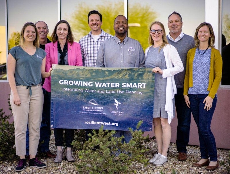
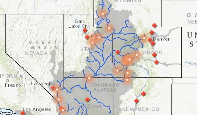
Although not the largest or longest river in the World, the Colorado River is known for its many legacies. The Babbitt Center for Land and Water Policy developed a StoryMap about the Colorado River, its tributaries, and the lands upon which communities, economies, and the environment depend. It is also about the places, people, and policies that have shaped water and land management and planning in the past and will continue to shape decisions about how we use, share, and conserve these finite resources today and in the future. With a widening gap between supply and demand, the water resources upon which land use, planning, and development depend are more vulnerable than ever.

This story is told across five sections:

  • A Balancing Act
  • Of Storage and Shortages
  • Who’s Using Water and Where?
  • Water Management Hurdles
  • Tools for a Resilient Future
data

The Babbitt Center has created an Esri ArcHub open data portal that contains the data, maps, and related reports seen or mentioned in The Hardest Working River in the West StoryMap. This allows individuals to download and explore the data for themselves.

Explore the Portal
Solicitud de propuestas

Scenario Planning for Disaster Recovery and Resilience

Fecha límite para postular: February 16, 2024 at 11:59 PM

This RFP will open for submissions on January 16, 2024.

The Consortium for Scenario Planning, a program of the Lincoln Institute of Land Policy, invites proposals for applications of exploratory scenario planning (XSP) processes in communities to address disaster recovery and resilience.

The consortium is looking for projects that will design community-based XSP workshops that can be used in disaster recovery and resilience planning. Applicants are not required to implement their workshop models, although they are welcome to do so. Following the project’s completion, the Lincoln Institute may select one or more projects to use as the basis for a technical assistance program, implemented the following year by Lincoln Institute staff and the project creator.

Disasters may be on a neighborhood, community-wide, or regional scale. Many specific disasters may be part of a cycle of cascading hazards, where the effects of one disaster bleed into or cause another, such as wildfires that cause catastrophic flooding, or floods that destroy homes, precipitate sanitation crises, and trigger landslides.

For this project, examples of disasters to be considered in workshops might include, but should not be limited to:

  • Wildfires
  • Floods
  • Severe weather events (hurricanes, tornadoes, etc.)
  • Earthquakes
  • Oil spills
  • Drought

RFP Schedule

  • Application deadline: February 16, 2024
  • Notification of accepted proposals: March 4, 2024
  • First draft: December 2025
  • Final draft: February 2025

Evaluation Criteria

The Lincoln Institute will evaluate proposals based on five criteria:

  • Relevance of the project to the RFP’s theme of exploratory scenario planning as applied to disaster recovery and resilience.
  • Adherence to and understanding of XSP method in proposed workshop design.
  • Capacity and expertise of the team and relevant analytical and/or practice-based experience.
  • Potential impact and usefulness of the project for practitioners of scenario planning.
  • Feasibility of project completion within a one-year timeframe.

Detalles

Fecha límite para postular
February 16, 2024 at 11:59 PM

Descargas


Palabras clave

adaptación, mitigación climática, recuperación pos-desastre, medio ambiente, gestión ambiental, planificación ambiental, planicie aluvial, la región intermontañosa del oeste, planificación de uso de suelo, Nueva Inglaterra, planificación, resiliencia, planificación de escenarios

People speaking on a stage in front of a mural

Lincoln Award Recognizes Outstanding Land Policy Journalism in Latin America

By Jon Gorey, Diciembre 11, 2023


Land policy decisions may not pack the headline punch of celebrity gossip or World Cup comebacks, but they can be far more consequential to people’s everyday lives. In that spirit, the Lincoln Institute of Land Policy awarded prizes for excellence in journalism on urban policy, sustainable development, and climate change at the 2023 Latin American Conference of Investigative Journalism (COLPIN) in Mexico City.  

The winning entries included an exploration of how climate finance mechanisms trap poorer countries in a cycle of debt and dependency, an account of indigenous land grabbing by an unscrupulous palm oil exporter, and a look at how luxury megaprojects in a Mexico City neighborhood threaten to drain the water supply for longtime residents. (Jump to the list of winners.)

This marks the second year that the Premio Lincoln has been awarded at the prestigious conference, which includes its own investigative reporting competition, as well as dozens of workshops and panel discussions held over four days. COLPIN is organized by the Lima, Peru–based Instituto Prensa y Sociedad (Press and Society Institute), or IPYS.  

Competition for the 2023 award—which drew 141 entries from 47 cities and 15 countries—was inspiring, says Laura Mullahy, senior program manager at the Lincoln Institute. The contest attracted so many worthy entries that she and the other judges decided to name three honorable mention winners this year, in addition to the top prizes. The 2023 winners hailed from Costa Rica, Brazil, and Mexico; last year’s winning entries were published in Mexico and Colombia.

The breadth of geography, topics, and media formats represented in the contest is an encouraging sign for Latin American journalism, Mullahy says—as are the winners themselves. “It was really very heartening to meet these talented, young, earnest journalists,” says Mullahy, who presented the awards both years. 

Empowering the Press

The Lincoln Institute has a long history of engaging journalists with its research, both in the United States—where for over 20 years, the organization’s Journalists Forum has convened members of the press around a central topic, such as climate change and housing—and in Latin America. The institute began offering land policy training classes for Brazilian journalists a decade ago, when economist Martim Smolka was the director of the Latin America and the Caribbean (LAC) program. “Back when Martim was director,” Mullahy recalls, “he always said, ‘There are three audiences I would do anything to get in a room, but they’re hard to get: members of parliament, judges, and journalists.’ So that was always in the back of my mind.”

At the time, Mullahy says, there was very little coverage of land policy in Latin American media, and what coverage did exist wasn’t always well informed; it wasn’t a topic journalists in the region encountered in their formal education. “Land policy is a little bit niche,” Mullahy says. “And so the thought was, well, maybe we’re the ones who can provide this.” 

With the goal of introducing core land policy concepts to journalists, the Lincoln Institute then partnered with IPYS to host a larger series of Latin America-wide training courses. Each session drew 30 or more participants, all of whom had to submit professional clips to be accepted into the program. By 2022, enough journalists were creating well-researched, engaging land use stories throughout Latin America that Mullahy and Adriana León at IPYS discussed the idea of offering a prize for urban land use reporting. “The stars seemed to align,” Mullahy says, and the inaugural Premio Lincoln drew more than 160 entries from 19 countries.


Lincoln Award recipients including Jennifer González Posadas, foreground, participated in a panel discussion at the 2023 Latin American Conference of Investigative Journalism.

In addition to cash prizes—$3,000 for first place, $2,000 for second, and $1,000 for third—Lincoln Award winners are invited to attend and participate in the four-day COLPIN conference. At the 2022 conference in Rio de Janeiro, “Our panel discussion with the award recipients and two seasoned journalists who served on the selection committee highlighted how land policy-related stories can be developed as compelling journalistic reporting,” Mullahy says. This year’s winners joined a trio of veteran journalists—Miguel Jurado and Vanina Berghella of Argentina, and Chico Regueira of Brazil—for a session on researching cities and urban development.

Journalists are important allies to the Lincoln Institute’s mission, Mullahy says, but even those with an interest in land policy issues don’t always get the support they need from their editors or organizations. So it’s important to recognize and support those who bring quality urban and land use reporting into the mainstream.

Alongside the Lincoln Institute’s more than 30-year tradition of conducting research and offering free professional development courses in Latin America, the efforts to encourage and celebrate informed land use journalism is paying off, and not just for the prizewinners. Mullahy can see positive changes in Latin American land management practices “in which Lincoln Institute courses and their students have had an influence and, in some cases, an active role,” she told the LatAm Journalism Review. “We know our presence can make a difference.” 

2023 Winners

Here are the winners of the 2023 Lincoln Prize for Journalism on Urban Policy, Sustainable Development, and Climate Change: 

First place: Hassel Fallas and Michelle Soto from Costa Rica for their eight-article series, “¡Muéstrame el dinero! La ruta de los fondos climáticos en un mundo cada vez más caliente” (“Show Me the Money! The Route of Climate Funds in an Increasingly Hot World”), published in a collaboration between La Data Cuenta and Ojo al Clima.  

The series explores the global climate financing system to reveal a complex but unequal financial architecture that favors the interests of the Global North and hurts the most vulnerable countries, who have contributed least to the problem. Based on the analysis of databases from multiple sources, the series signals the need to correct the inequities in the distribution of resources and protect the planet for future generations.  

Second place: Karla Mendes for her article “Exportadora de óleo de palma acusada de fraude, grilagem de terras em cemitérios quilombolas” (“Brazil Palm Oil Exporter Accused of Fraud, Land-Grabbing in Quilombola Cemeteries”), published in Mongabay, Brazil.  

The article exposes a wide range of land-grabbing allegations against Agropalma, the only Brazilian company with a sustainability certificate issued by the Roundtable on Sustainable Palm Oil (RSPO), claiming that more than half of the 264,000 acres registered by Agropalma was derived from fraudulent land titles and even the creation of a fake land registration bureau. Moreover, the allegations assert that part of the area occupied by Agropalma overlaps with ancestral Quilombola land, including two cemeteries. The feature is available in three languages: 

Portuguese:  Part 1 | Part 2 | Part 3  
English: Part 1 | Part 2 | Part 3  
Spanish: Part 1 | Part 2 | Part 3 

Third place: Alejandro Melgoza Rocha and Jennifer González Posadas for “Ciudad sin agua. Un pueblo contra el gigante de concreto” (“A City Without Water: The People Against a Concrete Giant”), published in Mexico’s N+.  

This multimedia feature and video examine the complex issue of water scarcity in Mexico City, where the construction of luxury towers and shopping centers has depleted aquifers in the metropolitan zone, putting the ecosystems of the city at risk. As communities and indigenous peoples suffer from water shortages, road congestion, destruction of green areas, increased costs of services, and dispossession of their territory, the inaction of the authorities against developers has resulted in chaotic conflict. The article tells the story of residents taking on the most powerful player in the real estate industry.   

Honorable mention: Thiago Medaglia, Brazil, for “Aquazônia—A Floresta-Água” (“Aquazonia—The Water Rainforest”)  

Honorable mention: Aldo Facho DedeKenneth Sánchez Gonzales, and Vania García Pestana, Peru, for the podcast series “Ciudades Que Inspiran” (“Cities That Inspire”) 

Honorable mention: Juan Diego Ortiz Jiménez, of Colombia, for “Nómadas, Airbnb y falta de casas: en Medellín no hay cama para tanta gente” (“Nomads, Airbnb, and Housing Shortage: In Medellín, There Aren’t Enough Beds”) 

2022 Winners  

First place: Alejandro Melgoza Rocha (N+ Focus, Mexico), for “Tulum: un paraiso ilegal” (“Tulum, an Illegal Paradise”) 

Second place: Mónica Rivera Rueda (El Espectador, Colombia), for “Lo que debe saber del POT en Bogotá” (“What You Need to Know about the Land Management Plan in Bogotá”)  

Third place: Andrés de la Peña Subacius (Zona Docs, Mexico), for “La ciudad inhabitable: ¿Redensificación o destrucción de la vivienda?” (“The Inhabitable City: Housing Redensification or Destruction?”) 


Jon Gorey is a staff writer at the Lincoln Institute of Land Policy.

Lead image: The opening ceremony of the 2023 Latin American Conference of Investigative Journalism (COLPIN) at the Colegio San Ildefonso, Mexico City. The backdrop is Diego Rivera’s first mural, La Creación (Creation), 1922. Credit: Laura Mullahy.

Two people walk on a flooded road

What Will Make Home Buyers Consider Climate Risk? What Happens Once They Do?

By Jon Gorey, Noviembre 17, 2023


Realtor Gabriella Beale stopped for lunch at a cafe in downtown Norfolk, Virginia, this summer, on her way to show her buyers a home in nearby Larchmont, a neighborhood of tree-lined streets and early 20th-century houses. Then a late August downpour dumped more than two inches of rain on the city, forcing Beale to cancel the showing—because she could no longer get to the house. She watched helplessly from the cafe as flash flooding filled the road outside.

“I couldn’t even get to my car because part of the road essentially became a river,” Beale said. This wasn’t a hurricane, or even a tropical storm—just a rainy Monday in this low-lying city of 238,000. Situated between the Elizabeth River and Chesapeake Bay, Norfolk is experiencing the fastest relative sea-level rise on the East Coast—more than two inches just since 2012—so there isn’t much room for extra water. Parts of the city flood even without rainfall during king tides, and the National Oceanic and Atmospheric Administration projects that the city’s dozen or so annual “sunny-day flooding” incidents could double as soon as 2030.

The encroaching water hasn’t gone unnoticed, Beale said: more buyers ask about flooding than in years past, even in neighborhoods outside the 100-year floodplain. She dutifully counsels all her clients on flood risk, discussing insurance costs, personal safety, and the potential drop in future resale value. Some buyers want nothing to do with a floodplain house, but others don’t mind the risk—or can’t afford to be picky. Beale acknowledges that she can’t make decisions for them. “People have different ideas of what level of flood risk they’re comfortable with, and it’s not really up to me to say, ‘This is a bad house.’”


Flooding in the Larchmont neighborhood of Norfolk, Virginia. Credit: Aileen Devlin/Virginia Sea Grant via Flickr.

By the time the stormwater finally subsided on that rainy Monday, Beale’s car was toast; she wasn’t sure it could be repaired. “I can tell that story, and some buyers still want to live in that neighborhood,” she said. Indeed, her buyers rescheduled their showing for the very next day.

* * *

BEALE’S CLIENTS are hardly alone in their pursuit of risky real estate. Even as climate change delivers more intense and more frequent storms, wildfires, and heat waves, home buyers across the United States continue to move into areas at greater risk of climate impacts like flooding, wildfire, drought, and extreme heat—in fact, they’re doing so at a faster pace.

That the climate is changing, and not for the better, is hard to miss. The US experienced a record 23 separate billion-dollar weather disasters in just the first nine months of 2023; the previous annual record of 22 was not even three years old, set in 2020. The number of buildings destroyed by wildfire in California each year has spiked 335 percent since 2009, according to First Street Foundation, a research nonprofit seeking to make climate risk data more accessible. Nationwide, we’re now losing an average of more than 17,000 structures a year to wildfire, a number that is forecast to top 33,700 by 2053—meaning we can soon expect to lose the equivalent of Daytona Beach, Florida, or Asheville, North Carolina, to fire every single year.


Billion-dollar weather and climate disasters through October 2023. Credit: National Centers for Environmental Information/NOAA.


Yet home buyers still don’t seem to factor in climate risk when they make one of the biggest decisions of their lives. We keep building and buying homes in the fire-prone “wildland-urban interface” where town meets wilderness, and moving closer to the water, not away from it.

The most flood-prone counties in the US had 384,000 more people move in than out in 2021 and 2022, according to a Redfin analysis, roughly double the net increase of the prior two years. That includes Lee County, Florida, which gained 60,000 net new residents in two years even as Hurricane Ian destroyed nearly 10,000 homes in 2022.

Counties facing the greatest wildfire risk, meanwhile, netted 426,000 new residents in that time. And those most threatened by heat collectively gained 629,000 net residents—including Maricopa County, Arizona, where 76,000 newcomers sweltered in temperatures that topped 110º Fahrenheit for 31 straight days last summer and left hundreds dead.

And yet, the housing market in Maricopa County has been almost as hot as the sidewalks that gave residents third-degree burns in July: median home prices rose a staggering 64 percent in four years, from $290,000 in June 2019 to $475,000 in 2023, as more residents moved in. Prices in Florida’s Lee County rose 70 percent in that time, compared to 40 percent nationwide. Accounting for likely long-term flood damage—to say nothing of drought or wildfire risk—a study published in Nature Climate Change estimated that the residential real estate market in the US is collectively overvalued by as much as $237 billion.

Homes under construction in Maricopa County, Arizona
New construction in Maricopa County, Arizona, which has seen record heat, drought, and growth. Credit: halbergman via iStock/Getty Images Plus.

The disconnect is largely driven by short-term affordability concerns, said Daryl Fairweather, chief economist at Redfin. “People are leaving places like San Francisco because their rent is too high, and then they’re moving to places like Tampa or Las Vegas because they can actually afford to buy a home there,” Fairweather said. “But what they’re not thinking about is how their housing expenses might change in the future, how the value of their home might change in the future, and also how the livability of those places might change in the future.”

Where the planet is sending us flashing red “stop” signals, home buyers and developers seem to see green lights. Why? And what will it take to get them to heed the stop signs?

Tell Me About It

One reason a driver might recklessly blow past a stop sign, putting themselves and others in danger, is if the sign itself isn’t visible—if it’s concealed by overgrown foliage, for example.

Sometimes warnings of flood or fire risk aren’t immediately obvious to home buyers, either.

“One thing that we’ve learned is that information is just so critical,” said Patrick Welch, policy analyst at the Lincoln Institute of Land Policy. “Even though there is so much information out there about climate risks, it’s not necessarily that accessible—people don’t know about it.”

In 23 states, for example, home sellers aren’t typically required to disclose a home’s flood history to potential buyers, including in vulnerable coastal states like Florida, Massachusetts, and Virginia. Only two states, California and Oregon, require some disclosure of wildfire risk. And often such notices are confusing or reach buyers too late for them to act on the information—after the home inspection, for example, or buried in a stack of forms signed at the closing.

Fire on a southern California hillside above homes
California requires some disclosure of wildfire risk, but it doesn’t apply to every property, ​and often comes late in the homebuying process. Credit: f00sion via E+/Getty Images.

Getting clear, accurate risk assessments into home buyers’ hands can help them make more climate-informed decisions about where they choose to live, Welch said.

“Disclosure of risks is very uneven across states,” agreed Margaret Walls, senior fellow at the nonprofit Resources for the Future. In fact, disclosure rules can even vary within a state, which is how Walls and her colleagues were able to isolate the impact of disclosing fire risk on home values in California in a new working paper

California requires home sellers located in a moderate, high, or very-high Fire Hazard Severity Zone to disclose that fire risk to buyers—but only if the home falls within a state responsibility zone, meaning the state manages wildfire prevention and response. In areas where the local jurisdiction is responsible, sellers aren’t required to disclose moderate or high fire risk.

That allowed Walls to compare homes that share the same level of fire risk—as well as school districts, walkability, and other location-based amenities—but have different disclosure requirements. By comparing years of sales data for neighboring homes on either side of the disclosure divide, the researchers were able to show that homes with a disclosed fire risk sold for an average of 4.3 percent less than similar nearby properties with undisclosed risk.

In other words, buyers who were made aware of the risks seemed to adjust their behaviors in a rational way—exactly what you’d hope to see in a well-functioning market. “We can’t expect markets to work and prices to reflect something unless we have all the information,” Walls said.

The effect of risk disclosure on sale prices seems to be strengthening as fire seasons intensify. The eight largest wildfires in California history have all occurred since 2017, burning more than 4 million acres, and 2020 was the state’s worst fire year on record. “We found a stronger effect in the more recent years,” Walls adds. “It’s getting more salient to people after these bad fire years.”

Past research has found that strict flood disclosure rules yield a similar price penalty of about 4 percent. In the absence of flood disclosures, though, home buyers can still get some idea of a home’s flood risk from the Federal Emergency Management Agency. FEMA’s flood maps aren’t perfect—they’re based on historical flooding, for one thing, not future climate models—but they’re freely available. Anyone can access them online, though Beale says most home buyers don’t think to do so until she recommends it. And even then, it’s hard to get a price quote for flood insurance without applying for coverage. In fact, because lenders require borrowers to purchase flood insurance on homes located within a FEMA high-risk floodplain, loan officers are often the ones breaking the bad news about flood risk and insurance premiums—typically very late in the process.

“Usually at that point, the buyers can’t get out of the contract,” Beale said. The average annual flood insurance premium nationwide was $888 in 2022, “so that’s not a huge impact if you’re spreading it out over 12 months,” she notes. But rates can vary dramatically by property, even cresting five figures. “If it comes back at $10,000, and you can still technically afford the house according to the lender … you can’t walk away.”

Major real estate sites Redfin and Realtor.com have started incorporating First Street’s climate risk data on their property listings—right alongside other typical home buyer concerns, such as school districts and taxes. And getting that information to a home buyer early in the process makes a real difference, according to a new working paper Fairweather coauthored.


Redfin and Realtor.com have started incorporating climate risk data from First Street Foundation into their property listings. Credit: Redfin.

Redfin started publishing flood risk data sitewide in February 2021. But before that, in late 2020, the brokerage leveraged a soft launch of the new feature to conduct a three-month experiment among 17.5 million users. Half of them saw detailed flood risk data and “Flood Factor” scores on the homes they searched, while the other half did not. That randomized flood risk information “had a significant and meaningful impact on users’ search behavior,” and influenced every stage of the home buying process, from initial search to making offers to the final purchase. Over time, buyers who encountered high Flood Factor scores on their initial home searches gradually adjusted their searches toward—and were later more likely to bid on—less flood-prone homes than were users who didn’t see flood risk information.

“Increasing information to home buyers, especially at the moment they’re buying a home, would help them make a different decision when it comes to taking on climate risk,” said Fairweather. 

A Reckoning in the Insurance Market

One way markets traditionally communicate risk is through insurance rates; higher premiums quite clearly reflect a greater likelihood of losses. But right now, the home and flood insurance markets are struggling to adapt to a range of issues, with the costs of climate change-fueled disasters, reconstruction, and fraudulent claims all on the rise.

For decades, FEMA’s National Flood Insurance Program (NFIP) has underpriced coverage, indirectly subsidizing homeowners in flood-prone areas by making it less expensive to live there than it should be. This is evident through simple math: The NFIP is $20 billion in debt, as premiums have failed to keep up with the actual cost of damages incurred.

FEMA took a step toward correcting that imbalance by implementing Risk Rating 2.0 in late 2021, a new methodology that better aligns premiums with an individual property’s flood risk. However, Congress capped NFIP rate increases at 18 percent a year to ease the impact on existing policyholders. A report by the Government Accountability Office found that median flood insurance premiums would still need to almost double, from $689 to $1,288, for the program to be actuarially sound, and that roughly one in 10 properties insured by the NFIP will eventually require at least a 300 percent rate hike. In Naples, Florida, for example, the average annual flood insurance premium among 1,568 policyholders was $2,228 in 2022; FEMA calculated the risk-based cost of those policies should average almost four times as much: $8,067 per year.

Homes in Naples, Florida
In Naples, Florida, the average annual flood insurance premium among 1,568 policyholders was $2,228. FEMA calculations suggest the risk-based cost of those policies should be nearly four times higher. Credit: Andrii Mischykcha via iStock/Getty Images Plus.

Meanwhile, private insurers (whose homeowner policies generally don’t cover flood damage) are increasingly finding it difficult or impossible to provide coverage at fair but profitable rates as windstorms and wildfires grow more destructive, and as reconstruction gets more expensive.

State Farm announced in May that it would no longer write new homeowner policies in California, where it is the largest insurer, citing “rapidly growing catastrophe exposure” and historically high construction costs. Soon after, Allstate announced that it would do the same, making permanent a pause on new policies instituted in 2022. More than a dozen insurance companies have pulled out of Florida and Louisiana in the past two years, leaving homeowners scrambling for coverage.

Insurance companies could theoretically just raise their rates enough to offset increased costs. But insurance is something of a necessity—lenders won’t approve a mortgage without it, and four in five home buyers rely on a home loan to finance their purchases. So, to protect consumers, big insurance premium hikes often must be approved by state regulators. And in California, insurers can only use past losses, not future risk estimates, to justify rate increases. That makes it hard for insurers to price their coverage accurately or profitably as risk intensifies. 

As Michael Wara, director of the Climate and Energy Policy Program at Stanford, told KQED, the price of home insurance in California no longer matches the risk. “Our insurance system kind of pretends that climate change doesn’t exist, and that’s not workable anymore,” he said.

The price signals that private insurers ordinarily provide through premium adjustments are crucial to a functioning real estate market, “because that is ultimately how decisions get made,” University of Pennsylvania economist Benjamin Keys told Penn Today. “When there are incentives for the choices that homebuilders make, that homeowners make, that’s going to reshape where we live and where we build. When we don’t get that price signal, that distorts our perceptions of risk.”

A report by First Street Foundation asserts that millions of US homes face more climate risk than their insurance rates would indicate, creating a “climate insurance bubble” in the market. “You don’t want someone to live in a place that always burns,” First Street Head of Climate Implications Jeremy Porter told Grist. “We’re subsidizing people to live in harm’s way.” In that respect, it makes some sense for home insurers like State Farm and Allstate to stop writing new policies in the most high-risk areas—doing so could help dissuade developers from building in places most likely to burn.

First Street Foundation climate insurance map
According to a recent report from the First Street Foundation, millions of homes in the United States face more climate risk than their insurance rates indicate, creating a “climate insurance bubble.” Credit: First Street Foundation.

But millions of people already live in high-risk areas. And when those homeowners can’t get insurance on the private market, they must turn to state-run plans that offer less coverage at higher prices. These public options are meant to offer policies of last resort, but their role is growing; in Florida, the public Citizens Property Insurance Corporation is now the state’s largest insurer, according to the First Street report, with 1.3 million policyholders. The number of homeowners on California’s state-run FAIR Plan more than doubled between 2018 and 2022, to nearly 273,000.

“I worry that a larger state role in insurance markets will bring political pressure to keep premiums low without reflecting the growing climate risks,” Keys said. “It’s challenging for a state-backed plan to raise rates aggressively on homeowners in that state. There’s real political tension.” State-run plans also transfer financial risk to taxpayers: Florida’s Citizens Property Insurance Corporation expects to turn a profit in 2023, but lost more than $2 billion in 2022. That’s one reason Florida is phasing in a new law over the next four years requiring all Citizens policyholders to obtain flood insurance as well.

In September, California insurance commissioner Ricardo Lara announced emergency steps aimed at stabilizing the state’s wobbly home insurance market by the end of 2024. Under these new rules, insurers will be permitted to consider climate change and future catastrophe risk when setting premiums. However, they’ll also be required to cover a percentage of high-risk homes, to start transitioning homeowners off the FAIR Plan and back into the private market. That could well be enough to draw insurance companies back, Keys says: “When an insurer leaves a state, it doesn’t mean that they don’t want to write insurance policies. It means that they don’t want to write insurance policies under the current regulatory environment and with the current limits on premiums. They want to make a profit.”

As insurance rates rise to account for increased climate risk, one way to ease the impact on homeowners (without artificially suppressing premiums) is for insurers to offer discounts when property owners invest in preventative risk-reduction measures—such as raising a home’s mechanical systems above the base flood elevation, or clearing fire-fueling vegetation from around a house. A new California initiative called “Safer From Wildfires,” introduced in late 2022, requires insurers to recognize and reward fire resiliency measures by offering discounts to homeowners who create five-foot ember-resistant zones around their homes, for example, or who invest in upgraded roofs, windows, or vents.

“By incentivizing policyholders to implement wildfire-resistant measures, insurance companies can create a win-win situation,” the First Street report notes. That could create a positive cycle, reducing the frequency and severity of wildfire losses—and the resulting financial burden on both insurers and communities—while potentially preserving home values.

Change the Lending Landscape

As the government-sponsored enterprises (GSEs) that back most mortgages in the US, Fannie Mae and Freddie Mac wield tremendous influence over the real estate market—and could also help home buyers heed climate risk.

The GSEs already require borrowers purchasing a high-flood-risk home to secure flood insurance as a condition of their mortgage. But they could, in theory, take more aggressive steps to dissuade risky home purchases, such as requiring a bigger down payment on high-risk properties, charging higher interest rates on such loans, or factoring climate risk into valuations. Fannie Mae has started enlisting climate analytics companies like First Street to figure out how and whether it can fairly incorporate climate risk into its underwriting and lending guidelines. 

It’s a delicate exercise, however. Adjusting valuation or lending criteria to make it more difficult or more expensive to get a mortgage in flood-prone areas would very likely devalue the affected homes. And it’s not just expensive beach houses. Due to historical discrimination and redlining practices, low-income households and people of color are disproportionately represented in the most flood-prone areas. These are some of the very communities Fannie and Freddie have been trying to better support through their “Duty to Serve” mandate. 


A Redfin analysis of 38 US metro areas found that people in formerly redlined neighborhoods–areas categorized as undesirable on discriminatory federal lending maps in the 1930s–face higher flood risk and related financial and safety concerns than those in other neighborhoods. Credit: Redfin.

“It’s really a double-edged sword,” said Ellie White, senior associate on the buildings team at RMI. Like the Lincoln Institute, RMI is a member of the Underserved Mortgage Markets Coalition (UMMC), which seeks to hold Fannie Mae and Freddie Mac accountable for bringing housing finance opportunities to families not traditionally served by the private market.

“A main roadblock of incorporating climate risk information into the valuation of a property revolves around this challenge of ensuring that we’re not devaluing properties in already high-risk, low-income, historically disadvantaged communities,” White said. “So I think the GSEs are very cautious, and rightfully so, about what it would mean if we had wide-scale incorporation of those physical risks into the valuation of property.”

The stakes are uniquely high in the US, where homeownership has long been a primary engine of wealth creation. “If not done correctly, this could really completely wipe out families’ generational wealth, and it would disproportionately impact low-income communities,” Welch said. “It’s a really complicated, tricky issue.” Local governments that rely heavily on property taxes could also see major shifts in their tax base if climate risk were fully reflected in home values. While municipalities can typically offset potential revenue loss by adjusting tax rates when property values decline, large shifts in the distribution of tax burdens can create political challenges.

But the GSEs could do other things, like using risk research and data to guide policy, and helping homeowners in high-risk areas pay for resiliency upgrades like elevating structures. “The GSEs can take more action on the community engagement front, to support educational programs and raise awareness of these risks and resilience solutions among home buyers,” White said.


Raising a house above flood level on Long Island, New York. Lenders could influence the market by dissuading the purchase of vulnerable properties and helping existing homeowners pay for resilience upgrades. Credit: John Penney via iStock Editorial/Getty Images Plus.

In a letter to Federal Housing Finance Authority Director Sandra Thompson in August, the UMMC made a wide range of policy recommendations. Among them: requiring the disclosure of both climate risk and energy performance on existing homes backed with GSE mortgages, and requiring new homes backed by GSE loans to meet more energy-efficient building codes. The latter would reduce long-term ownership costs for home buyers, while also reducing financial risk to the GSEs.

Zoning for the Future

Figuring out how to protect, insure, or move residents of existing neighborhoods that face increased climate risk is a thorny problem without many satisfactory solutions. But at the very least, experts say, we should stop creating more at-risk residents, and focus new development in climate-resilient places. 

“New construction has been increasingly going in places with high climate risks, particularly when it comes to wildfire risk and drought risk,” Fairweather said. “And it’s exurban sprawl that is to blame. Because of single-family zoning, people build more and more into places that aren’t naturally equipped for climate change—they’re building into the forests in inland California, they’re building into the deserts, which don’t have access to water.”

New home construction in Nevada
Taking a gamble on new home construction in Nevada. Credit: 4Kodiak via iStock/Getty Images Plus.

Communities should instead be trying to shift development away from high-climate-risk areas, and encouraging more density and affordable housing in safer areas, says Michael Rodriguez, research director at Smart Growth America. “Climate-informed zoning can easily overlay with a lot of other priorities that a city has,” he said, such as transit-oriented development.

Right now, land markets clearly aren’t sending the right signals about climate risk, Welch said, but planners and elected officials could help correct that at a local level. “Updating zoning codes and land use regulations to reflect climate risks, whether it’s wildfire or flooding, are relatively simple ways that local governments can start to move the needle on this,” he said.   

Back in Norfolk, Virginia, city leaders have taken the lead on climate-informed zoning. Over the past decade, Norfolk has adopted a pair of new land use plans: the short-term PlaNorfolk2030, and the long-term Vision 2100, along with accompanying zoning overlays.

The long-range plan divides the city into four color-coded sections. Red zones, which include the naval base and the downtown district where Beale watched stormwater surge through the streets, are densely developed and economically important, but very vulnerable to flooding; the plan calls for investments in flood protection and mitigation in these areas. Yellow zones indicate flood-prone residential and historic areas, where a resilience overlay will discourage new development but support existing residents’ adaptation efforts. Low-risk green zones are where the city wants to invest in denser, transit-rich neighborhoods. And purple zones, which also have a lower flood risk, are slated for infrastructure investments and lower-density development aimed at preserving housing affordability. 

Norfolk Virginia Vision 2100 map
Leaders in Norfolk, Virginia, have developed land use maps that indicate areas where the city intends to invest in flood mitigation and resilience (red and yellow) and areas where new infrastructure and housing development will be encouraged (green and purple). Credit: PlaNorfolk2030.

Such a climate policy can influence land use and real estate decisions in a couple of ways, Rodriguez said. “It might work through literal policy incentives and disincentives, in a tangible sense, like money or regulations,” he said. “But then there’s also the signaling aspect. The city government has now put out a map, and that map in itself can send a signal that can have market impacts.”

Some people worried that, by officially declaring some places risky and others preferable for development, Norfolk’s plan could spook home buyers and investors and sink home values in the high-risk areas. But Rodriguez and his colleagues compared years of sales and permit data before and after the Vision 2100 plan was released, and, as they describe in a new working paper commissioned by the Lincoln Institute, there was no statistical impact on home prices.

That could be the result of the unusually strong pandemic real estate market during the years studied, the authors wrote, or a general lack of climate concern among area home buyers at the time. But it may offer some assurance to hesitant communities: Enacting climate-informed zoning to guide future development doesn’t necessarily have to wreak havoc on existing home values, at least in the short term.

“It’s a long-term solution—it’s not going to change the development patterns or reduce the risk today or tomorrow,” Welch said. “But it’s going to slowly incentivize and push development into less risky areas. And I think one of the takeaways from that study was that you can do this and not immediately crash the local housing market or cause a panic.”

Norfolk’s experience also showed that an inclusive process can ease perceptions of malicious remapping. “You’re drawing lines on the map, and you’re saying, ‘Build here, don’t build there,’” Rodriguez said. “That feels weird, and it feels a little bit like redlining in a historical context of planning. And that feels doubly weird when we know that a lot of the places facing the most climate risk tend to be poor, and tend to have more people of color. . . . There has to be a lot of community input and communication as to what it means to have climate-informed zoning to try and mitigate some of those concerns.”

In that sense, while Norfolk’s policy lacks “teeth” and the city has yet to implement follow-up measures such as density bonuses or the transfer of development rights (which would allow landowners in vulnerable zones to sell their development rights to builders in a low-risk zone), the city has already taken a huge step. “They were one of one of the few communities out there that did anything like this,” Rodriguez said.

States and municipalities have other levers they can pull, too—some more drastic than others.

In water-stressed Arizona, for example—where the Colorado River is overdrawn, and depleted underground aquifers are projected to eventually run dry at current usage levels—state officials recently announced a moratorium on new residential construction that relies on groundwater in the Phoenix metro area. 

Even without placing an outright ban on new construction in high-risk areas, communities can, through zoning and other regulations, effectively stymie risky new development by refusing to fund or permit new streets, water service, and other key infrastructure in high-risk settings. The federal government uses a similar approach to protect sensitive coastal ecosystems through the Coastal Barrier Resources Act. The CBRA doesn’t explicitly outlaw development in those areas, but dissuades it by withholding federal support for things like infrastructure, flood insurance, and disaster relief. That disincentive has proven remarkably effective, research commissioned by the Lincoln Institute has shown, reducing development by 85 percent.

It’s worth noting that Norfolk didn’t outright ban new construction in high-flood-risk areas, either. But it did set stricter building codes in those zones, which can help the city’s built environment adapt to climate risk by accomplishing two things at once. “To the extent that you do build there, at least you’re going to build something that’s more resilient,” Rodriguez said. Meanwhile, higher design standards can add cost and complexity to construction in vulnerable areas, creating a disincentive to build there, and encouraging developers to locate projects on safer sites instead.

Local governments can also charge higher taxes or impact fees to discourage building or buying in high-risk areas—for example, raising water and sewage rates in water-stressed areas, or funding wildfire prevention efforts with a higher tax on fire-prone properties. “Higher fees in risky areas serve two purposes,” write Brookings Institute researchers Julia Gill and Jenny Schuetz. “They encourage price-sensitive households to choose safer locations, and they also provide local governments with more revenue to upgrade the climate resilience of infrastructure.”

All of these policies could help point home buyers toward making better, more rational decisions. But where we choose to live sometimes defies reason.

Flooding in Norfolk, Virginia
Flooding in Norfolk, Virginia, in 2021. Credit: Aileen Devlin/Virginia Sea Grant via Flickr.

Beale, the Norfolk realtor who counsels all her buyers about flood risk, understands why some of them still choose a high-risk home. For some, it’s straightforward economics. “If a buyer can only afford $150,000, and they want a detached house, Norfolk’s going to be it—and it’s maybe in a flood risk area,” Beale said.

But for others, it’s a deep-seated desire that isn’t so easily erased by rising insurance rates or flood disclosure forms. “These are beautiful neighborhoods” of century-old Colonials and tree-lined sidewalks, she said. “It’s not all about money. It’s this perceived dream of homeownership—this ideal of, ‘What do you want your life to be?’”

Unfortunately, the one thing that does seem to break through and change home buyer behavior is witnessing a weather disaster. Beale says many buyers still shy away from particular streets because they remember driving past flood-ravaged houses there after a bad storm.

After all, no one’s ideal dream of homeownership involves fleeing a fire or wading through floodwater. Fairweather expects attitudes to shift as risk increasingly becomes reality for more people. “I think experience will be a teacher,” she said, “as there are more hurricanes and more fire events. I think more homeowners will start to worry about it when they see it in real life.”


Jon Gorey is a staff writer at the Lincoln Institute of Land Policy.

Lead image: Tidal flooding in Norfolk, Virginia. Credit: Aileen Devlin/Virginia Sea Grant via Flickr.