Showing: All Publications
March 2019, English
City Tech
The Road to Smarter Transit Is Paved with Data
March 2019, English
Transportation officials from Virginia to Hawaii are taking advantage of big data to make decisions differently, thanks to the work of the State Smart Transportation Initiative.
March 2019, English
Transportation officials from Virginia to Hawaii are taking advantage of big data to make decisions differently, thanks to the work of the State Smart Transportation Initiative.
Doing Bad by Doing Good?
An Empirical Analysis of the Incentives from Informal Settlements’ Upgrading Programs on Urban Informality
March 2019, English
March 2019, English
Políticas de Suelo, Derecho Urbanístico y Cambio Climático
Instrumentos Urbanísticos-Tributarios como Medidas para Enfrentar al Cambio Climático
March 2019, Spanish
March 2019, Spanish
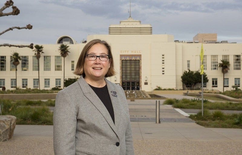
Mayor’s Desk
Santa Monica Goes All-In on Green: Reflections from Mayor Gleam Davis
March 2019, English
For some people, Santa Monica conjures images of sunshine and surfing. But the southern California city should rightly be known for sustainability, too. The City Council adopted the Santa Monica Sustainable City Program in 1994; twenty-five years later, the city has made measurable progress on projects ranging from retrofitting buildings to embracing renewable energy. […]
Backyard Brouhaha
Could Inclusionary Housing Break the YIMBY Deadlock?
February 2019, English
The movement known as YIMBY, or Yes in My Back Yard, has long argued that more development will reduce housing prices. Critics argue—with some evidence—that things aren't that simple, but some communities are moving forward using inclusionary housing.
February 2019, English
The movement known as YIMBY, or Yes in My Back Yard, has long argued that more development will reduce housing prices. Critics argue—with some evidence—that things aren't that simple, but some communities are moving forward using inclusionary housing.
Climate Adaptation
As the Sea Rises, Communities Learn to Have Difficult Conversations About Retreat
February 2019, English
Across the United States, as tidal flooding and extreme weather increase, coastal communities are learning to confront the inevitable—that at least some residents will need to retreat to safer ground.
February 2019, English
Across the United States, as tidal flooding and extreme weather increase, coastal communities are learning to confront the inevitable—that at least some residents will need to retreat to safer ground.
Improving Tax Increment Financing (TIF) for Economic Development
February 2019, English
February 2019, English